File:ECHO Gambia Editable A4 Landscape.png
Jump to navigation
Jump to search

Size of this preview: 800 × 566 pixels. Other resolutions: 320 × 226 pixels | 640 × 453 pixels | 1,024 × 724 pixels | 1,123 × 794 pixels.
Original file (1,123 × 794 pixels, file size: 312 KB, MIME type: image/png)
Captions
Captions
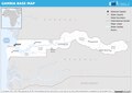
Gambia Base map
Summary[edit]
| Description |
English: Gambia Base map |
| Date | 18 November 2014 (upload date) |
| Source | Gambia Base map |
| Author | ERCC - Emergency Response Coordination Centre |
| Other versions |
|
Licensing[edit]
Public documents (any content whatever its medium) produced by the Commission or by entities on its behalf published by the Commission or the Publications Office or which have not been published for economic or other practical reasons, such as studies, reports and other data shall be made available for reuse unless otherwise specified[1] without restrictions according to 2011/833/EU: Commission Decision of 12 December 2011 on the reuse of Commission documents
Note: Content on ec.europa.eu or its data portal is published with the specified restrictions of the CC BY 4.0 license.
| |
File history
Click on a date/time to view the file as it appeared at that time.
| Date/Time | Thumbnail | Dimensions | User | Comment | |
|---|---|---|---|---|---|
| current | 10:42, 4 November 2023 | | 1,123 × 794 (312 KB) | OptimusPrimeBot (talk | contribs) | #Spacemedia - Upload of https://erccportal.jrc.ec.europa.eu/API/ERCC/Maps/DownloadPublicMap?contentItemID=940&fileN=SecondFile&forceDownload=True via Commons:Spacemedia |
You cannot overwrite this file.
File usage on Commons
The following 2 pages use this file: