File:EF3 tree damage near Sawyerville, Alabama.jpg
Jump to navigation
Jump to search

Size of this preview: 800 × 450 pixels. Other resolutions: 320 × 180 pixels | 640 × 360 pixels | 1,024 × 576 pixels | 1,280 × 720 pixels | 2,560 × 1,440 pixels | 3,840 × 2,160 pixels.
Original file (3,840 × 2,160 pixels, file size: 2.68 MB, MIME type: image/jpeg)
Captions
Captions
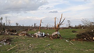
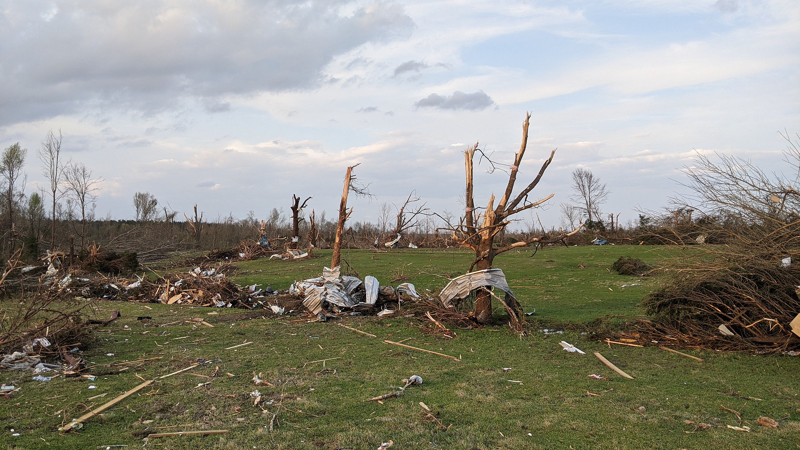
Heavy EF3 damage to trees in a debris-strewn field south of Sawyerville, Alabama.
Summary
[edit]
| Description |
English: Trees heavily debarked and stripped out branches in a field strewed with debris south of Sawyerville, Alabama. |
| Date | |
| Source | https://services.dat.noaa.gov/arcgis/rest/services/nws_damageassessmenttoolkit/DamageViewer/FeatureServer/0/2284877/attachments/1423354 |
| Author | NWS Birmingham |
| Camera location | | View this and other nearby images on: OpenStreetMap |
|---|
Licensing
[edit]
This image is in the public domain because it contains materials that originally came from the U.S. National Oceanic and Atmospheric Administration, taken or made as part of an employee's official duties.
|
File history
Click on a date/time to view the file as it appeared at that time.
| Date/Time | Thumbnail | Dimensions | User | Comment | |
|---|---|---|---|---|---|
| current | 20:59, 30 March 2021 | | 3,840 × 2,160 (2.68 MB) | ChessEric (talk | contribs) | Uploaded a work by NWS Birmingham from https://services.dat.noaa.gov/arcgis/rest/services/nws_damageassessmenttoolkit/DamageViewer/FeatureServer/0/2284877/attachments/1423354 with UploadWizard |
You cannot overwrite this file.
File usage on Commons
The following page uses this file:
File usage on other wikis
The following other wikis use this file:
- Usage on en.wikipedia.org