File:EF4 damage Elkhorn, NE 2024 (3).jpg
Jump to navigation
Jump to search
Size of this preview: 800 × 600 pixels. Other resolutions: 320 × 240 pixels | 640 × 480 pixels | 1,024 × 768 pixels | 1,280 × 960 pixels | 2,560 × 1,920 pixels | 3,264 × 2,448 pixels.
Original file (3,264 × 2,448 pixels, file size: 2.6 MB, MIME type: image/jpeg)
Captions
Captions
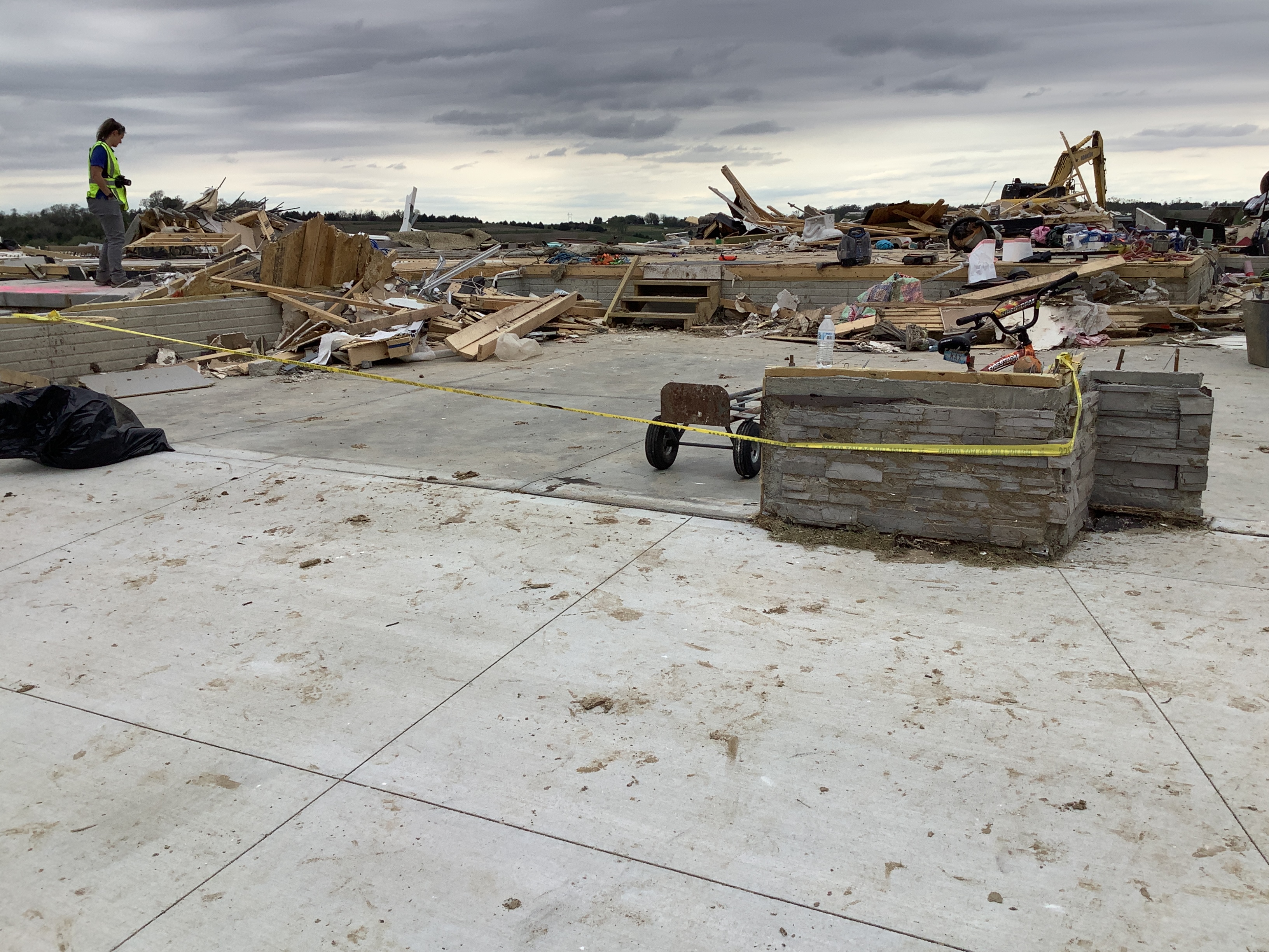
A home that was destroyed at low-end EF4 intensity on north side of Elkhorn, Nebraska.
Summary
[edit].jpg&action=edit§ion=1)
| Description |
English: A home that was destroyed at low-end EF4 intensity on north side of Elkhorn, Nebraska.
"All walls collapsed. Foundation was swept clean of debris. Vehicles thrown in this location. Home built and inspected within past 2 years. Primary connector from floor to walls were nails. Sill plate bolted to poured foundation." |
| Date | |
| Source | https://services.dat.noaa.gov/arcgis/rest/services/nws_damageassessmenttoolkit/DamageViewer/FeatureServer/0/3978418/attachments/2392985 |
| Author | National Weather Service Omaha/Valley NE |
| Camera location | | View this and other nearby images on: OpenStreetMap |
|---|
.jpg¶ms=041.301951_N_-096.248135_E_globe:Earth_type:camera_heading:198.51&language=en)
Licensing
[edit].jpg&action=edit§ion=2)
This work is in the public domain in the United States because it is a work prepared by an officer or employee of the United States Government as part of that person’s official duties under the terms of Title 17, Chapter 1, Section 105 of the US Code.
Note: This only applies to original works of the Federal Government and not to the work of any individual U.S. state, territory, commonwealth, county, municipality, or any other subdivision. This template also does not apply to postage stamp designs published by the United States Postal Service since 1978. (See § 313.6(C)(1) of Compendium of U.S. Copyright Office Practices). It also does not apply to certain US coins; see The US Mint Terms of Use.
|
 | |
| This file has been identified as being free of known restrictions under copyright law, including all related and neighboring rights. | ||
File history
Click on a date/time to view the file as it appeared at that time.
| Date/Time | Thumbnail | Dimensions | User | Comment | |
|---|---|---|---|---|---|
| current | 17:02, 28 July 2024 | | 3,264 × 2,448 (2.6 MB) | ChessEric (talk | contribs) | Uploaded a work by National Weather Service Omaha/Valley NE from https://services.dat.noaa.gov/arcgis/rest/services/nws_damageassessmenttoolkit/DamageViewer/FeatureServer/0/3978418/attachments/2392985 with UploadWizard |
You cannot overwrite this file.
File usage on Commons
There are no pages that use this file.
File usage on other wikis
The following other wikis use this file:
- Usage on en.wikipedia.org
.jpg&oldid=904802915)