File:Eastern Equatoria map.svg
Jump to navigation
Jump to search

Size of this PNG preview of this SVG file: 800 × 493 pixels. Other resolutions: 320 × 197 pixels | 640 × 394 pixels | 1,024 × 631 pixels | 1,280 × 788 pixels | 2,560 × 1,576 pixels | 812 × 500 pixels.
Original file (SVG file, nominally 812 × 500 pixels, file size: 63 KB)
Captions
Captions
Add a one-line explanation of what this file represents
Summary[edit]
| Description |
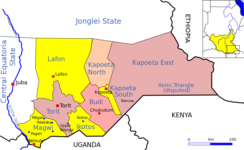
English: Sketch map of Eastern Equatoria state, South Sudan |
| Date | |
| Source | Own work |
| Author | Aymatth2 |
Licensing[edit]
I, the copyright holder of this work, hereby publish it under the following license:
| This file is made available under the Creative Commons CC0 1.0 Universal Public Domain Dedication. | |
| The person who associated a work with this deed has dedicated the work to the public domain by waiving all of their rights to the work worldwide under copyright law, including all related and neighboring rights, to the extent allowed by law. You can copy, modify, distribute and perform the work, even for commercial purposes, all without asking permission.
|
File history
Click on a date/time to view the file as it appeared at that time.
| Date/Time | Thumbnail | Dimensions | User | Comment | |
|---|---|---|---|---|---|
| current | 16:39, 16 July 2011 | | 812 × 500 (63 KB) | Aymatth2 (talk | contribs) | Corrections to county borders |
| 16:38, 16 July 2011 |  | 812 × 500 (63 KB) | Aymatth2 (talk | contribs) | Corrections to county borders | |
| 01:42, 13 July 2011 |  | 812 × 500 (54 KB) | Aymatth2 (talk | contribs) | Better context map | |
| 16:02, 7 July 2011 |  | 812 × 500 (45 KB) | Aymatth2 (talk | contribs) | {{Information |Description ={{en|1=Sketch map of Central Equatoria, South Sudan}} |Source ={{own}} |Author =Aymatth2 |Date =2011-07-07 |Permission = |other_versions = }} Category:Sudan |
You cannot overwrite this file.
File usage on Commons
There are no pages that use this file.
File usage on other wikis
The following other wikis use this file:
- Usage on ca.wikipedia.org
- Usage on de.wikipedia.org
- Usage on en.wikipedia.org
- Usage on fr.wikipedia.org
- Usage on he.wikipedia.org
- Usage on ja.wikipedia.org
- Usage on no.wikipedia.org
- Usage on pt.wikipedia.org
- Usage on sv.wikipedia.org
- Usage on vi.wikipedia.org
- Usage on zu.wikipedia.org