File:Eglise Notre-Dame de Puymiclan.jpg
跳转到导航
跳转到搜索

本预览的尺寸:588 × 599像素。 其他分辨率:236 × 240像素 | 471 × 480像素 | 754 × 768像素 | 1,005 × 1,024像素 | 2,010 × 2,048像素 | 5,569 × 5,674像素。
原始文件 (5,569 × 5,674像素,文件大小:13.99 MB,MIME类型:image/jpeg)
说明
说明
添加一行文字以描述该文件所表现的内容
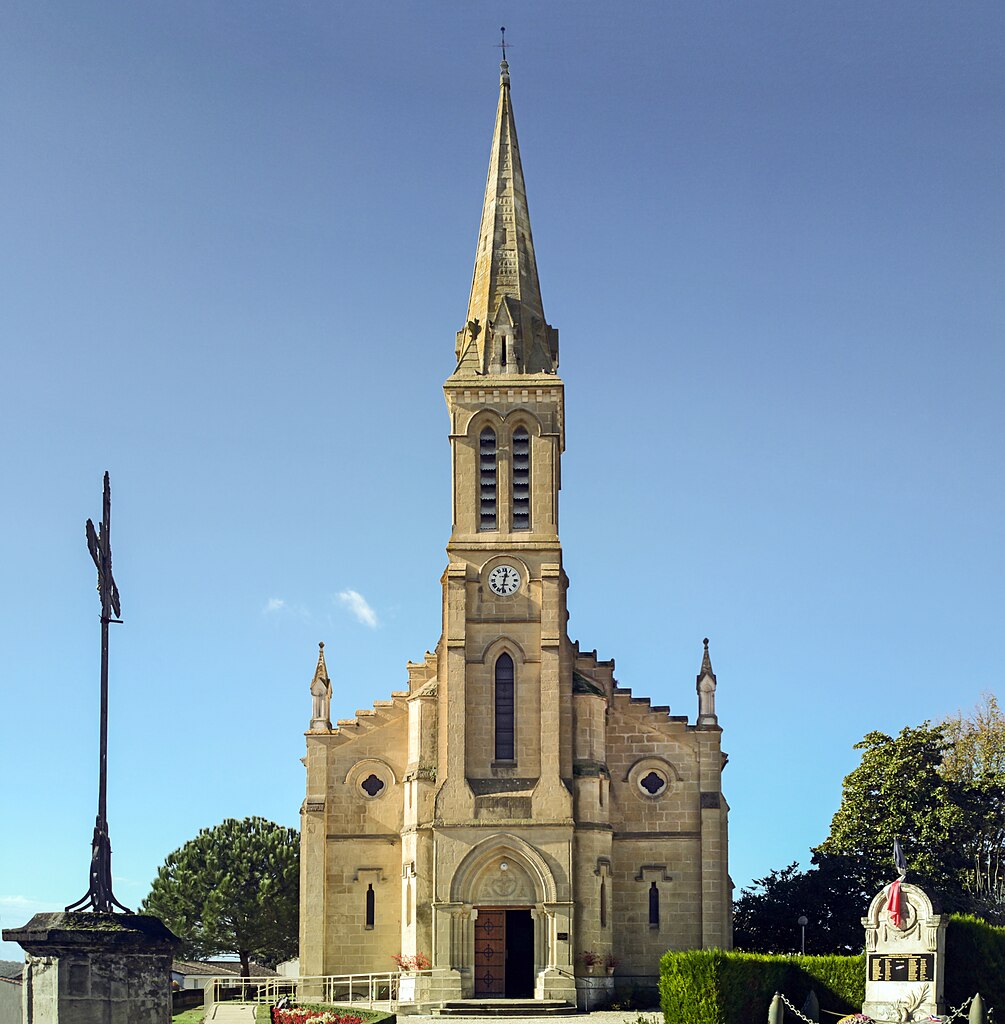
Church of Our Lady of the pines, facade - Puymiclan, France
摘要
[编辑]| 描述 |
English: Church of Our Lady of the pines, Puymiclan, Lot-et-Garonne, France. Built on the foundations of an old medieval chapel of a castle which today there are only ruins. Its bell tower surmounted by a spire, dates from the late nineteenth century by the architect Jean-Jules Mondet. Français : Eglise Notre-Dame des pins, Puymiclan, Lot-et-Garonne, France. Bâtie sur les fondations d'une ancienne chapelle médiévale d'un château dont, aujourd'hui, il ne reste que des ruines. Son clocher surmonté d'une flèche, date de la fin du XIXe siècle, par l'architecte Jean-Jules Mondet. |
| 日期 | 摄于2015年11月21日 |
| 来源 | 自己的作品 |
| 作者 | Didier Descouens |
| 授权 (二次使用本文件) |
我,本作品著作权人,特此采用以下许可协议发表本作品: 本文件采用知识共享署名-相同方式共享 4.0 国际许可协议授权。
|
| 其他版本 |
|

| 相机位置 | | 在以下服务上查看本图像和附近其他图像: OpenStreetMap |
|---|
| 物体位置 | | 在以下服务上查看本图像和附近其他图像: OpenStreetMap |
|---|

|
根据最有价值图像标准,这张图像被评定为在Church of Our Lady of the pines, facade - Puymiclan, France范畴内最有价值的共享资源图像。你可以在Commons:Valued image candidates/Eglise Notre-Dame de Puymiclan.jpg参看它的提名。 |
文件历史
点击某个日期/时间查看对应时刻的文件。
| 日期/时间 | 缩略图 | 大小 | 用户 | 备注 | |
|---|---|---|---|---|---|
| 当前 | 2015年11月22日 (日) 09:04 | | 5,569 × 5,674(13.99 MB) | Archaeodontosaurus(留言 | 贡献) | {{Information |Description ={{en|1=c}} |Source ={{own}} |Author =Archaeodontosaurus |Date = |Permission = |other_versions = }} |
您不可以覆盖此文件。
文件用途
以下5个页面使用本文件:
.jpg)
全域文件用途
以下其他wiki使用此文件:
- ca.wikipedia.org上的用途
- ceb.wikipedia.org上的用途
- de.wikipedia.org上的用途
- en.wikipedia.org上的用途
- es.wikipedia.org上的用途
- eu.wikipedia.org上的用途
- fr.wikipedia.org上的用途
- hu.wikipedia.org上的用途
- it.wikipedia.org上的用途
- kk.wikipedia.org上的用途
- ms.wikipedia.org上的用途
- oc.wikipedia.org上的用途
- pl.wikipedia.org上的用途
- pt.wikipedia.org上的用途
- ro.wikipedia.org上的用途
- sk.wikipedia.org上的用途
- sv.wikipedia.org上的用途
- uk.wikipedia.org上的用途
- uz.wikipedia.org上的用途
- vi.wikipedia.org上的用途
- zh-min-nan.wikipedia.org上的用途
- zh.wikipedia.org上的用途