File:Environs lautaret sous combeynot (cropped).jpg
Jump to navigation
Jump to search

Size of this preview: 800 × 535 pixels. Other resolutions: 320 × 214 pixels | 640 × 428 pixels | 1,024 × 685 pixels | 1,280 × 856 pixels | 1,937 × 1,295 pixels.
Original file (1,937 × 1,295 pixels, file size: 766 KB, MIME type: image/jpeg)
Captions
Captions
Add a one-line explanation of what this file represents
Summary
[edit].jpg&action=edit§ion=1)
| Description |
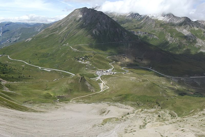
Français : Environs du col du Lautaret vus des pentes du Combeynot. Au centre : hameau du Lautaret (au niveau du col) ; au-dessus : Jardin botanique alpin du Lautaret et route vers le col du Galiber ; la route allant de gauche à droite de l'image est la route départementale 1091 (ancienne route nationale 91). |
| Date | |
| Source | Own work |
| Author | Etienne Baudon |
| Other versions |
| Camera location | | View this and other nearby images on: OpenStreetMap |
|---|
.jpg¶ms=045.025062_N_0006.416897_E_globe:Earth_type:camera__&language=en)
Licensing
[edit].jpg&action=edit§ion=2)
I, the copyright holder of this work, hereby publish it under the following license:
This file is licensed under the Creative Commons Attribution-Share Alike 3.0 Unported license.
- You are free:
- to share – to copy, distribute and transmit the work
- to remix – to adapt the work
- Under the following conditions:
- attribution – You must give appropriate credit, provide a link to the license, and indicate if changes were made. You may do so in any reasonable manner, but not in any way that suggests the licensor endorses you or your use.
- share alike – If you remix, transform, or build upon the material, you must distribute your contributions under the same or compatible license as the original.
| Annotations | This image is annotated: View the annotations at Commons |
.jpg)
File history
Click on a date/time to view the file as it appeared at that time.
| Date/Time | Thumbnail | Dimensions | User | Comment | |
|---|---|---|---|---|---|
| current | 18:03, 27 April 2017 | | 1,937 × 1,295 (766 KB) | BaldBoris (talk | contribs) | File:Environs lautaret sous combeynot.jpg cropped 63 % horizontally and 8 % vertically using CropTool with lossless mode. |
You cannot overwrite this file.
File usage on Commons
The following page uses this file:
File usage on other wikis
The following other wikis use this file:
- Usage on da.wikipedia.org
- Usage on de.wikipedia.org
- Usage on en.wikipedia.org
- Usage on fr.wikipedia.org
- Usage on ja.wikipedia.org
- Usage on sv.wikipedia.org
.jpg&oldid=851030945)