File:Ethnographic map of Slavs, Lubor Niederle.JPG
Πρωτότυπο αρχείο (1.017 × 847 εικονοστοιχεία, μέγεθος αρχείου: 366 KB, τύπος MIME: image/jpeg)
Λεζάντες
Λεζάντες
Σύνοψη[επεξεργασία]
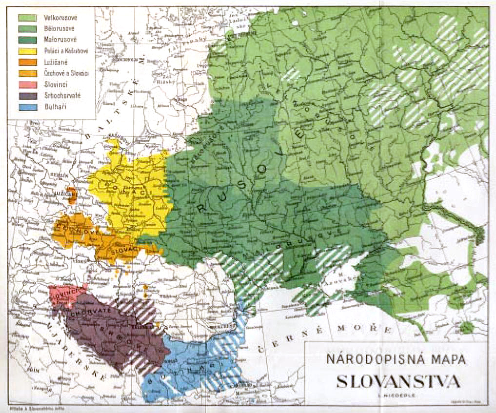
| Περιγραφή |
A picture from a book by Czech archaeologist en:Lubor Niederle "Slavic Antiquities" (Slovanské starožitnosti), series published between 1902-24. The name can be translated as "Ethnographical map of Slavs".
|
| Ημερομηνία | Published 1902-24 |
| Πηγή | Uploaded picture was found in online version of a review about Czech nation between 1899-1914, chapter 5 at [1] (PDF file, all texts in Czech). They have it scanned from the book. The image quality is not the greatest. |
| Δημιουργός | Uploaded to Wikipedia on 17:50, July 7, 2006 by w:User:Pavel Vozenilek |
| άλλες εκδόσεις | Етноґрафічна карта славянщини.jpg |

|
This ethnographic map image could be re-created using vector graphics as an SVG file. This has several advantages; see Commons:Media for cleanup for more information. If an SVG form of this image is available, please upload it and afterwards replace this template with
{{vector version available|new image name}}.
It is recommended to name the SVG file “Ethnographic map of Slavs, Lubor Niederle.svg”—then the template Vector version available (or Vva) does not need the new image name parameter. |


Αδειοδότηση[επεξεργασία]
Ο δημιουργός πέθανε το 1944, οπότε αυτό το έργο είναι κοινό κτήμα στη χώρα προέλευσής του και άλλες χώρες και περιοχές όπου η διάρκεια πνευματικών δικαιωμάτων είναι όσο η ζωή του δημιουργού και μέχρι 75 χρόνια μετά ή λιγότερο. | |
| Αυτό το αρχείο έχει χαρακτηριστεί ως απαλλαγμένο από γνωστούς περιορισμούς βάσει της νομοθεσίας περί πνευματικής ιδιοκτησίας, περιλαμβανομένων όλων των συναφών και συγγενικών δικαιωμάτων. | |
Ιστορικό αρχείου
Πατήστε σε μια ημερομηνία/ώρα για να δείτε το αρχείο όπως εμφανιζόταν εκείνη την χρονική στιγμή.
| Ημερομηνία/Ώρα | Μικρογραφία | Διαστάσεις | Χρήστης | Σχόλιο | |
|---|---|---|---|---|---|
| τρέχον | 12:07, 24 Νοεμβρίου 2009 | | 1.017 × 847 (366 KB) | Чръный человек (συζήτηση | Συνεισφορά) | colours? contrast |
| 19:21, 26 Απριλίου 2009 |  | 1.017 × 847 (154 KB) | Piotrus (συζήτηση | Συνεισφορά) | {{Information |Description=A picture from a book by Czech archaeologist Lubor Niederle "Slavic Antiquities" (Slovanské starožitnosti), series published between 1902-24. The name can be translated as "Ethnographical map of Slavs". <br> Textual descri |
Δεν μπορείτε να αντικαταστήσετε αυτό το αρχείο.
Χρήση αρχείου
Η ακόλουθη σελίδα χρησιμοποιεί προς αυτό το αρχείο:
Καθολική χρήση αρχείου
Τα ακόλουθα άλλα wiki χρησιμοποιούν αυτό το αρχείο:
- Χρήση σε en.wikipedia.org
- Χρήση σε ru.wikipedia.org
- Historical maps of ethnic groups in Europe
- Maps of the Slavs
- Old Linguistic maps
- Ethnographic maps of Austria-Hungary
- Historical maps of ethnic groups in the Balkans
- Historical maps of ethnic groups in Belarus
- Historical maps of ethnic groups in Bulgaria
- Historical maps of ethnic groups in North Macedonia
- Historical maps of ethnic groups in Serbia
- Historical maps of ethnic groups in Vojvodina
- Historical maps of ethnic groups in Bosnia and Herzegovina
- Historical maps of ethnic groups in Croatia
- Historical maps of ethnic groups in Slovenia
- Historical maps of ethnic groups in Ukraine
- Ukrainians in Austria-Hungary
- Linguistic maps of Slavic languages
- Maps of ethnic groups in Europe
- Lubor Niederle