File:Europe polar stereographic Caucasus Urals boundary.svg
Pereiti į navigaciją
Jump to search

Rinkmenos SVG peržiūros PNG dydisː 700 × 545 taškų. Kitos 5 rezoliucijos: 308 × 240 taškų | 617 × 480 taškų | 987 × 768 taškų | 1 280 × 997 taškų | 2 560 × 1 993 taškų.
Pradinė rinkmena (SVG rinkmena, formaliai 700 × 545 taškų, rinkmenos dydis: 1,32 MiB)
Captions
Captions
Add a one-line explanation of what this file represents
Aprašymas
[keisti]
| Aprašymas |
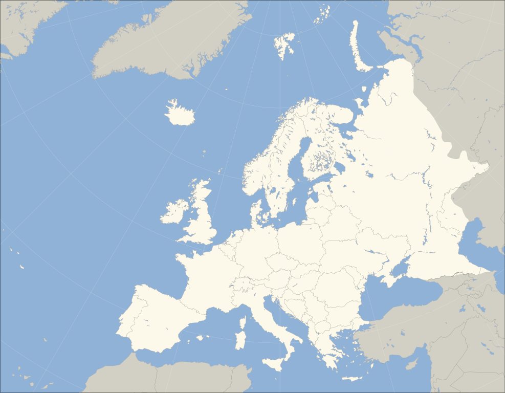
English: A blank political map of Europe. The continental boundary to Asia indicated follows the standard convention of the crest of the Greater Caucasus, the Urals River and the Urals Mountains to the Sea of Kara. |
| Data | (UTC) |
| Šaltinis | |
| Autorius |
|
| Kitos versijos | Derivative works of this file: Historical Europe-Asia boundaries 1700 to 1900.png |
_cropped.svg)
| This is a retouched picture, which means that it has been digitally altered from its original version. Modifications: fixed Caucasus crest. The original can be viewed here: Blank map of Europe (polar stereographic projection) cropped.svg:
|
Aš, šio darbo autoriaus teisių savininkas, publikuoju jį su šiomis licencijomis:
Šiam failui taikoma Creative Commons Attribution-Share Alike 3.0 Unported licencija.
- Jūs galite:
- dalintis – kopijuoti, platinti bei persiųsti šį darbą
- pri(si)taikyti – adaptuoti darbą
- Su šiomis sąlygomis:
- autoriaus nurodymas – Turite pateikti atitinkamą kreditą, pateikti nuorodą į licenciją ir nurodyti, ar buvo atlikti pakeitimai. Tai galite padaryti bet kokiu būdu, bet ne taip, kad licencijos išdavėjas patvirtintų jus ar jūsų naudojimą.
- dalinkis panašiai – Jei perdirbsite, redaguosite ar atkursite šį darbą, jį galėsite platinti tik su tokia pačia ar panašia į šią licencija.

|
Suteikiamas leidimas kopijuoti, platinti ir/ar redaguoti šį dokumentą pagal GNU Free Documentation licencijos versijos 1.2 ar bet kurios vėlesnės versijos sąlygas, publikuotas Free Software Foundation; be nekintamų dalių, be priekinių ir galinių tekstinių žymų viršeliuose. Šios licencijos kopija įtraukta dalyje, pavadintoje GNU Free Documentation License. |
|
|
Suteikiamas leidimas kopijuoti, platinti ir/ar redaguoti šį dokumentą pagal GNU Free Documentation licencijos versijos 1.2 ar bet kurios vėlesnės versijos sąlygas, publikuotas Free Software Foundation; be nekintamų dalių, be priekinių ir galinių tekstinių žymų viršeliuose. Šios licencijos kopija įtraukta dalyje, pavadintoje GNU Free Documentation License. |
Galite pasirinkti, kurią licenciją norite naudoti.
The map has been created with the Generic Mapping Tools: https://www.generic-mapping-tools.org/ using one or more of these public-domain datasets for the relief:
|
|
|
Suteikiamas leidimas kopijuoti, platinti ir/ar redaguoti šį dokumentą pagal GNU Free Documentation licencijos versijos 1.2 ar bet kurios vėlesnės versijos sąlygas, publikuotas Free Software Foundation; be nekintamų dalių, be priekinių ir galinių tekstinių žymų viršeliuose. Šios licencijos kopija įtraukta dalyje, pavadintoje GNU Free Documentation License. |
Originalus įkėlimo įrašas
[keisti]
This image is a derivative work of the following images:
- File:Blank_map_of_Europe_(polar_stereographic_projection)_cropped.svg licensed with Cc-by-sa-3.0, GFDL, GFDL-GMT
- 2011-04-10T03:22:32Z Adrignola 700x545 (1641312 Bytes) Reverted to version as of 13:44, 31 March 2010 - everyone cool down and discuss changes on the talk page, then make an update everyone can agree on
- 2011-04-08T18:51:00Z ComtesseDeMingrelie 700x545 (211693 Bytes) Reverted to version as of 01:06, 5 April 2011
- 2011-04-08T11:57:33Z Chipmunkdavis 700x545 (1641312 Bytes) Revert undiscussed changes
- 2011-04-05T01:06:25Z ComtesseDeMingrelie 700x545 (211693 Bytes) Reverted to version as of 19:46, 4 April 2011
- 2011-04-04T20:45:40Z Green, White and Gold 700x545 (1641312 Bytes) Reverted to version as of 13:44, 31 March 2010 Revert POV
- 2011-04-04T19:46:16Z ComtesseDeMingrelie 700x545 (211693 Bytes) rv. explained removal. making consistent with the page.
- 2011-04-04T18:43:01Z Green, White and Gold 700x545 (1641312 Bytes) Reverted to version as of 13:44, 31 March 2010
- 2011-04-02T05:49:39Z ComtesseDeMingrelie 700x545 (211693 Bytes) Correcting [[:en:Phasis|Phasis]] riverbank
- 2010-03-31T13:44:03Z Kmusser 700x545 (1641312 Bytes) Moldova-Ukraine border fix
- 2009-01-11T12:43:35Z Ssolbergj 700x545 (1640667 Bytes) {{Information |Description= |Source= |Date= |Author= |Permission= |other_versions= }}
- 2009-01-10T03:42:38Z Ssolbergj 700x545 (1580458 Bytes) {{Information |Description={{en|1=244}} |Source=Own work by uploader |Author=[[User:Ssolbergj|Ssolbergj]] |Date=24 |Permission= |other_versions= }}
Uploaded with derivativeFX
Rinkmenos istorija
Paspauskite ant datos/laiko, kad pamatytumėte rinkmeną tokią, kokia ji buvo tuo metu.
| Data/Laikas | Miniatiūra | Matmenys | Naudotojas | Paaiškinimas | |
|---|---|---|---|---|---|
| dabartinis | 23:37, 26 spalio 2014 | | 700 × 545 (1,32 MiB) | R8R (aptarimas | indėlis) | Have all separatists either in or out; Georgia may be a European country culturally and politically (I don't know if so), but not geographically (instead of another revert, start a discussion first) |
| 13:13, 20 spalio 2014 |  | 700 × 545 (1,32 MiB) | Politologia (aptarimas | indėlis) | Reverted to version as of 19:55, 18 October 2014 | |
| 13:29, 19 spalio 2014 |  | 700 × 545 (1,31 MiB) | Deni Mataev (aptarimas | indėlis) | Again, The entirety of Georgia is not in Europe geographically, only North Eastern parts are | |
| 19:55, 18 spalio 2014 |  | 700 × 545 (1,32 MiB) | Politologia (aptarimas | indėlis) | Reverted to version as of 10:10, 18 October 2014 | |
| 12:19, 18 spalio 2014 |  | 700 × 545 (1,31 MiB) | Deni Mataev (aptarimas | indėlis) | Reverted to version as of 14:48, 9 October 2014 Georgia as of whole is not part of Europe geographically | |
| 10:10, 18 spalio 2014 |  | 700 × 545 (1,32 MiB) | Politologia (aptarimas | indėlis) | Georgia Updated | |
| 14:48, 9 spalio 2014 |  | 700 × 545 (1,31 MiB) | AceDouble (aptarimas | indėlis) | added Kosovo | |
| 06:30, 1 rugsėjo 2013 |  | 700 × 545 (1,32 MiB) | Fulvio314 (aptarimas | indėlis) | Areas and borders fine alignment | |
| 16:51, 15 vasario 2012 |  | 700 × 545 (1,09 MiB) | Artem Karimov (aptarimas | indėlis) | either include all separatists or none | |
| 06:20, 29 lapkričio 2011 |  | 700 × 545 (1,52 MiB) | Wsiegmund (aptarimas | indėlis) | Reverted to version as of 07:04, 11 April 2011; ; do not upload over existing version without consensus. |
Jūs negalite perrašyti šios rinkmenos.
Rinkmenos naudojimas
Šie puslapiai naudoja šią rinkmeną:
- Political organizations of Europe
- User:Fulvio314/commons gallery
- Commons:Graphic Lab/Map workshop/Archive/2012
- File:Blank political map of Europe (polar stereographic projection) cropped.svg
- File:Europe islands.svg
- File:Europe polar stereographic Caucasus Urals boundary.svg.png (failo peradresavimas)
- File:Historical Europe-Asia boundaries 1700 to 1900.png
- File:Νήσοι τῆς Εὐρώπης.png
- File:Ποταμοὶ τῆς Εὐρώπης.png
- File:Χερσόνησοι τῆς Εὐρώπης.png
- File:Ὅροι τῆς Εὐρώπης.png
- Template:Europe and Sea
_cropped.svg)
Visuotinis rinkmenos naudojimas
Ši rinkmena naudojama šiose viki svetainėse:
- Naudojama az.wikipedia.org
- Naudojama bn.wikibooks.org
- Naudojama bs.wikipedia.org
- Naudojama ca.wikipedia.org
- Naudojama ckb.wikipedia.org
- Naudojama de.wikipedia.org
- Naudojama en.wikipedia.org
- Europe
- User:Zaz-en
- User:Lumber Jack second account
- List of European countries by area
- Talk:List of European countries by area
- Template talk:Greek diaspora
- Template:Europe and seas labelled map
- User:DeadTotoro
- User:Cnbrb/sandbox
- Talk:Europe/Archive 8
- User:W163/Draft/Number of Internet users in Europe map
- Talk:United Kingdom/Archive 27
- User:Pharaoh Amun
- User:Phinumu/European Tour venues
- User:Killer the Feline/sandbox
- User:Kpfiwa/sandbox
- Naudojama en.wikivoyage.org
- Naudojama fa.wikipedia.org
- Naudojama fr.wikipedia.org
- Naudojama hu.wiktionary.org
Žiūrėti visuotinį šios rinkmenos naudojimą.