File:European Union Norway Locator.png
Jump to navigation
Jump to search
Size of this preview: 800 × 352 pixels. Other resolutions: 320 × 141 pixels | 640 × 282 pixels | 1,432 × 630 pixels.
Original file (1,432 × 630 pixels, file size: 40 KB, MIME type: image/png)
Captions
Captions
Add a one-line explanation of what this file represents
Summary[edit]
| Description |
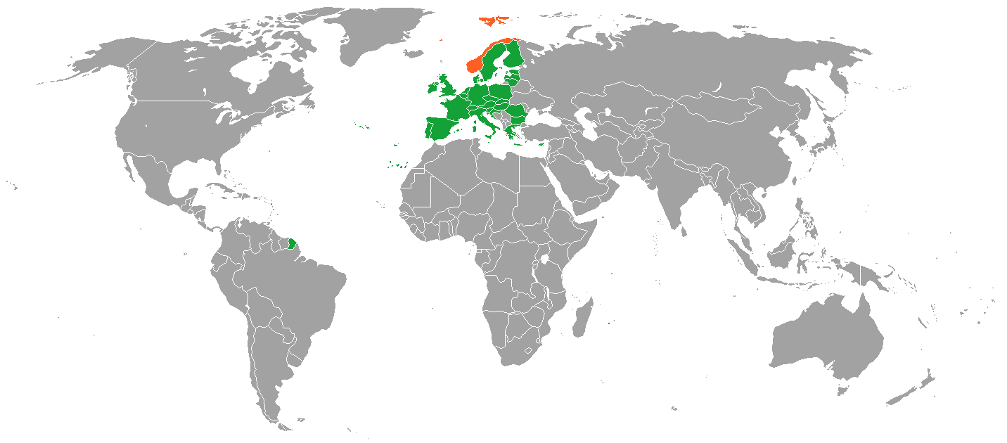
English: blue-EU, green-enlargement agenda, orange-EU member state special territories outside EU, red - Norway |
| Date | (UTC) |
| Source | Own work (Original text: I (Alinor (talk)) created this work entirely by myself.) |
| Author | Alinor (talk) |
Licensing[edit]
Alinor at English Wikipedia, the copyright holder of this work, hereby publishes it under the following licenses:
This file is licensed under the Creative Commons Attribution-Share Alike 3.0 Unported license.
Attribution: Alinor at English Wikipedia
- You are free:
- to share – to copy, distribute and transmit the work
- to remix – to adapt the work
- Under the following conditions:
- attribution – You must give appropriate credit, provide a link to the license, and indicate if changes were made. You may do so in any reasonable manner, but not in any way that suggests the licensor endorses you or your use.
- share alike – If you remix, transform, or build upon the material, you must distribute your contributions under the same or compatible license as the original.

|
Permission is granted to copy, distribute and/or modify this document under the terms of the GNU Free Documentation License, Version 1.2 or any later version published by the Free Software Foundation; with no Invariant Sections, no Front-Cover Texts, and no Back-Cover Texts. A copy of the license is included in the section entitled GNU Free Documentation License. |
You may select the license of your choice.
Original upload log[edit]
The original description page was here. All following user names refer to en.wikipedia.
- 2010-07-22 15:41 Alinor 2420×1292 (207198 bytes) {{Information |Description = blue-EU, green-enlargement agenda, orange-EU member state special territories outside EU, red - Norway |Source = I (~~~) created this work entirely by myself. |Date = ~~~~~ |Author = ~~~ |othe
- 2011-06-16 04:32 Phoenix500 1432×742 (58152 bytes) New Map that follows Legend.
File history
Click on a date/time to view the file as it appeared at that time.
| Date/Time | Thumbnail | Dimensions | User | Comment | |
|---|---|---|---|---|---|
| current | 16:40, 11 March 2018 | | 1,432 × 630 (40 KB) | Maphobbyist (talk | contribs) | Check |
| 15:05, 11 March 2018 |  | 1,432 × 630 (40 KB) | Maphobbyist (talk | contribs) | South Sudan border | |
| 14:53, 29 January 2012 |  | 1,432 × 742 (57 KB) | BotMultichillT (talk | contribs) | {{BotMoveToCommons|en.wikipedia|year={{subst:CURRENTYEAR}}|month={{subst:CURRENTMONTHNAME}}|day={{subst:CURRENTDAY}}}} == {{int:filedesc}} == {{Information |description={{en|1=blue-EU, green-enlargement agenda, orange-EU member state special territories |
You cannot overwrite this file.
File usage on Commons
There are no pages that use this file.
File usage on other wikis
The following other wikis use this file:
- Usage on en.wikipedia.org
- Usage on ja.wikipedia.org