File:European Union Switzerland Locator.svg
Zur Navigation springen
Zur Suche springen

Größe der PNG-Vorschau dieser SVG-Datei: 587 × 600 Pixel. Weitere Auflösungen: 235 × 240 Pixel | 470 × 480 Pixel | 752 × 768 Pixel | 1.002 × 1.024 Pixel | 2.004 × 2.048 Pixel | 593 × 606 Pixel.
Originaldatei (SVG-Datei, Basisgröße: 593 × 606 Pixel, Dateigröße: 711 KB)
Bildtexte
Kurzbeschreibungen
Ergänze eine einzeilige Erklärung, was diese Datei darstellt.
Beschreibung[Bearbeiten]
| Beschreibung |
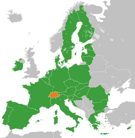
English: The European Union and Switzerland
Français : L'Union Européenne à 28 sans ses frontières internes et la Suisse.
Suisse
UE à 28 |
| Datum | |
| Quelle |
Eigenes Werk Diese W3C-unbestimmte Vektorgrafik wurde mit Inkscape erstellt . |
| Urheber | S. Solberg J. |
| Andere Versionen |
|
.svg)
Lizenz[Bearbeiten]
| Ich, der Urheberrechtsinhaber dieses Werkes, veröffentliche es als gemeinfrei. Dies gilt weltweit. In manchen Staaten könnte dies rechtlich nicht möglich sein. Sofern dies der Fall ist: Ich gewähre jedem das bedingungslose Recht, dieses Werk für jedweden Zweck zu nutzen, es sei denn, Bedingungen sind gesetzlich erforderlich. |
Dateiversionen
Klicke auf einen Zeitpunkt, um diese Version zu laden.
| Version vom | Vorschaubild | Maße | Benutzer | Kommentar | |
|---|---|---|---|---|---|
| aktuell | 13:41, 20. Nov. 2022 | | 593 × 606 (711 KB) | M.Bitton (Diskussion | Beiträge) | Reverted to version as of 02:10, 19 November 2022 (UTC): per COM:OVERWRITE. 2016 was 6 years ago, making this map stable. Feel free to upload under a different name |
| 09:18, 20. Nov. 2022 |  | 593 × 606 (714 KB) | Рагин1987 (Diskussion | Beiträge) | Removed the gray square at the maritime borders of Spain, also painted over Malta from blue to green (also a member of the EU). Slightly expanded the map to the borders of Georgia (the territory of Abkhazia), since Georgia, like Moldova, is a member of the Eastern Partnership, an associated trio and applied for EU membership. Please, before automatically referring to COM:OVERWRITE, take a close look at the history of the file, and the fact that its format was radically edited in 2016. | |
| 02:10, 19. Nov. 2022 |  | 593 × 606 (711 KB) | M.Bitton (Diskussion | Beiträge) | Reverted to version as of 11:59, 3 February 2020 (UTC): that's not a "small correction" | |
| 13:26, 18. Nov. 2022 |  | 593 × 606 (710 KB) | Рагин1987 (Diskussion | Beiträge) | Small correction | |
| 11:59, 3. Feb. 2020 |  | 593 × 606 (711 KB) | Darranc (Diskussion | Beiträge) | Remove UK from EU | |
| 17:49, 26. Okt. 2016 |  | 680 × 520 (604 KB) | Giorgi Balakhadze (Diskussion | Beiträge) | Rv of sockpuppet and per COM:OVERWRITE | |
| 05:23, 19. Mär. 2015 |  | 680 × 520 (620 KB) | Leftcry (Diskussion | Beiträge) | Update layout | |
| 10:09, 15. Jul. 2013 |  | 680 × 520 (307 KB) | Augusta 89 (Diskussion | Beiträge) | Localisation des micro-États européens. | |
| 09:48, 1. Jul. 2013 |  | 680 × 520 (318 KB) | Treehill (Diskussion | Beiträge) | + croatia | |
| 02:04, 17. Mai 2008 |  | 680 × 520 (458 KB) | Ssolbergj (Diskussion | Beiträge) | == Summary == {{Information |Description=The European Union and Switzerland |Source=self-made {{inkscape}} |Date=17 May 2008 |Author= S. Solberg J. |Permission= |other_versions= }} == Licensing == {{PD-se |
Du kannst diese Datei nicht überschreiben.
Dateiverwendung
Die folgende Seite verwendet diese Datei:
Globale Dateiverwendung
Die nachfolgenden anderen Wikis verwenden diese Datei:
- Verwendung auf de.wikipedia.org
- Verwendung auf en.wikipedia.org
- Verwendung auf fi.wikipedia.org
- Verwendung auf fr.wikipedia.org
- Verwendung auf fr.wikiquote.org
- Verwendung auf id.wikipedia.org
- Verwendung auf it.wikipedia.org
- Verwendung auf nl.wikipedia.org
- Verwendung auf pl.wikipedia.org
- Verwendung auf sv.wikipedia.org
- Verwendung auf uk.wikipedia.org