File:European Union Ukraine Locator.svg
Zur Navigation springen
Zur Suche springen

Größe der PNG-Vorschau dieser SVG-Datei: 587 × 600 Pixel. Weitere Auflösungen: 235 × 240 Pixel | 470 × 480 Pixel | 752 × 768 Pixel | 1.002 × 1.024 Pixel | 2.004 × 2.048 Pixel | 593 × 606 Pixel.
Originaldatei (SVG-Datei, Basisgröße: 593 × 606 Pixel, Dateigröße: 711 KB)
Bildtexte
Kurzbeschreibungen
Ergänze eine einzeilige Erklärung, was diese Datei darstellt.
Beschreibung[Bearbeiten]
| Beschreibung |
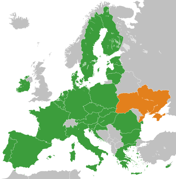
English: The European Union and Ukraine. Українська: Європейський Союз і Україна. Español: La Unión Europea y Ucrania. Deutsch: Die Europäische Union und die Ukraine. العربية: الاتحاد الأوروبي وأوكرانيا. فارسی: اتحادیه اروپا و اوکراین. |
| Datum | |
| Quelle |
Eigenes Werk Diese W3C-unbestimmte Vektorgrafik wurde mit Inkscape erstellt . |
| Urheber | S. Solberg J. |
Lizenz[Bearbeiten]
| Ich, der Urheberrechtsinhaber dieses Werkes, veröffentliche es als gemeinfrei. Dies gilt weltweit. In manchen Staaten könnte dies rechtlich nicht möglich sein. Sofern dies der Fall ist: Ich gewähre jedem das bedingungslose Recht, dieses Werk für jedweden Zweck zu nutzen, es sei denn, Bedingungen sind gesetzlich erforderlich. |
| This map is ineligible for copyright and therefore in the public domain, because it consists entirely of information that is common property and contains no original authorship. For more information, see Commons:Threshold of originality § Maps.
|
Dateiversionen
Klicke auf einen Zeitpunkt, um diese Version zu laden.
| Version vom | Vorschaubild | Maße | Benutzer | Kommentar | |
|---|---|---|---|---|---|
| aktuell | 13:40, 20. Nov. 2022 | | 593 × 606 (711 KB) | M.Bitton (Diskussion | Beiträge) | Reverted to version as of 01:53, 19 November 2022 (UTC): per COM:OVERWRITE. 2016 was 6 years ago, making this map stable. Feel free to upload under a different name |
| 08:48, 20. Nov. 2022 |  | 593 × 606 (712 KB) | Рагин1987 (Diskussion | Beiträge) | Removed the gray square at the maritime borders of Spain. Slightly expanded the map to the borders of Georgia (the territory of Abkhazia), since Georgia, like Moldova, is a member of the Eastern Partnership, an associated trio and applied for EU membership. Please, before automatically referring to COM:OVERWRITE, take a close look at the history of the file, and the fact that its format was radically edited in 2016. | |
| 01:53, 19. Nov. 2022 |  | 593 × 606 (711 KB) | M.Bitton (Diskussion | Beiträge) | Reverted to version as of 14:42, 3 July 2020 (UTC): meaningless edit summary | |
| 13:06, 18. Nov. 2022 |  | 593 × 606 (710 KB) | Рагин1987 (Diskussion | Beiträge) | Small correction | |
| 14:42, 3. Jul. 2020 |  | 593 × 606 (711 KB) | Halbgeviertstrich (Diskussion | Beiträge) | Reverted presumably accidental colour change for Malta | |
| 12:42, 5. Feb. 2020 |  | 593 × 606 (711 KB) | Darranc (Diskussion | Beiträge) | Reverted to version as of 11:57, 3 February 2020 (UTC) - UK isn't in the EU. This file name is a Ukraine locator in relation to the EU | |
| 17:22, 3. Feb. 2020 |  | 593 × 606 (711 KB) | L.tak (Diskussion | Beiträge) | update UK (former member, colour #123456, still applies the treaty in transition phase) | |
| 17:14, 3. Feb. 2020 |  | 680 × 520 (604 KB) | L.tak (Diskussion | Beiträge) | Reverted to version as of 18:15, 26 October 2016 (UTC): Still applicable in the UK during transition phase | |
| 11:57, 3. Feb. 2020 |  | 593 × 606 (711 KB) | Darranc (Diskussion | Beiträge) | Remove UK from EU | |
| 18:15, 26. Okt. 2016 |  | 680 × 520 (604 KB) | Giorgi Balakhadze (Diskussion | Beiträge) | Rv of sockpuppet and per COM:OVERWRITE |
Du kannst diese Datei nicht überschreiben.
Dateiverwendung
Die folgenden 3 Seiten verwenden diese Datei:
.svg)
Globale Dateiverwendung
Die nachfolgenden anderen Wikis verwenden diese Datei:
- Verwendung auf ar.wikipedia.org
- Verwendung auf ca.wikipedia.org
- Verwendung auf de.wikipedia.org
- Ukraine und die Europäische Union
- Benutzer:Francis McLloyd/Interessengebiet Ukraine
- Assoziierungsabkommen zwischen der Europäischen Union und der Ukraine
- Delegation der Europäischen Union für die Ukraine
- Wikipedia:Kartenwerkstatt/Archiv/Zurückgewiesene und zurückgestellte Aufträge 2015
- Beitrittsverhandlungen der Ukraine mit der Europäischen Union
- Verwendung auf en.wikipedia.org
- User:Lionheart Omega
- User:Yulia Romero
- User:Idaltu
- Ukraine–European Union relations
- User:Dirtybutclean
- User:Manuela Listkiewska
- User:Narking
- User:Deavenger
- User:Yulia Romero/OpinionsOfYulia Romero
- User:Yulia Romero/Userbox/EU enlargement Ukraine
- User:Bolegash
- User:Gggh
- User:PKLion
- User:Temujin321
- User:Balkanian`s word
- User talk:A Nobody/Deletion discussions
- User:A.h. king/Userbox/No EU enlargement Ukraine
- User:EllsworthSK
- User:Smart30
- User:Bouncingnewsgreen
- User:Nickispeaki
- User:MAXXX-309
- User:Biletsky Volodymyr
- Accession of Ukraine to the European Union
- User:Julianhayda
- User:AlonsoRiveraM
- User:K9re11
- User:Liegger
- User:Patersonp6
- User:Michalgill
- User:Oleh Kushch
- User:+JMJ+
- Wikipedia:Userboxes/Politics/Multinational/European Union
- Wikipedia:Userboxes/Politics by country/Ukraine
- User:JaikeV
- User:Nomadbones
- User:TheTurtleHistorian
Weitere globale Verwendungen dieser Datei anschauen.