File:European political map.jpg
Jump to navigation
Jump to search
No higher resolution available.
European_political_map.jpg (616 × 600 pixels, file size: 306 KB, MIME type: image/jpeg)
Captions
Captions
Add a one-line explanation of what this file represents
Summary[edit]
| Description |
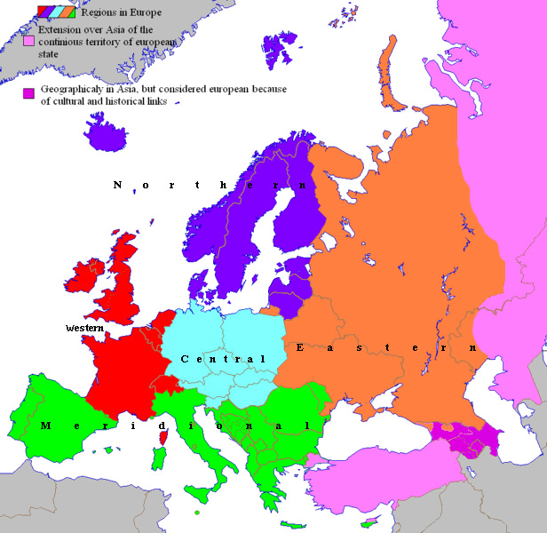
English: Rectified geopolitical areas of Europe since 2007
Français : Zones géopolitiques de l'Europe depuis 2007 |
| Date | |
| Source | Spiridon Manoliu's maps |
| Author | Spiridon Manoliu |
Licensing[edit]
| I, the copyright holder of this work, release this work into the public domain. This applies worldwide. In some countries this may not be legally possible; if so: I grant anyone the right to use this work for any purpose, without any conditions, unless such conditions are required by law. |
File history
Click on a date/time to view the file as it appeared at that time.
| Date/Time | Thumbnail | Dimensions | User | Comment | |
|---|---|---|---|---|---|
| current | 17:19, 10 September 2022 | | 616 × 600 (306 KB) | Рагин1987 (talk | contribs) | Small correction |
| 18:52, 1 November 2014 |  | 616 × 600 (181 KB) | Spiridon Ion Cepleanu (talk | contribs) | Orthography & colours | |
| 13:12, 30 March 2009 |  | 616 × 600 (183 KB) | Spiridon Ion Cepleanu (talk | contribs) | {{Information |Description={{en|1=Rectified geopolitical areas of Europe since 2007}} {{fr|1=Zones géopolitiques de l'Europe depuis 2007}} |Source=Spiridon Manoliu's maps |Author=Spiridon Manoliu |Date=March 30, 2009 |Permission= |other_versions= }} <!- |
You cannot overwrite this file.
File usage on Commons
There are no pages that use this file.