File:Färnebofjärden NASA ASTER satellite.jpeg
Jump to navigation
Jump to search
Size of this preview: 449 × 600 pixels. Other resolutions: 180 × 240 pixels | 359 × 480 pixels | 575 × 768 pixels | 766 × 1,024 pixels | 1,533 × 2,048 pixels | 5,856 × 7,824 pixels.
Original file (5,856 × 7,824 pixels, file size: 5.4 MB, MIME type: image/jpeg)
Captions
Captions
Add a one-line explanation of what this file represents
Summary
[edit]
| Description |
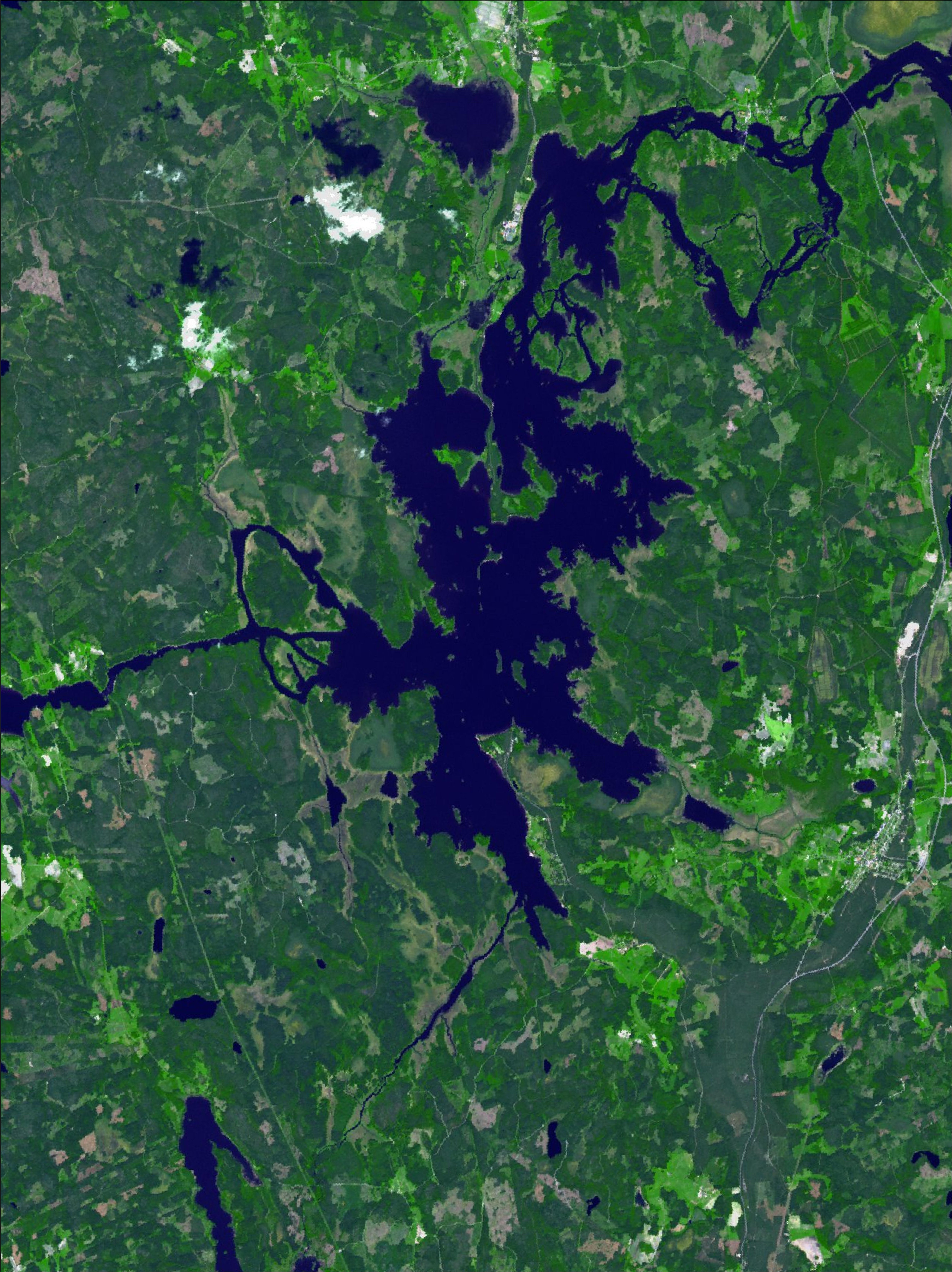
Français : Photo satellite découpée Aster du 3 juin 2011 : le lac Färnebofjärden et le fleuve Dalälven sont à leur niveau normal. Deux petits nuages en haut à gauche : attention à ne pas prendre leur ombre pour des lacs !
Approximate geographic limits of this cropped photo : |
| Date | |
| Source | Aster 3 juin 2011 |
| Author | NASA + Bourrichon (reprojection, découpage) |
Licensing
[edit]
| This file is in the public domain in the United States because it was solely created by NASA. NASA copyright policy states that "NASA material is not protected by copyright unless noted". (See Template:PD-USGov, NASA copyright policy page or JPL Image Use Policy.) | ||
 |
Warnings:
|
File history
Click on a date/time to view the file as it appeared at that time.
| Date/Time | Thumbnail | Dimensions | User | Comment | |
|---|---|---|---|---|---|
| current | 23:09, 4 November 2011 | | 5,856 × 7,824 (5.4 MB) | Bourrichon (talk | contribs) | =={{int:filedesc}}== {{Information |description={{fr|1=Photo satellite découpée Aster du 3 juin 2011 : le lac Färnebofjärden et le fleuve Dalälven sont à leur niveau normal. Deux petits nuages en haut à ga |
You cannot overwrite this file.
File usage on Commons
There are no pages that use this file.
File usage on other wikis
The following other wikis use this file:
- Usage on fr.wikipedia.org