File:Falklands-Map-Spanish-1769.png
Original file (954 × 738 pixels, file size: 1.2 MB, MIME type: image/png)
Captions
Captions
Summary
[edit]
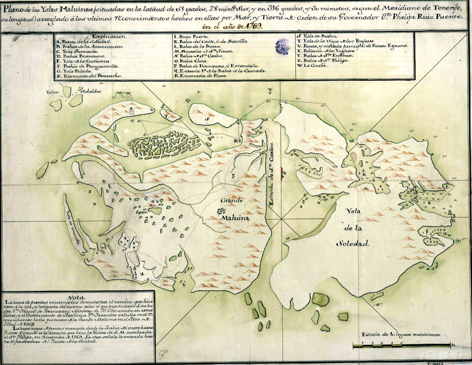
| Description |
English: Map of the Falkland Islands. Scale ca. 1:500000. Real Escuela de Navegación de Cádiz, ca. 1770 |
| Date | |
| Source | Plano de las Yslas Maluinas, situadas en la latitud de 51 grados, 28 mins. Sur, y en 316 grados y 30 minutos, segun el Meridiano de Tenerife, su longitud arreglado à los ultimos reconocimientos hechos en ellas por Mar, y Tierra de orden de su Governador Dn. Phelipe Ruiz Puente en el año de 1769 |
| Author | Unknown, 18th century |
Licensing
[edit]
|
This is a faithful photographic reproduction of a two-dimensional, public domain work of art. The work of art itself is in the public domain for the following reason:
The official position taken by the Wikimedia Foundation is that "faithful reproductions of two-dimensional public domain works of art are public domain".
This photographic reproduction is therefore also considered to be in the public domain in the United States. In other jurisdictions, re-use of this content may be restricted; see Reuse of PD-Art photographs for details. | ||||
File history
Click on a date/time to view the file as it appeared at that time.
| Date/Time | Thumbnail | Dimensions | User | Comment | |
|---|---|---|---|---|---|
| current | 10:03, 25 March 2018 | | 954 × 738 (1.2 MB) | Apcbg (talk | contribs) | User created page with UploadWizard |
You cannot overwrite this file.
File usage on Commons
The following page uses this file:
File usage on other wikis
The following other wikis use this file:
- Usage on en.wikipedia.org
- Usage on es.wikipedia.org