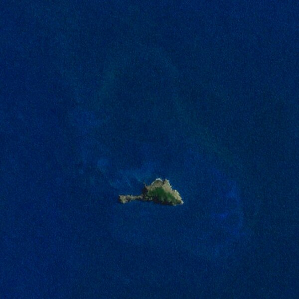
File:Fatu Huku - image satellite Landsat7 - 2000.jpg
Jump to navigation
Jump to search

Size of this preview: 600 × 600 pixels. Other resolutions: 240 × 240 pixels | 634 × 634 pixels.
Original file (634 × 634 pixels, file size: 108 KB, MIME type: image/jpeg)
Captions
Captions
Add a one-line explanation of what this file represents
Summary
[edit]| Description | ||||
| Date | ||||
| Source | Nasa World Wind | |||
| Author | Sémhur | |||
| Permission (Reusing this file) |
|

| Object location | | View this and other nearby images on: OpenStreetMap |
|---|
File history
Click on a date/time to view the file as it appeared at that time.
| Date/Time | Thumbnail | Dimensions | User | Comment | |
|---|---|---|---|---|---|
| current | 18:51, 25 July 2008 | | 634 × 634 (108 KB) | Sémhur (talk | contribs) | == Description == {{Information |Description= {{en|Fatu Huku island, viewed by the satellite Landsat 7. Marquesas Islands, French Polynesia.}} {{fr|Île de Fatu Huku, vue depuis le satellite [[:fr:Land |
You cannot overwrite this file.
File usage on Commons
There are no pages that use this file.
File usage on other wikis
The following other wikis use this file:
- Usage on eo.wikipedia.org
- Usage on pl.wikipedia.org
- Usage on ru.wikipedia.org