File:Fault model of Tokai Earthqauke in 1976 and 2001.gif
Jump to navigation
Jump to search
Size of this preview: 522 × 600 pixels. Other resolutions: 209 × 240 pixels | 606 × 696 pixels.
Original file (606 × 696 pixels, file size: 65 KB, MIME type: image/gif)
Captions
Captions
Add a one-line explanation of what this file represents
Summary[edit]
| Description |
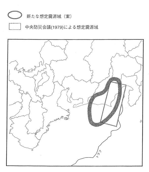
한국어: 1976년과 2001년 일본 지진조사위원회가 제작한 상정된 도카이 지진의 진원지 모델 지도. |
| Date | |
| Source | https://www.jishin.go.jp/main/chousa/01sep_nankai/f05.htm |
| Author | 地震調査研究推進本部事務局 |
Licensing[edit]

|
This work is licensed under the Government of Japan Standard Terms of Use (Ver.2.0). The Terms of Use are compatible with the Creative Commons Attribution License 4.0 International. For the terms of use of this work, see this license page.
|
This file is licensed under the Creative Commons Attribution 4.0 International license.
Attribution: 地震調査研究推進本部事務局
- You are free:
- to share – to copy, distribute and transmit the work
- to remix – to adapt the work
- Under the following conditions:
- attribution – You must give appropriate credit, provide a link to the license, and indicate if changes were made. You may do so in any reasonable manner, but not in any way that suggests the licensor endorses you or your use.
File history
Click on a date/time to view the file as it appeared at that time.
| Date/Time | Thumbnail | Dimensions | User | Comment | |
|---|---|---|---|---|---|
| current | 03:38, 15 June 2021 | | 606 × 696 (65 KB) | Twotwo2019 (talk | contribs) | Uploaded a work by 地震調査研究推進本部事務局 from https://www.jishin.go.jp/main/chousa/01sep_nankai/f05.htm with UploadWizard |
You cannot overwrite this file.
File usage on Commons
There are no pages that use this file.
File usage on other wikis
The following other wikis use this file:
- Usage on ko.wikipedia.org