File:Fisher School Bridge (Five Rivers Bridge) (32425348434).jpg

Original file (5,944 × 3,943 pixels, file size: 14.39 MB, MIME type: image/jpeg)
Captions
Captions
Summary
[edit]_(32425348434).jpg&action=edit§ion=1)
| Description |
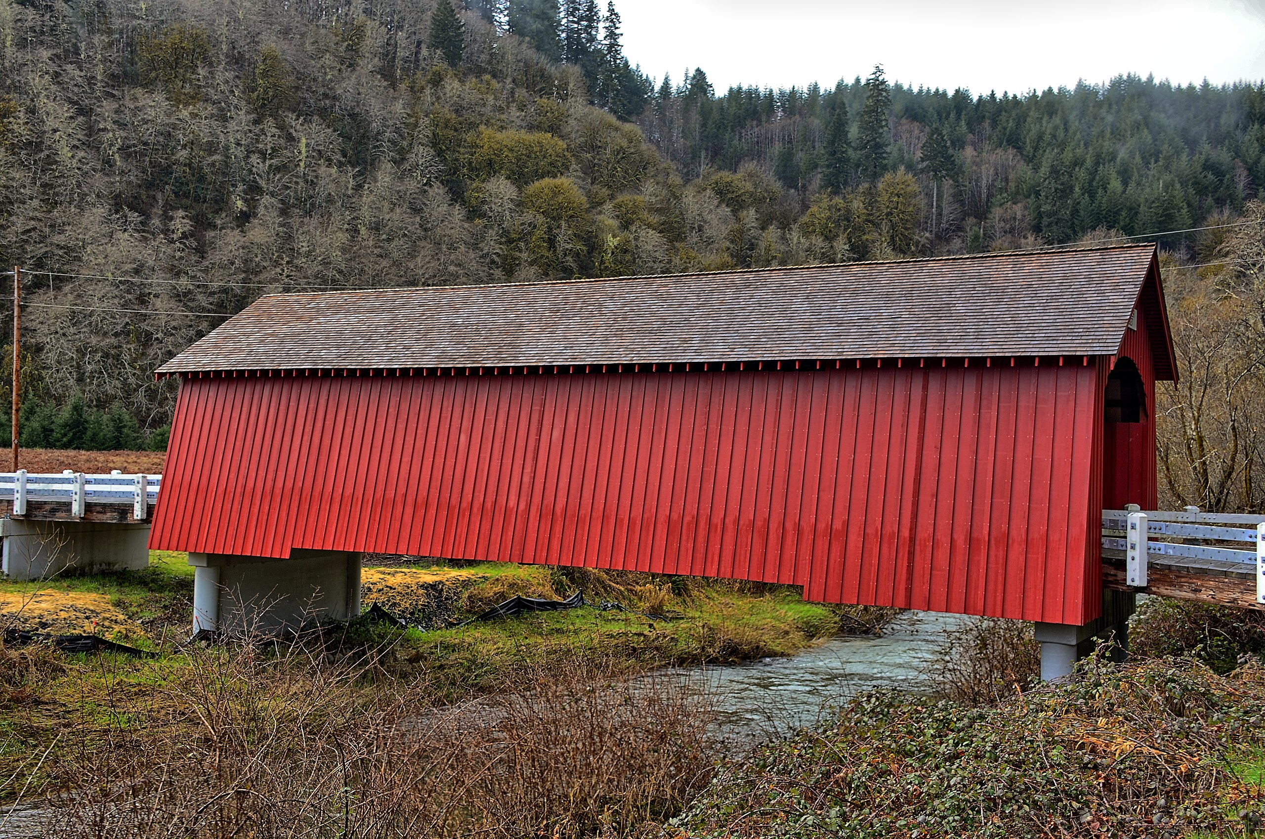
Fisher School Bridge has an alternative name, the Five Rivers Bridge. This bridge was given this name, due to the fact that it spans a fork of Five Rivers. It was given the Fisher School title, because of its location near the Fisher Elementary School, which is no longer standing. This bridge was built in 1919 and is 72 feet long. It is speculated that the bridge may have been destroyed and rebuilt in 1927, but records show 1919 as the original date. The bridge was built by George Melvin, a workman, and local farmers which helped in preparing the lumber. Fisher Bridge was built using Howe Trusses. This design was patented by William Howe in 1840 and combined iron uprights with wooden supports. The other architectural features are a shingled gabled roof, wooden decking, board and batten siding, and enclosing buttresses. REHABILITATION In 1998, a consulting engineer working for the county determined the bridge was unsafe and recommended it be torn down, if not completely renovated. In 2001, with the assistance of the Oregon Department of Transportation, a federal grant was secured to pay for most of the renovation cost. The total project included new pilings, replacement floor beams, deck, stringers, siding and roof. The bridge was painted barn red, as is the tradition in Lincoln County. The rehabilitation of the Fisher School Bridge by the Lincoln County Public Works Department – with a great deal of assistance and participation by local members of the Covered Bridge Society of Oregon – was recognized with a first place award in the category of Rehabilitated Bridges. The county commissioners held a rededication ceremony for the bridge on June 4, 2005. |
| Date | |
| Source | Fisher School Bridge (Five Rivers Bridge) |
| Author | Kirt Edblom from Kihei, Hi, United States |
| Camera location | | View this and other nearby images on: OpenStreetMap |
|---|
_(32425348434).jpg¶ms=044.291702_N_-123.841420_E_globe:Earth_type:camera_source:Flickr_&language=en)
Licensing
[edit]_(32425348434).jpg&action=edit§ion=2)
- You are free:
- to share – to copy, distribute and transmit the work
- to remix – to adapt the work
- Under the following conditions:
- attribution – You must give appropriate credit, provide a link to the license, and indicate if changes were made. You may do so in any reasonable manner, but not in any way that suggests the licensor endorses you or your use.
- share alike – If you remix, transform, or build upon the material, you must distribute your contributions under the same or compatible license as the original.
| This image was originally posted to Flickr by Kirt Edblom at https://flickr.com/photos/27190564@N02/32425348434. It was reviewed on 9 May 2021 by FlickreviewR 2 and was confirmed to be licensed under the terms of the cc-by-sa-2.0. |
File history
Click on a date/time to view the file as it appeared at that time.
| Date/Time | Thumbnail | Dimensions | User | Comment | |
|---|---|---|---|---|---|
| current | 19:50, 9 May 2021 | | 5,944 × 3,943 (14.39 MB) | Sentinel user (talk | contribs) | Transferred from Flickr via #flickr2commons |
You cannot overwrite this file.
File usage on Commons
There are no pages that use this file.
_(32425348434).jpg&oldid=855743889)