File:Flag-map of Ontario.svg
Aller à la navigation
Aller à la recherche

Taille de cet aperçu PNG pour ce fichier SVG : 445 × 501 pixels. Autres résolutions : 213 × 240 pixels | 426 × 480 pixels | 682 × 768 pixels | 909 × 1 024 pixels | 1 819 × 2 048 pixels.
Fichier d’origine (Fichier SVG, nominalement de 445 × 501 pixels, taille : 260 kio)
Légendes
Légendes
Ajoutez en une ligne la description de ce que représente ce fichier
Description[modifier]
| Description |
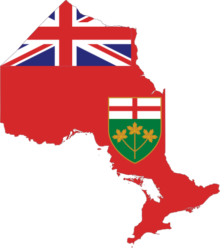
English: Flag-map of Ontario |
| Date | (UTC) |
| Source | |
| Auteur |
|
| Autres versions |
 |
Conditions d’utilisation[modifier]
Ce fichier est disponible selon les termes de la licence Creative Commons Attribution – Partage dans les Mêmes Conditions 3.0 (non transposée).
- Vous êtes libre :
- de partager – de copier, distribuer et transmettre cette œuvre
- d’adapter – de modifier cette œuvre
- Sous les conditions suivantes :
- paternité – Vous devez donner les informations appropriées concernant l'auteur, fournir un lien vers la licence et indiquer si des modifications ont été faites. Vous pouvez faire cela par tout moyen raisonnable, mais en aucune façon suggérant que l’auteur vous soutient ou approuve l’utilisation que vous en faites.
- partage à l’identique – Si vous modifiez, transformez, ou vous basez sur cette œuvre, vous devez distribuer votre contribution sous la même licence ou une licence compatible avec celle de l’original.
Journal des téléversements d’origine[modifier]
This image is a derivative work of the following images:
- File:Canada_Ontario_location_map.svg licensed with Cc-by-sa-3.0
- 2009-08-31T19:05:05Z NordNordWest 2032x2314 (1376421 Bytes)
- 2009-08-26T10:26:50Z NordNordWest 2032x2314 (1347915 Bytes) {{int:filedesc}} {{Information |Description= {{de|Positionskarte von [[:de:Ontario|Ontario]], [[:de:Kanada|Kanada]]}} Quadratische Plattkarte, N-S-Streckung 155 %. Geographische Begrenzung der Karte: * N: 57.1° N * S: 41.3°
- File:Flag_of_Ontario.svg licensed with PD-self
- 2008-12-23T01:04:28Z Bosonic dressing 2400x1200 (7743 Bytes) rv: so that the red in St. George's cross properly matches that in rest of flag, as per spects
- 2008-12-22T20:44:24Z Dancingwombatsrule 2400x1200 (11180 Bytes) Reverted to version as of 20:22, 25 June 2007
- 2008-12-14T01:05:12Z Bosonic dressing 2400x1200 (7743 Bytes) {{Information |Description= |Source= |Date= |Author= |Permission= |other_versions= }}
- 2008-12-14T01:04:12Z Bosonic dressing 1200x1553 (7765 Bytes) {{Information |Description= |Source= |Date= |Author= |Permission= |other_versions= }}
- 2007-06-25T20:22:55Z Zscout370 2400x1200 (11180 Bytes) The Ontario Ministry of Government Services emailed me the Pantone colors of the shield and the rest of the colors are from the British flag image.
- 2006-05-04T19:28:40Z Episteme 2400x1200 (15502 Bytes) xmlns:sodipodi added
- 2006-01-30T22:46:36Z E Pluribus Anthony 2400x1200 (15434 Bytes) Reverted to earlier revision
- 2006-01-30T12:34:52Z Greentubing 600x300 (10218 Bytes) +XML header
- 2006-01-30T00:42:24Z Greentubing 600x300 (10242 Bytes) Optimisation; Colour correction to [[:Image:Flag of the United Kingdom.svg]]
- 2005-12-02T12:57:40Z E Pluribus Anthony 2400x1200 (15434 Bytes) Flag of Ontario
- 2005-11-26T21:15:40Z Kooma 992x496 (5421 Bytes) {{Information| |Description = Flag of [[:Category:Ontario|Ontario]] |Source = [http://www.sodipodi.com/index.php3?section=clipart/flags&area=flags&n=49 Sodipodi's Clipart Gallery] |Date = |Author = Pat Suwalski |Permission =
- File:Ontario-flag-contour.png licensed with PD-self
- 2006-11-04T02:29:24Z Qyd 613x638 (93918 Bytes) {{Information |Description=Contour of the province of [[Ontario]], [[Canada]], with flag overlay |Source=Coat from [[:Image:Flag of Ontario.svg]], contour from GIS |Date=Oct 2006 |Author={{User|Qyd}} |Permission=PD |other_ver
Téléversé avec derivativeFX
Historique du fichier
Cliquer sur une date et heure pour voir le fichier tel qu'il était à ce moment-là.
| Date et heure | Vignette | Dimensions | Utilisateur | Commentaire | |
|---|---|---|---|---|---|
| actuel | 23 avril 2012 à 23:27 | | 445 × 501 (260 kio) | DrRandomFactor (d | contributions) | Reverted to version as of 16:05, 9 May 2010 |
| 9 mai 2010 à 19:23 |  | 456 × 511 (377 kio) | Svgalbertian (d | contributions) | Added dropshadow. | |
| 9 mai 2010 à 16:05 |  | 445 × 501 (260 kio) | Svgalbertian (d | contributions) | == {{int:filedesc}} == {{Information |Description={{en|Flag-map of Ontario}} |Source=*File:Canada_Ontario_location_map.svg *File:Flag_of_Ontario.svg *File:Ontario-flag-contour.png |Date=2010-05-09 16:03 (UTC) |Author=*[[:File:Canada_Onta |
Vous ne pouvez pas remplacer ce fichier.
Utilisations locales du fichier
Les 6 pages suivantes utilisent ce fichier :
Utilisations du fichier sur d’autres wikis
Les autres wikis suivants utilisent ce fichier :
- Utilisation sur cy.wikipedia.org
- Utilisation sur en.wikipedia.org
- Talk:Canadian English
- Talk:Lester B. Pearson
- Talk:Moose
- Talk:Robertson Davies
- Talk:Great Lakes
- Talk:St. Lawrence River
- Talk:French colonization of the Americas
- Talk:Ottawa
- Talk:CN Tower
- Talk:Anne Carson
- Talk:Toronto
- Talk:Gerald Bull
- Talk:General Motors
- Talk:Bobby Orr
- Talk:Northrop Frye
- Talk:Neil Young
- Talk:Paul Martin
- Talk:Gene Eugene
- Talk:Rush (band)
- Talk:Toronto Blue Jays
- Talk:Bobby Hull
- Talk:Gordon Graydon
- Talk:James Randi
- Talk:Brampton
- Talk:Jane Jacobs
- Wikipedia talk:WikiProject Toronto
- Talk:War of 1812
- Talk:North Bay, Ontario
- Talk:Avril Lavigne
- Talk:Carleton Place
- Talk:1930 British Empire Games
- Talk:London, Ontario
- Talk:Taiga
- Talk:James LaBrie
- Talk:William Mulock
- Talk:St. Catharines
- Talk:Don Cherry
- Talk:Etobicoke
- Talk:Tim Hortons
- Talk:Lenape
- Talk:Proposal for the Province of Toronto
- Talk:Ottawa Senators
- Talk:Reptilia (zoo)
Voir davantage sur l’utilisation globale de ce fichier.