File:Flag-map of Prince Edward Island.svg
Aller à la navigation
Aller à la recherche

Taille de cet aperçu PNG pour ce fichier SVG : 800 × 386 pixels. Autres résolutions : 320 × 154 pixels | 640 × 309 pixels | 1 024 × 494 pixels | 1 280 × 617 pixels | 2 560 × 1 235 pixels | 1 072 × 517 pixels.
Fichier d’origine (Fichier SVG, nominalement de 1 072 × 517 pixels, taille : 1,2 Mio)
Légendes
Légendes
Ajoutez en une ligne la description de ce que représente ce fichier
Description[modifier]
| Description |
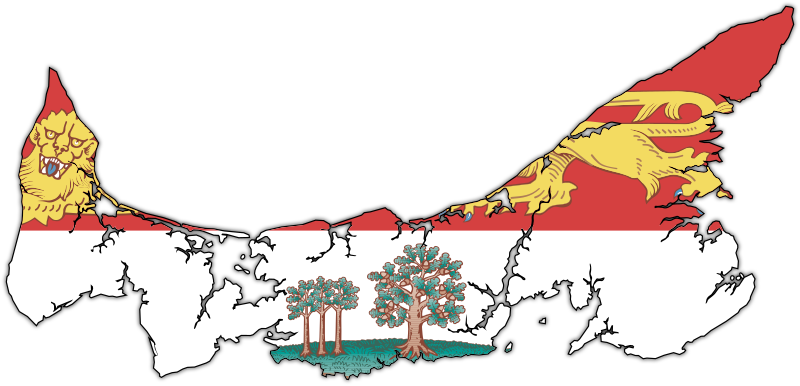
English: Flag-map of Prince Edward Island |
| Date | (UTC) |
| Source | |
| Auteur | |
| SVG information | Le code de ce fichier SVG n'est pas valide en raison d'une erreur. |
Conditions d’utilisation[modifier]
Ce fichier est disponible selon les termes de la licence Creative Commons Attribution – Partage dans les Mêmes Conditions 3.0 (non transposée).
- Vous êtes libre :
- de partager – de copier, distribuer et transmettre cette œuvre
- d’adapter – de modifier cette œuvre
- Sous les conditions suivantes :
- paternité – Vous devez donner les informations appropriées concernant l'auteur, fournir un lien vers la licence et indiquer si des modifications ont été faites. Vous pouvez faire cela par tout moyen raisonnable, mais en aucune façon suggérant que l’auteur vous soutient ou approuve l’utilisation que vous en faites.
- partage à l’identique – Si vous modifiez, transformez, ou vous basez sur cette œuvre, vous devez distribuer votre contribution sous la même licence ou une licence compatible avec celle de l’original.
Journal des téléversements d’origine[modifier]
This image is a derivative work of the following images:
- File:Canada_Prince_Edward_Island_location_map.svg licensed with Cc-by-sa-3.0
- 2009-08-24T20:29:01Z NordNordWest 1039x822 (161580 Bytes) {{int:filedesc}} {{Information |Description= {{de|Positionskarte von [[:de:Prince Edward Island|Prince Edward Island]], [[:de:Kanada|Kanada]]}} Quadratische Plattkarte, N-S-Streckung 145 %. Geographische Begrenzung der Karte:
- File:Flag_of_Prince_Edward_Island.svg licensed with PD-self
- 2010-03-17T03:36:15Z Zscout370 1800x1200 (809356 Bytes) Compression
- 2009-12-15T20:59:09Z Zscout370 1800x1200 (1033860 Bytes) Combined some elements, now under 1 Meg.
- 2006-05-04T19:35:26Z Episteme 1800x1200 (1205255 Bytes) DOCTYPE added
- 2006-02-16T00:26:59Z Denelson83 1800x1200 (1205156 Bytes) Several defects fixed
- 2005-10-12T04:29:30Z E Pluribus Anthony 1800x1200 (622458 Bytes) Flag of Prince Edward Island
- 2005-10-09T07:23:17Z E Pluribus Anthony 1800x1200 (622572 Bytes) Flag of Prince Edward Island
- 2005-10-09T07:10:42Z E Pluribus Anthony 1800x1200 (622572 Bytes) Flag of Prince Edward Island
- File:PEI-flag_contour.png licensed with PD-self
- 2006-12-09T03:30:41Z Qyd 1035x495 (205909 Bytes) {{Information |Description=Contour of the province of [[Prince Edward Island]], [[Canada]], with flag overlay |Source=contour from GIS |Date=Oct 2006 |Author={{User|Qyd}} |Permission=PD |other_versions=None }} [[Category:Maps
Téléversé avec derivativeFX
Historique du fichier
Cliquer sur une date et heure pour voir le fichier tel qu'il était à ce moment-là.
| Date et heure | Vignette | Dimensions | Utilisateur | Commentaire | |
|---|---|---|---|---|---|
| actuel | 9 mai 2010 à 22:59 | | 1 072 × 517 (1,2 Mio) | Svgalbertian (d | contributions) | Changed angle of drop shadow. |
| 9 mai 2010 à 19:15 |  | 1 072 × 517 (1,2 Mio) | Svgalbertian (d | contributions) | Added drop shadow. | |
| 9 mai 2010 à 18:17 |  | 1 055 × 500 (1,15 Mio) | Svgalbertian (d | contributions) | == {{int:filedesc}} == {{Information |Description={{en|Flag-map of Prince Edward Island}} |Source=*File:Canada_Prince_Edward_Island_location_map.svg *File:Flag_of_Prince_Edward_Island.svg *File:PEI-flag_contour.png |Date=2010-05-09 18:15 |
Vous ne pouvez pas remplacer ce fichier.
Utilisations locales du fichier
Les 5 pages suivantes utilisent ce fichier :
Utilisations du fichier sur d’autres wikis
Les autres wikis suivants utilisent ce fichier :
- Utilisation sur cy.wikipedia.org
- Utilisation sur en.wikipedia.org
- Talk:Canadian English
- Talk:Anne of Green Gables
- Talk:Lucy Maud Montgomery
- Talk:French colonization of the Americas
- Talk:Prince Edward Island
- Talk:University of Prince Edward Island
- Talk:First Nations in Canada
- Abegweit Passage
- Talk:The Maritimes
- Talk:Acadian French
- Talk:Catherine Callbeck
- Talk:Charlottetown
- Talk:Acadians
- Talk:Anne Shirley
- Talk:Music of the Maritimes
- Talk:Samuel Holland (surveyor)
- Talk:Tignish
- Bonshaw, Prince Edward Island
- Talk:Music of Prince Edward Island
- Abegweit First Nation
- Talk:Léonce Bernard
- Talk:MV Abegweit (1947)
- Talk:Louis Henry Davies
- Talk:Gerard Gallant
- Talk:Brad Richards
- Talk:Charlottetown Islanders
- Talk:Rick Vaive
- Talk:Dominion Police
- Talk:Indigenous peoples in Canada
- Talk:Prince Edward Island National Park
- Talk:List of political scandals in Canada
- Skinners Pond, Prince Edward Island
- Talk:Expulsion of the Acadians
- Lot 1, Prince Edward Island
- Template:PrinceEdwardIsland-geo-stub
- Talk:List of Prince Edward Island senators
- Talk:Gulf of St. Lawrence
- Basin Head, Prince Edward Island
- Talk:Amber MacArthur
- Knutsford, Prince Edward Island
- Talk:Hurricane Juan
- Talk:Island Waste Management Corporation
- Talk:Flag of Prince Edward Island
- Union Road
- Talk:Cardigan (electoral district)
- Foxley River, Prince Edward Island
- Talk:List of colleges in Prince Edward Island
- Talk:Holland College
Voir davantage sur l’utilisation globale de ce fichier.