File:Flagge Kreis Nordfriesland.svg
Ir a la navegación
Ir a la búsqueda

Tamaño de esta previsualización PNG del archivo SVG: 500 × 300 píxeles. Otras resoluciones: 320 × 192 píxeles | 640 × 384 píxeles | 1024 × 614 píxeles | 1280 × 768 píxeles | 2560 × 1536 píxeles.
Archivo original (archivo SVG, nominalmente 500 × 300 píxeles, tamaño de archivo: 17 kB)
Leyendas
Leyendas
Añade una explicación corta acerca de lo que representa este archivo
Resumen[editar]
| Descripción |
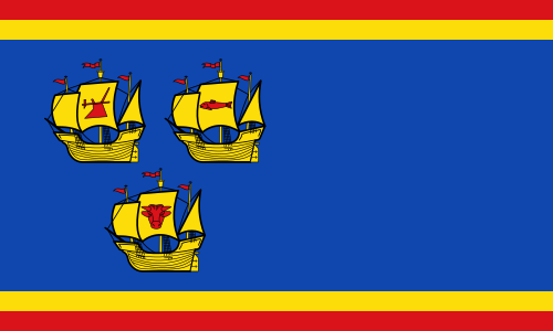
Deutsch: Flagge Kreis Nordfriesland
English: Flag of Kreis Nordfriesland
Română: Steagul districtului german Nordfriesland |
|||
| Fecha | ||||
| Fuente | https://efi2.schleswig-holstein.de/wr/wr.asp?Aktion=Datenblatt&ID=179 | |||
| Autor | Wilhelm Horst Lippert | |||
| Permiso (Reutilización de este archivo) |
|

Historial del archivo
Haz clic sobre una fecha y hora para ver el archivo tal como apareció en ese momento.
| Fecha y hora | Miniatura | Dimensiones | Usuario | Comentario | |
|---|---|---|---|---|---|
| actual | 12:14 29 mar 2015 | | 500 × 300 (17 kB) | Jürgen Krause (discusión | contribs.) | redrawn - FIAV colours - refered to discussion https://de.wikipedia.org/wiki/Wikipedia:WikiProjekt_Wappen#Kreis_Nordfriesland |
| 14:22 3 ene 2013 |  | 2500 × 1500 (31 kB) | ArnoldPlaton (discusión | contribs.) | User created page with UploadWizard |
No puedes sobrescribir este archivo.
Usos del archivo
Las siguientes páginas usan este archivo:
- Flags of districts of Germany
- Kreis Nordfriesland
- User:ArnoldPlaton
- File:Kreis Nordfriesland flag.jpg
- File:Kreis Nordfriesland flag.svg (archivo de redirección)
- Category:Geography of Kreis Nordfriesland
- Category:Kreis Nordfriesland
- Category:Kreis Nordfriesland by century
- Category:Kreis Nordfriesland in the 16th century
- Category:Kreis Nordfriesland in the 17th century
- Category:Kreis Nordfriesland in the 18th century
- Category:Kreis Nordfriesland in the 19th century
- Category:Kreis Nordfriesland in the 20th century
- Category:Kreis Nordfriesland in the 21st century
- Category:Maps of Kreis Nordfriesland
- Category:Villages in Kreis Nordfriesland
Uso global del archivo
Las wikis siguientes utilizan este archivo:
- Uso en bg.wikipedia.org
- Uso en ca.wikipedia.org
- Districte de Nordfriesland
- Risum-Lindholm
- Plantilla:Municipis Nordfriesland
- Pellworm
- Nordstrand
- Elisabeth-Sophien-Koog
- Sylt (municipi)
- Hörnum
- Kampen (Sylt)
- List (Sylt)
- Wenningstedt-Braderup
- Gröde
- Hooge
- Langeneß
- Nebel (Amrum)
- Wittdün
- Norddorf
- Alkersum
- Borgsum
- Dunsum
- Midlum (Föhr)
- Nieblum
- Oevenum
- Oldsum
- Süderende
- Utersum
- Witsum
- Wrixum
- Wyk auf Föhr
- Niebüll
- Dagebüll
- Galmsbüll
- Stedesand
- Emmelsbüll-Horsbüll
- Friedrich-Wilhelm-Lübke-Koog
- Klanxbüll
- Aventoft
- Neukirchen (Nordfriesland)
- Rodenäs
- Achtrup
- Bosbüll
- Braderup
- Bramstedtlund
- Ellhöft
- Enge-Sande
- Holm (Nordfriesland)
- Humptrup
- Karlum
- Klixbüll
Ver más uso global de este archivo.