File:John Fogelsonger House, Amherst, New York - 20191109.jpg
(Redirected from File:Fogelsonger House - 20191109.jpg)

Size of this preview: 800 × 600 pixels. Other resolutions: 320 × 240 pixels | 640 × 480 pixels | 1,024 × 768 pixels | 1,280 × 960 pixels | 2,375 × 1,781 pixels.
Original file (2,375 × 1,781 pixels, file size: 1.43 MB, MIME type: image/jpeg)
Captions
Captions
Add a one-line explanation of what this file represents
Summary[edit]
| Description |
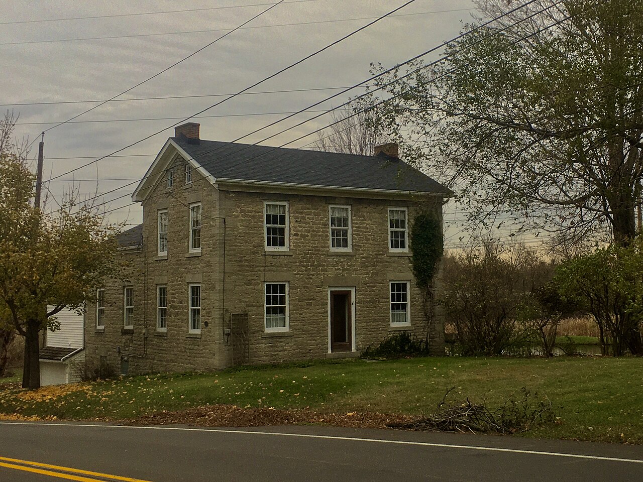
English: The John Fogelsonger House, 219 Park Club Lane, Amherst, New York, November 2019. Erected in 1825, this traditional German-style stone house stood at the center of the Fogelsonger family's land holdings just past the western border of the village of Williamsville, fronting Main Street with Fogelsonger Road (now Park Club Lane) passing through it. Born in Lancaster County, Pennsylvania, in 1799, John Fogelsonger was one of the founding fathers of the town, arriving in Amherst while still a very young man and purchasing this large parcel in 1818. For the first few years, Fogelsonger used the sulfur springs on the property to establish a cider and grist mill; however, by 1830, he had turned his attention to the high-quality outcroppings of limestone and flint he saw, opening the Williamsville Stone Quarry that year. His son Wendell took over the business in 1852. Though it was sold outside the family around 1900, the Fogelsonger Quarry, as it was also called, grew to be a major local supplier of limestone for building purposes - for instance, the Mennonite church that the Fogelsongers attended was built in 1834 with stone from the quarry. At its height, the 220-acre (88-hectare) complex included not only furnaces and other operational facilities, but also lodging for his sizable workforce. The late 1950s saw the former Fogelsonger property divided up for development, and the quarry itself, as well as the remaining buildings other than the stone house, were finally obliterated in 1962 when Exit 7 of Interstate 290 was constructed directly west of Park Club Lane. The home remains privately owned. |
| Date | Taken on 9 November 2019, 15:14:27 |
| Source | Own work |
| Author | Andre Carrotflower |
| Camera location | | View this and other nearby images on: OpenStreetMap |
|---|
Licensing[edit]
I, the copyright holder of this work, hereby publish it under the following license:
This file is licensed under the Creative Commons Attribution-Share Alike 4.0 International license.
- You are free:
- to share – to copy, distribute and transmit the work
- to remix – to adapt the work
- Under the following conditions:
- attribution – You must give appropriate credit, provide a link to the license, and indicate if changes were made. You may do so in any reasonable manner, but not in any way that suggests the licensor endorses you or your use.
- share alike – If you remix, transform, or build upon the material, you must distribute your contributions under the same or compatible license as the original.
File history
Click on a date/time to view the file as it appeared at that time.
| Date/Time | Thumbnail | Dimensions | User | Comment | |
|---|---|---|---|---|---|
| current | 04:05, 10 November 2019 | | 2,375 × 1,781 (1.43 MB) | Andre Carrotflower (talk | contribs) | User created page with UploadWizard |
You cannot overwrite this file.
File usage on Commons
The following page uses this file:
- File:Fogelsonger House - 20191109.jpg (file redirect)
Metadata
Categories:
- Houses in Amherst, New York
- November 2019 in New York (state)
- Stone houses in New York (state)
- Federal style houses in New York (state)
- Houses built in New York (state) in 1825
- 2019 in Erie County, New York
- Stone buildings in Erie County, New York
- Federal architecture in Erie County, New York
- 1820s architecture in Erie County, New York
- Onondaga Limestone buildings