File:FondMandeureMathay.png
Jump to navigation
Jump to search
Size of this preview: 800 × 510 pixels. Other resolutions: 320 × 204 pixels | 640 × 408 pixels | 1,024 × 653 pixels | 1,433 × 914 pixels.
Original file (1,433 × 914 pixels, file size: 794 KB, MIME type: image/png)
Captions
Captions
Add a one-line explanation of what this file represents
Summary
[edit]
| Description |
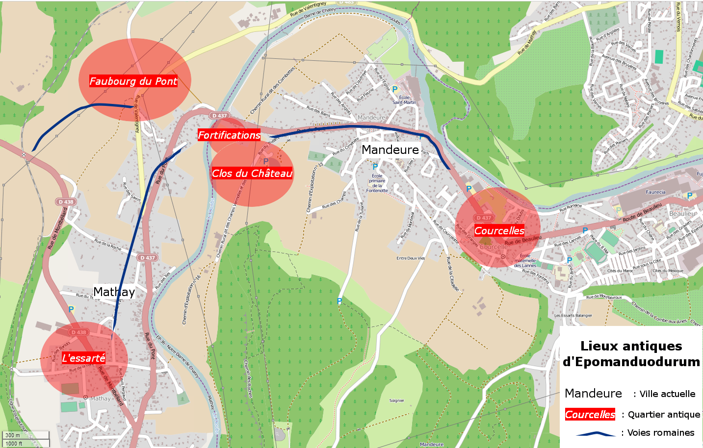
Français : Localisation des lieux antiques d'Epomanduodurum (Mandeure, France) |
| Date | |
| Source | Own work |
| Author | Sacamol |
| Camera location | | View this and other nearby images on: OpenStreetMap |
|---|
Fond cartographique :OpenStreetMap Données : Collectif 2007 : Epomanduodurum, une ville chez les Séquanes : bilan de quatre années de recherche à Mandeure et Mathay (Doubs), in Gallia, 64, 2007, p.359,p373. (Lire en ligne)
Licensing
[edit]
I, the copyright holder of this work, hereby publish it under the following license:
This file is licensed under the Creative Commons Attribution-Share Alike 3.0 Unported license.
- You are free:
- to share – to copy, distribute and transmit the work
- to remix – to adapt the work
- Under the following conditions:
- attribution – You must give appropriate credit, provide a link to the license, and indicate if changes were made. You may do so in any reasonable manner, but not in any way that suggests the licensor endorses you or your use.
- share alike – If you remix, transform, or build upon the material, you must distribute your contributions under the same or compatible license as the original.
File history
Click on a date/time to view the file as it appeared at that time.
| Date/Time | Thumbnail | Dimensions | User | Comment | |
|---|---|---|---|---|---|
| current | 20:44, 8 November 2013 | | 1,433 × 914 (794 KB) | Sacamol (talk | contribs) | User created page with UploadWizard |
You cannot overwrite this file.
File usage on Commons
There are no pages that use this file.
File usage on other wikis
The following other wikis use this file:
- Usage on fr.wikipedia.org
- Usage on it.wikipedia.org