File:Fort Laurens plaque.JPG
Jump to navigation
Jump to search
Size of this preview: 477 × 599 pixels. Other resolutions: 191 × 240 pixels | 382 × 480 pixels | 611 × 768 pixels | 815 × 1,024 pixels | 2,400 × 3,015 pixels.
Original file (2,400 × 3,015 pixels, file size: 4 MB, MIME type: image/jpeg)
Captions
Captions
Add a one-line explanation of what this file represents
Summary
[edit]
| Description |
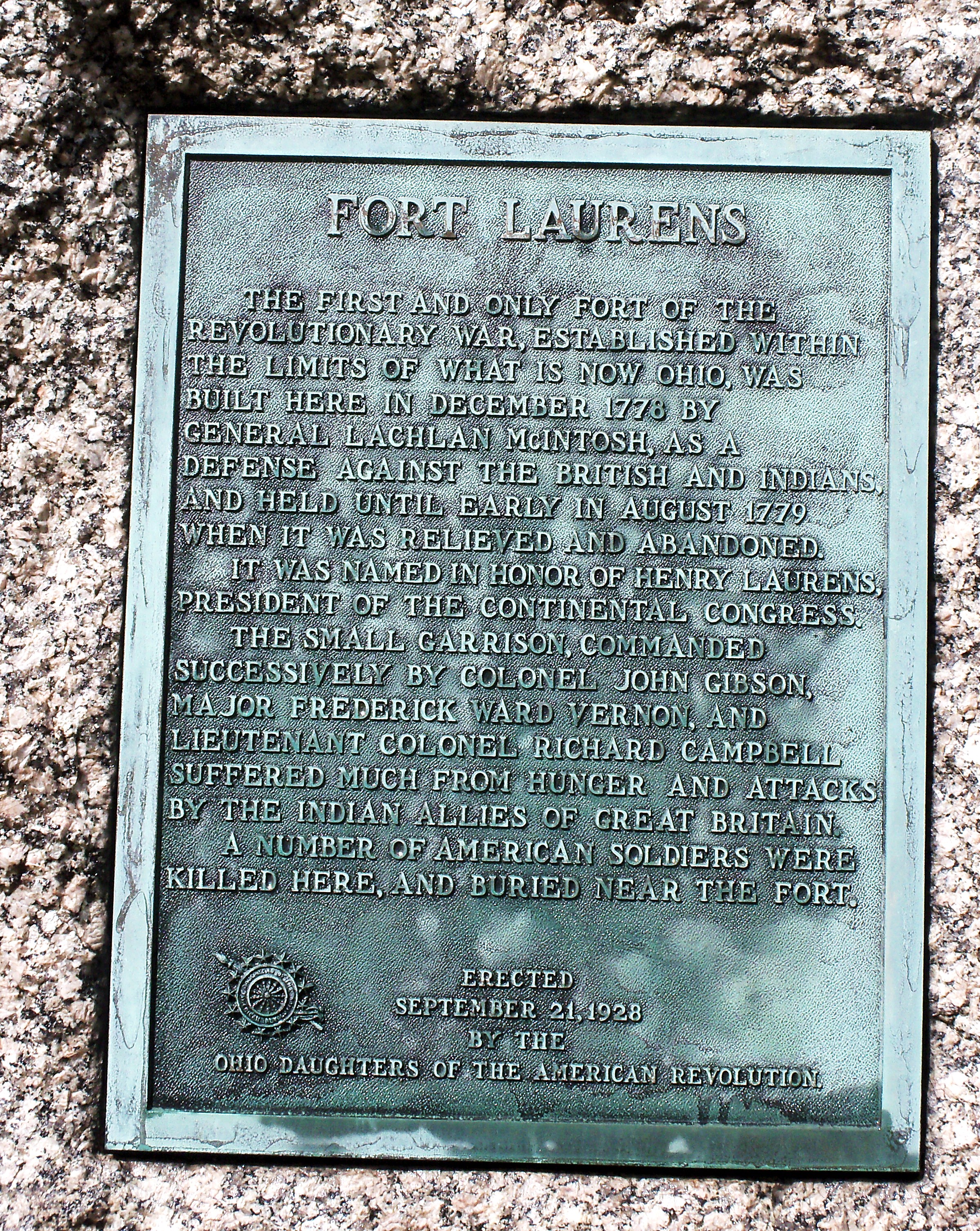
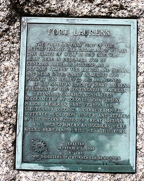
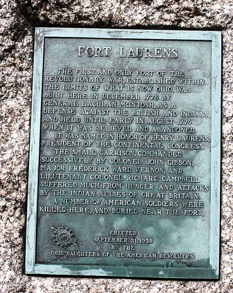
English: 1778-1779 fort near Bolivar Ohio
|
||
| Date | Taken on 3 September 2010 | ||
| Source | Own work | ||
| Author | Roseohioresident |
| Camera location | | View this and other nearby images on: OpenStreetMap |
|---|
Licensing
[edit]
| I, the copyright holder of this work, release this work into the public domain. This applies worldwide. In some countries this may not be legally possible; if so: I grant anyone the right to use this work for any purpose, without any conditions, unless such conditions are required by law. |
File history
Click on a date/time to view the file as it appeared at that time.
| Date/Time | Thumbnail | Dimensions | User | Comment | |
|---|---|---|---|---|---|
| current | 18:04, 7 September 2010 | | 2,400 × 3,015 (4 MB) | Roseohioresident (talk | contribs) | {{Information |Description={{en|1=1778-1779 fort near Bolivar Ohio}} |Source={{own}} |Author=Roseohioresident |Date=2010-09-03 |Permission= |other_versions= }} {{Location|40|38|18|N|81|27|23|W|name=Fort Laur |
You cannot overwrite this file.
File usage on Commons
The following page uses this file:
File usage on other wikis
The following other wikis use this file:
- Usage on en.wikipedia.org
- Usage on www.wikidata.org