File:Four corners.jpg
跳至導覽
跳至搜尋
預覽大小:465 × 599 像素。 其他解析度:186 × 240 像素 | 372 × 480 像素 | 596 × 768 像素 | 794 × 1,024 像素 | 1,589 × 2,048 像素 | 4,500 × 5,800 像素。
原始檔案 (4,500 × 5,800 像素,檔案大小:4.33 MB,MIME 類型:image/jpeg)
說明
說明
添加單行說明來描述出檔案所代表的內容
摘要
[編輯]
| 描述 |
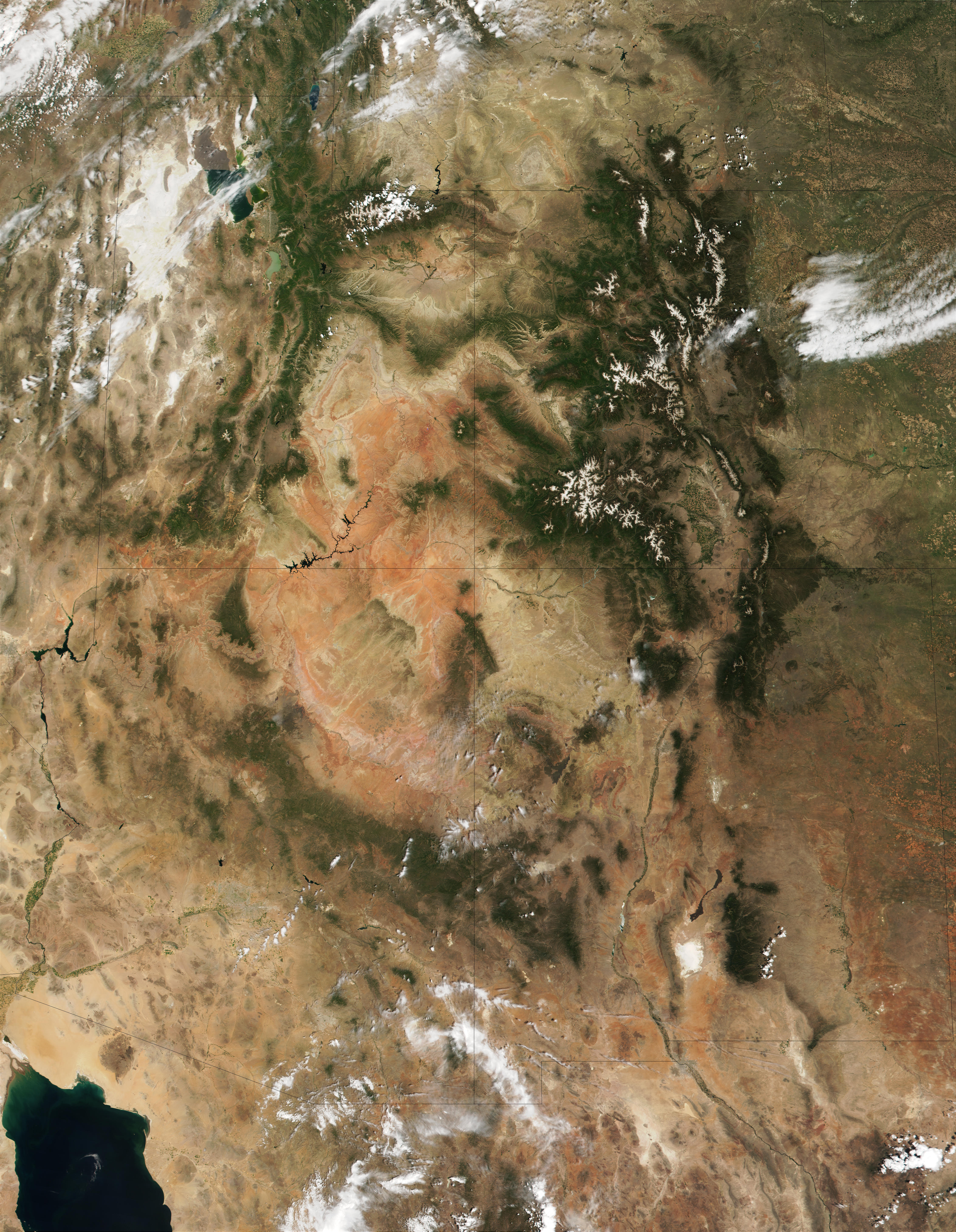
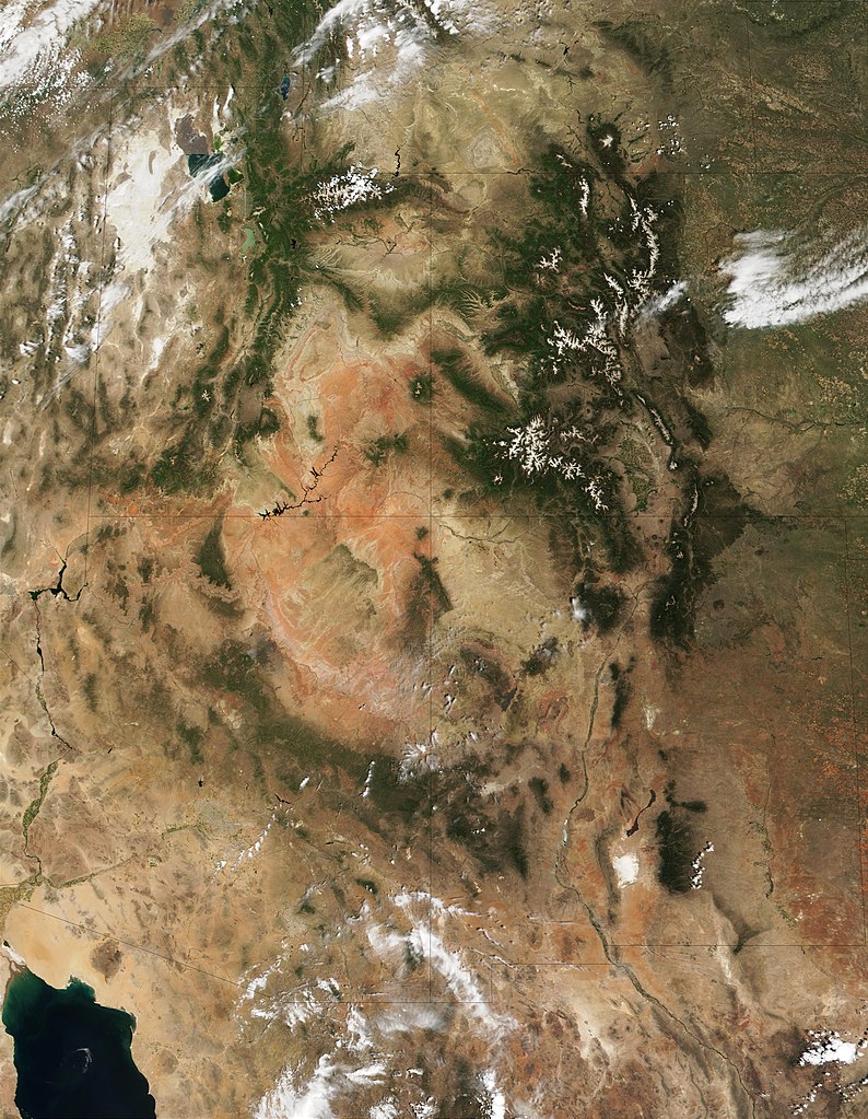
English: This MODIS true-color image is centered on the Four Corners region in the Southwest United States. Recognizable features include the forest-covered Rocky Mountains, which still have snow-covered peaks, running through Colorado and into New Mexico. To the west of Colorado is Utah, where the Great Salt Lake can be seen at the upper left. The Colorado Plateau, with its salmon-colored rocks, extends south from Utah into Arizona. The Grand Canyon of the Colorado River cuts westward through the mountains in northern Arizona. |
| 日期 | |
| 來源 | http://visibleearth.nasa.gov/view_rec.php?id=1980 |
| 作者 | Jacques Descloitres, MODIS Land Rapid Response Team (NASA) |
授權條款
[編輯]
| 本作品由NASA創作,屬於公有領域。根據NASA的版權政策:“NASA的創作除非另有聲明否則不受版權保護。”(參見:Template:PD-USGov/zh,NASA版權政策或JPL圖像使用政策) | ||
 |
警告:
|
檔案歷史
點選日期/時間以檢視該時間的檔案版本。
| 日期/時間 | 縮圖 | 尺寸 | 使用者 | 備註 | |
|---|---|---|---|---|---|
| 目前 | 2010年12月20日 (一) 11:53 | | 4,500 × 5,800(4.33 MB) | Orionist(留言 | 貢獻) | high res from original source |
| 2005年2月23日 (三) 13:32 |  | 396 × 511(187 KB) | Complex01(留言 | 貢獻) |
無法覆蓋此檔案。
檔案用途
下列頁面有用到此檔案:
全域檔案使用狀況
以下其他 wiki 使用了這個檔案:
- ar.wikipedia.org 的使用狀況
- az.wikipedia.org 的使用狀況
- bg.wikipedia.org 的使用狀況
- bn.wikipedia.org 的使用狀況
- bs.wikipedia.org 的使用狀況
- ckb.wikipedia.org 的使用狀況
- en.wikipedia.org 的使用狀況
- es.wikipedia.org 的使用狀況
- et.wikipedia.org 的使用狀況
- fa.wikipedia.org 的使用狀況
- fi.wikipedia.org 的使用狀況
- he.wikipedia.org 的使用狀況
- hu.wikipedia.org 的使用狀況
- it.wikipedia.org 的使用狀況
- ja.wikipedia.org 的使用狀況
- ka.wikipedia.org 的使用狀況
- kk.wikipedia.org 的使用狀況
- kn.wikipedia.org 的使用狀況
- ko.wikipedia.org 的使用狀況
- lfn.wikipedia.org 的使用狀況
- lt.wikipedia.org 的使用狀況
- mk.wikipedia.org 的使用狀況
- ml.wikipedia.org 的使用狀況
- nl.wikipedia.org 的使用狀況
- pa.wikipedia.org 的使用狀況
- pl.wikipedia.org 的使用狀況
- pnb.wikipedia.org 的使用狀況
- pt.wikipedia.org 的使用狀況
- ru.wikipedia.org 的使用狀況
- sd.wikipedia.org 的使用狀況
- si.wikipedia.org 的使用狀況
- sq.wikipedia.org 的使用狀況
- ta.wikipedia.org 的使用狀況
- vi.wikipedia.org 的使用狀況
- zh.wikipedia.org 的使用狀況