File:France proposal regions (2014) map.svg
Jump to navigation
Jump to search

Size of this PNG preview of this SVG file: 507 × 553 pixels. Other resolutions: 220 × 240 pixels | 440 × 480 pixels | 704 × 768 pixels | 939 × 1,024 pixels | 1,878 × 2,048 pixels.
Original file (SVG file, nominally 507 × 553 pixels, file size: 149 KB)
Captions
Captions
Add a one-line explanation of what this file represents
Summary
[edit]| Description |
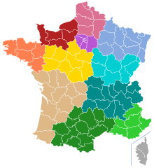
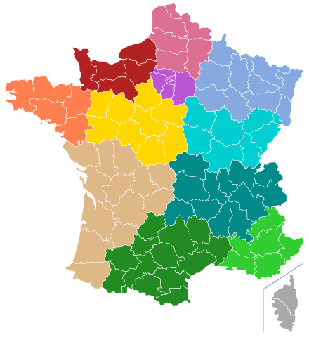
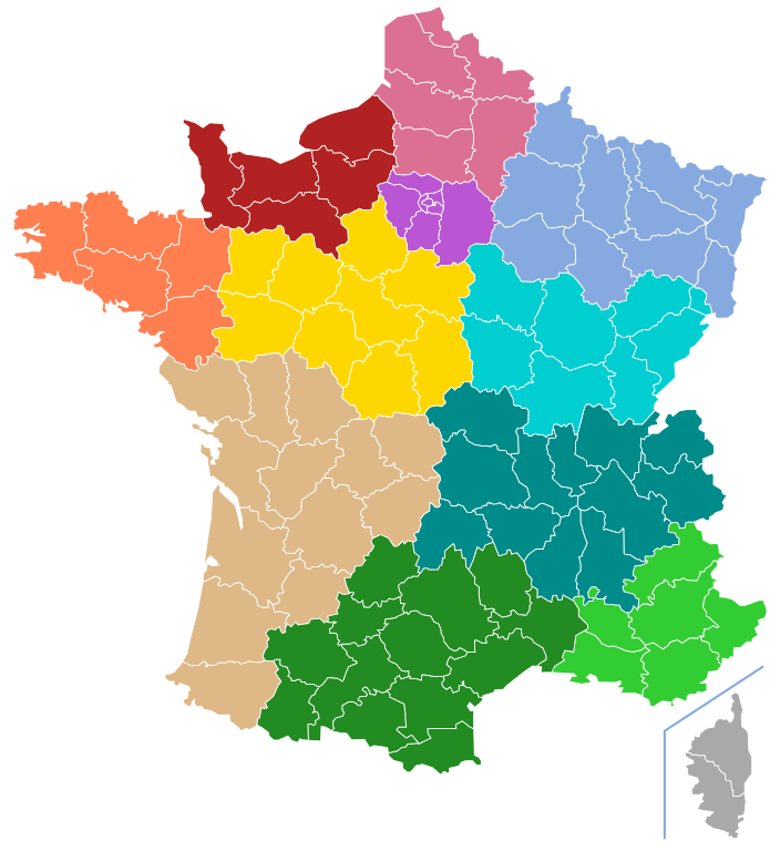
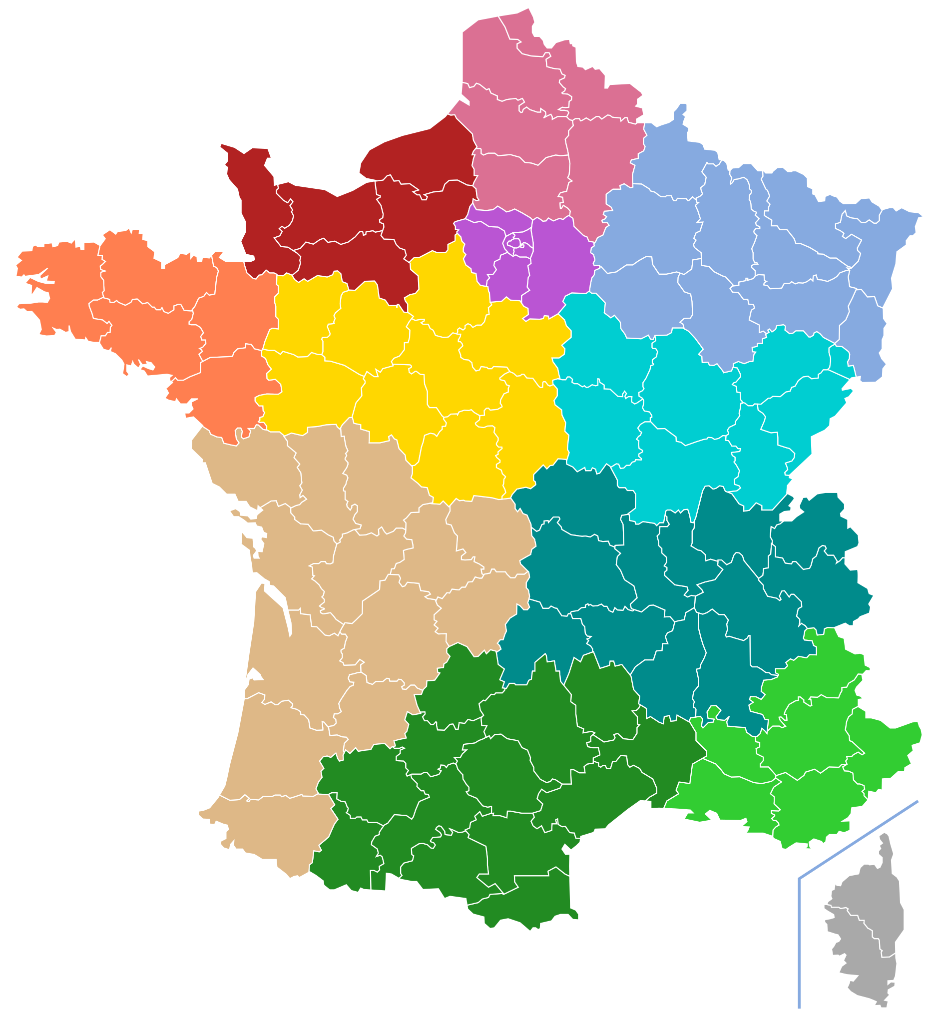
English: Map of twelve proposal french regions (2014 project)
Français : Carte des douze régions français proposées (projet de 2014) |
||||||||
| Date | |||||||||
| Source |
Informations: http://www.challenges.fr/economie/20140411.CHA2681/regions-la-carte-secrete-du-gouvernement.html Original map: File:Départements de France-simple.svg |
||||||||
| Author | User:Naturals | ||||||||
| Permission (Reusing this file) |
I, the copyright holder of this work, hereby publish it under the following licenses:
You may select the license of your choice. |

_map.svg&action=edit§ion=1)
Licensing
[edit]_map.svg&action=edit§ion=2)
I, the copyright holder of this work, hereby publish it under the following license:
This file is licensed under the Creative Commons Attribution-Share Alike 3.0 Unported license.
- You are free:
- to share – to copy, distribute and transmit the work
- to remix – to adapt the work
- Under the following conditions:
- attribution – You must give appropriate credit, provide a link to the license, and indicate if changes were made. You may do so in any reasonable manner, but not in any way that suggests the licensor endorses you or your use.
- share alike – If you remix, transform, or build upon the material, you must distribute your contributions under the same or compatible license as the original.
File history
Click on a date/time to view the file as it appeared at that time.
| Date/Time | Thumbnail | Dimensions | User | Comment | |
|---|---|---|---|---|---|
| current | 22:52, 3 May 2014 | | 507 × 553 (149 KB) | SenseiAC (talk | contribs) | Aucun changement, mais tentative de corriger des bugs d'affichage / No change, simply attempt to correct diplaying bugs. |
| 13:46, 21 April 2014 |  | 507 × 553 (149 KB) | Naturals (talk | contribs) | corrections | |
| 13:43, 21 April 2014 |  | 507 × 553 (149 KB) | Naturals (talk | contribs) | {{Information |Description= {{en|Map of twelve proposal french regions (2014 project)}} {{fr|Carte des douze régions français proposées (projet de 2014)}} |Source=Informations: http://www.challenges.fr/economie/20140411.CHA2681/regions-la-carte-secr... |
You cannot overwrite this file.
File usage on Commons
There are no pages that use this file.
File usage on other wikis
The following other wikis use this file:
- Usage on ca.wikipedia.org
- Usage on en.wikipedia.org
- Usage on eu.wikipedia.org
- Usage on fr.wikipedia.org
- Usage on nn.wikipedia.org
- Usage on no.wikipedia.org
- Usage on vi.wikipedia.org
_map.svg&oldid=500903814)