File:Frances 2004-08-31 1755Z.jpg
跳转到导航
跳转到搜索

本预览的尺寸:466 × 599像素。 其他分辨率:187 × 240像素 | 373 × 480像素 | 597 × 768像素 | 796 × 1,024像素 | 1,593 × 2,048像素 | 5,600 × 7,200像素。
原始文件 (5,600 × 7,200像素,文件大小:7.03 MB,MIME类型:image/jpeg)
说明
说明
添加一行文字以描述该文件所表现的内容
摘要
[编辑]
| 描述 |
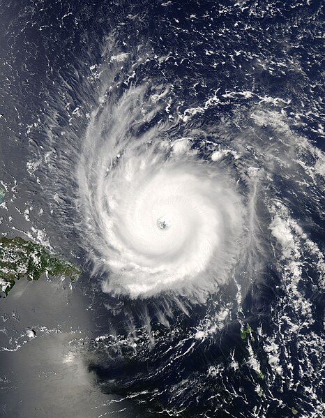
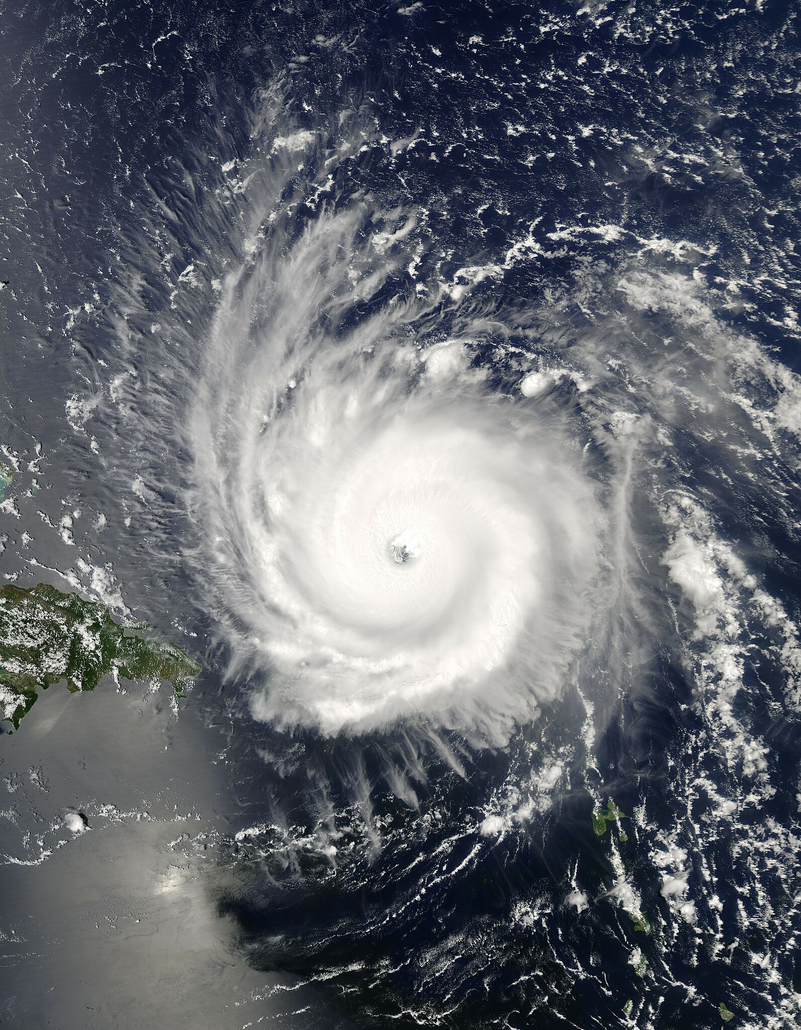
The MODIS instrument aboard NASA's Aqua satellite captured this true-color image of Hurricane Frances on August 31, 2004 at 17:55 UTC (1:55 PM EDT). At the time this image was taken Frances was located approximately 230 km (140 miles) north-northeast of San Juan, Puerto Rico and was moving towards the west near 26 km/hr (16 mph). Maximum sustained winds were near 225 km/hr (140 mph) and the storm's minimum central pressure was down to 942 millibars. The MODIS Rapid Response System provides this image at additional resolutions and formats. |
|||
| 日期 | ||||
| 来源 | http://visibleearth.nasa.gov/view_rec.php?id=6584 | |||
| 作者 | Jacques Descloitres, MODIS Rapid Response Team, NASA/GSFC | |||
| 授权 (二次使用本文件) |
|
|||
| 其他版本 | Image:Hurricane Frances 2004.jpg |
文件历史
点击某个日期/时间查看对应时刻的文件。
| 日期/时间 | 缩略图 | 大小 | 用户 | 备注 | |
|---|---|---|---|---|---|
| 当前 | 2006年9月26日 (二) 21:50 | | 5,600 × 7,200(7.03 MB) | Good kitty(留言 | 贡献) | |
| 2006年5月3日 (三) 04:27 |  | 2,800 × 3,600(2.43 MB) | Titoxd(留言 | 贡献) | {{information | Description=Image of Hurricane Frances near Hispaniola | Source= http://earthobservatory.nasa.gov/NaturalHazards/natural_hazards_v2.php3?img_id=12389 | Date=uploaded May 3, 2006 | Author=NASA | Permissi |
您不可以覆盖此文件。
文件用途
以下2个页面使用本文件:
全域文件用途
以下其他wiki使用此文件:
- ca.wikipedia.org上的用途
- en.wikipedia.org上的用途
- eo.wikipedia.org上的用途
- es.wikipedia.org上的用途
- fi.wikipedia.org上的用途
- fr.wikipedia.org上的用途
- pl.wikipedia.org上的用途
- pt.wikipedia.org上的用途
- simple.wikipedia.org上的用途
- th.wikipedia.org上的用途
- uk.wikipedia.org上的用途
- www.wikidata.org上的用途
- zh.wikipedia.org上的用途