File:Frauenweiler, 69168 Wiesloch, Germany - panoramio - Otmar Merkel.jpg
From Wikimedia Commons, the free media repository
Jump to navigation
Jump to search
![File:Frauenweiler, 69168 Wiesloch, Germany - panoramio - Otmar Merkel.jpg](https://upload.wikimedia.org/wikipedia/commons/thumb/f/f5/Frauenweiler%2C_69168_Wiesloch%2C_Germany_-_panoramio_-_Otmar_Merkel.jpg/800px-Frauenweiler%2C_69168_Wiesloch%2C_Germany_-_panoramio_-_Otmar_Merkel.jpg?20161102182628)
Size of this preview: 800 × 600 pixels. Other resolutions: 320 × 240 pixels | 640 × 480 pixels | 1,024 × 768 pixels | 1,280 × 960 pixels | 2,560 × 1,920 pixels | 4,160 × 3,120 pixels.
Original file (4,160 × 3,120 pixels, file size: 4.74 MB, MIME type: image/jpeg)
File information
Structured data
Captions
Captions
Add a one-line explanation of what this file represents
DescriptionFrauenweiler, 69168 Wiesloch, Germany - panoramio - Otmar Merkel.jpg |
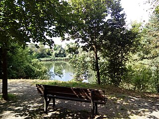
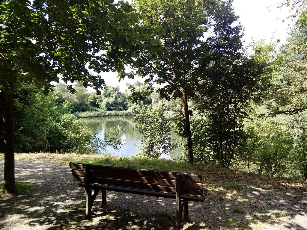
Frauenweiler, 69168 Wiesloch, Germany Ruhezone am Bottloch See |
||
Date | Taken on 27 July 2016 | ||
Source | https://web.archive.org/web/20161103060011/http://www.panoramio.com/photo/132447225 | ||
Author | Otmar Merkel | ||
Permission (Reusing this file) |
![]() ![]() This file is licensed under the Creative Commons Attribution 3.0 Unported license. Attribution: Otmar Merkel
|
Camera location | 49° 16′ 44.97″ N, 8° 40′ 33.41″ E ![]() | View this and other nearby images on: OpenStreetMap | ![]() |
---|
File history
Click on a date/time to view the file as it appeared at that time.
Date/Time | Thumbnail | Dimensions | User | Comment | |
---|---|---|---|---|---|
current | 18:26, 2 November 2016 | ![]() | 4,160 × 3,120 (4.74 MB) | Panoramio upload bot (talk | contribs) | {{Information |description=Frauenweiler, 69168 Wiesloch, Germany <p>Ruhezone am Bottloch See</p> |date={{Taken on|2016-07-27}} |source=http://www.panoramio.com/photo/132447225 |author=[http://www.panoramio.com/user/8603675?with_photo_id=132447225 Otma... |
You cannot overwrite this file.
File usage on Commons
The following 2 pages use this file:
Metadata
This file contains additional information such as Exif metadata which may have been added by the digital camera, scanner, or software program used to create or digitize it. If the file has been modified from its original state, some details such as the timestamp may not fully reflect those of the original file. The timestamp is only as accurate as the clock in the camera, and it may be completely wrong.
Camera manufacturer | Elite 5 |
---|---|
Camera model | Elite 5 |
Exposure time | 1,833/1,000,000 sec (0.001833) |
F-number | f/2 |
ISO speed rating | 57 |
Date and time of data generation | 11:09, 27 July 2016 |
Lens focal length | 3.5 mm |
Orientation | Normal |
Horizontal resolution | 72 dpi |
Vertical resolution | 72 dpi |
Software used | [[w:MediaTek Camera Application
|MediaTek Camera Application ]] |
File change date and time | 11:09, 27 July 2016 |
Y and C positioning | Co-sited |
Exposure Program | Not defined |
Exif version | 2.2 |
Date and time of digitizing | 11:09, 27 July 2016 |
Meaning of each component |
|
APEX exposure bias | 0 |
Metering mode | Center weighted average |
Light source | Other light source |
Flash | Flash did not fire |
DateTime subseconds | 53 |
DateTimeOriginal subseconds | 53 |
DateTimeDigitized subseconds | 53 |
Supported Flashpix version | 1 |
Color space | sRGB |
Exposure mode | Auto exposure |
White balance | Auto white balance |
Digital zoom ratio | 1 |
Scene capture type | Standard |
Structured data
Items portrayed in this file
depicts
49°16'44.972"N, 8°40'33.413"E
27 July 2016
0.001833 second
3.5 millimetre
image/jpeg
Hidden categories:
- Germany photographs taken on 2016-07-27
- CC-BY-3.0
- Panoramio images reviewed by trusted users
- Photos from Panoramio
- Files with coordinates missing SDC location of creation (49° N, 8° E)
- Media needing category review as of 2 November 2016
- Panoramio files uploaded by Panoramio upload bot
- Taken with Leagoo Elite 5