File:French Empire in September 1812.png
Jump to navigation
Jump to search
Size of this preview: 592 × 600 pixels. Other resolutions: 237 × 240 pixels | 474 × 480 pixels | 758 × 768 pixels | 1,011 × 1,024 pixels | 1,895 × 1,920 pixels.
Original file (1,895 × 1,920 pixels, file size: 646 KB, MIME type: image/png)
Captions
Captions
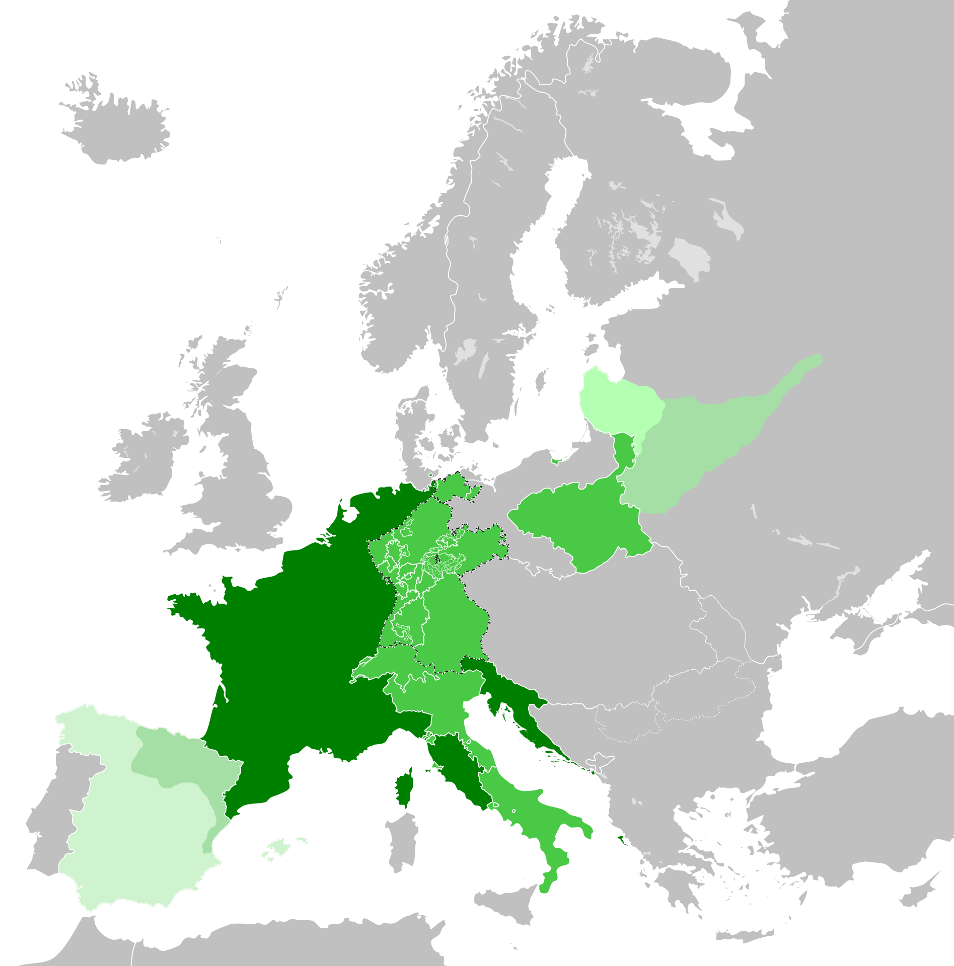
The original map is by alpathon. I have edited this to include the French invasion of Russia
Summary[edit]
| Description |
English: The original map is by alpathon. I have edited this to include the French invasion of Russia. This work depicts France at its peak territorial control |
| Date | |
| Source | This is originally Alpathon’s map. I have edited the map to make it accurate for the period |
| Author | Alpathon |
Licensing[edit]
This file is licensed under the Creative Commons Attribution 4.0 International license.
- You are free:
- to share – to copy, distribute and transmit the work
- to remix – to adapt the work
- Under the following conditions:
- attribution – You must give appropriate credit, provide a link to the license, and indicate if changes were made. You may do so in any reasonable manner, but not in any way that suggests the licensor endorses you or your use.
File history
Click on a date/time to view the file as it appeared at that time.
| Date/Time | Thumbnail | Dimensions | User | Comment | |
|---|---|---|---|---|---|
| current | 04:08, 23 July 2023 | | 1,895 × 1,920 (646 KB) | Ihaveabadname (talk | contribs) | Accuracy |
| 08:52, 2 June 2023 |  | 1,895 × 1,920 (641 KB) | The Great Mule of Eupatoria (talk | contribs) | Uploaded a work by Alpathon from This is originally Alpathon’s map. I have edited the map to make it accurate for the period with UploadWizard |
You cannot overwrite this file.
File usage on Commons
There are no pages that use this file.
File usage on other wikis
The following other wikis use this file:
- Usage on nl.wikipedia.org