File:French Guiana Location Map.svg
Jump to navigation
Jump to search

Size of this PNG preview of this SVG file: 800 × 565 pixels. Other resolutions: 320 × 226 pixels | 640 × 452 pixels | 1,024 × 724 pixels | 1,280 × 905 pixels | 2,560 × 1,809 pixels | 842 × 595 pixels.
Original file (SVG file, nominally 842 × 595 pixels, file size: 401 KB)
Captions
Captions
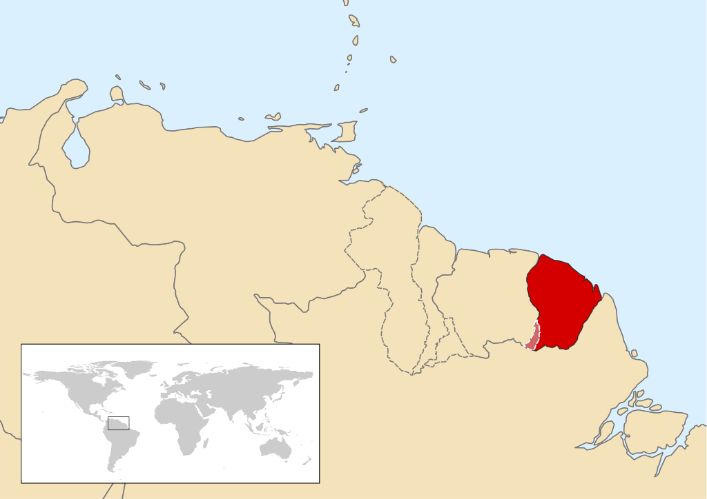
Location map of French-Guiana showing the disputed areas in a neutral manner
Summary
[edit]
| Description |
English: Location map of French-Guiana showing the disputed areas in a neutral manner. Many maps on the internet show the disputed areas between Suriname-French Guiana as non existent. the disputed area between these 2 countries have been there since colonial times and is still not resolved. Leaving them completely off the map of Suriname and showing them as French Guianese territory is not Neutral. |
| Date | |
| Source | Own work |
| Author | SurinameCentral |
Licensing
[edit]
I, the copyright holder of this work, hereby publish it under the following license:
This file is licensed under the Creative Commons Attribution-Share Alike 4.0 International license.
- You are free:
- to share – to copy, distribute and transmit the work
- to remix – to adapt the work
- Under the following conditions:
- attribution – You must give appropriate credit, provide a link to the license, and indicate if changes were made. You may do so in any reasonable manner, but not in any way that suggests the licensor endorses you or your use.
- share alike – If you remix, transform, or build upon the material, you must distribute your contributions under the same or compatible license as the original.
File history
Click on a date/time to view the file as it appeared at that time.
| Date/Time | Thumbnail | Dimensions | User | Comment | |
|---|---|---|---|---|---|
| current | 18:18, 17 June 2023 | | 842 × 595 (401 KB) | SurinameCentral (talk | contribs) | Uploaded own work with UploadWizard |
You cannot overwrite this file.
File usage on Commons
There are no pages that use this file.
File usage on other wikis
The following other wikis use this file:
- Usage on en.wikipedia.org
- Usage on nl.wikipedia.org