File:Frojel formation map.svg
Jump to navigation
Jump to search

Size of this PNG preview of this SVG file: 426 × 589 pixels. Other resolutions: 173 × 240 pixels | 347 × 480 pixels | 555 × 768 pixels | 740 × 1,024 pixels | 1,481 × 2,048 pixels.
Original file (SVG file, nominally 426 × 589 pixels, file size: 253 KB)
Captions
Captions
Add a one-line explanation of what this file represents
| Description |
English: See below |
| Date |
|
| Source | Redrawn after Calner 2005 |
| Author | Smith609 |
Summary[edit]
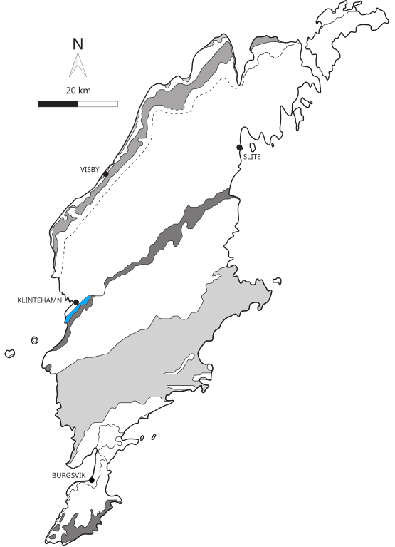
| Description | Geological map of the Gotland, Sweden, with Burgsvik Beds highlighted |
| Date | |
| Source | self-made after Calner 2005. DOI:10.1130/G21185.1 |
| Author | Verisimilus |
| Permission (Reusing this file) |
This file is licensed under the Creative Commons Attribution 3.0 Unported license.
|
This W3C-unspecified vector image was created with Inkscape .
File history
Click on a date/time to view the file as it appeared at that time.
| Date/Time | Thumbnail | Dimensions | User | Comment | |
|---|---|---|---|---|---|
| current | 17:46, 6 July 2008 | | 426 × 589 (253 KB) | Smith609 (talk | contribs) | {{Information |Description= |Source= |Date= |Author= |Permission= |other_versions= }} |
| 17:43, 6 July 2008 |  | 426 × 589 (253 KB) | Smith609 (talk | contribs) | {{Information |Description={{en|1=See below}} |Source=Redrawn after Calner 2005 |Author=Smith609 |Date= |Permission= |other_versions= }} == Summary == {{Information |Description=Geological map of the Gotland, Sweden, with Burgsvik Beds h |
You cannot overwrite this file.
File usage on Commons
There are no pages that use this file.
File usage on other wikis
The following other wikis use this file:
- Usage on en.wikipedia.org
- Usage on sv.wikipedia.org