File:Gale crater topo.png
Jump to navigation
Jump to search

Size of this preview: 800 × 552 pixels. Other resolutions: 320 × 221 pixels | 640 × 442 pixels | 1,024 × 707 pixels | 1,280 × 884 pixels | 2,712 × 1,872 pixels.
Original file (2,712 × 1,872 pixels, file size: 2.95 MB, MIME type: image/png)
Captions
Captions
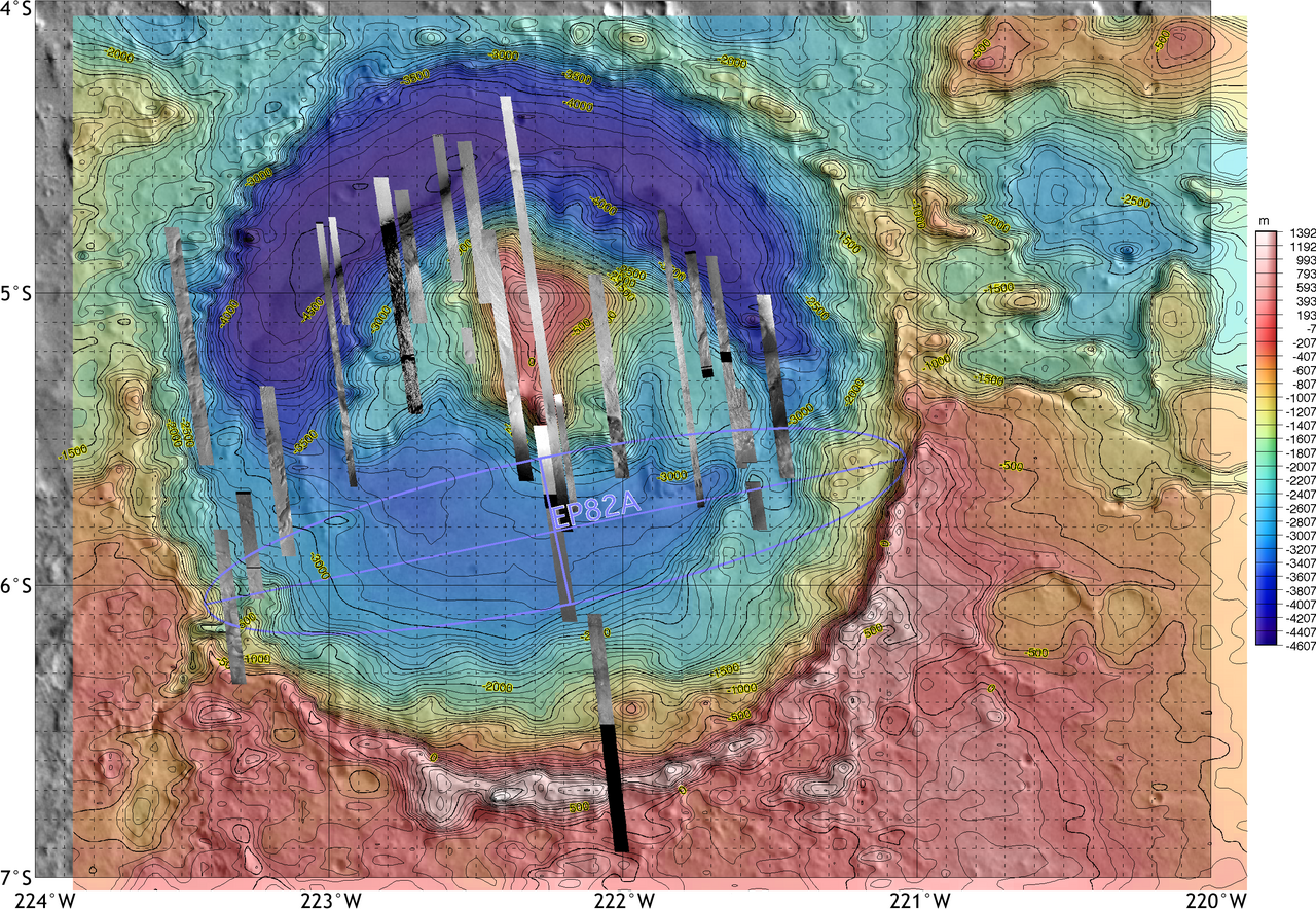
Topographic map of Gale crater on Mars, with the proposed but rejected landing ellipse for the MER-A
Summary[edit]
| Description |
English: Topographic map of Gale crater on Mars, with the proposed but rejected landing ellipse for the MER-A superimposed. The MER lander was ultimately sent elsewhere, but the opposite side of the crater was selected for the 2011 Mars Science Laboratory rover. |
| Date | |
| Source | https://marsoweb.nas.nasa.gov/landingsites/mer2003/topsites/Gale/ |
| Author | NASA/JPL-CalTech/ASU |
| Other versions |
 |
| Location on Mars | View this and other nearby images on: Google Maps |
|---|
Licensing[edit]
| This file is in the public domain in the United States because it was solely created by NASA. NASA copyright policy states that "NASA material is not protected by copyright unless noted". (See Template:PD-USGov, NASA copyright policy page or JPL Image Use Policy.) | ||
 |
Warnings:
|
File history
Click on a date/time to view the file as it appeared at that time.
| Date/Time | Thumbnail | Dimensions | User | Comment | |
|---|---|---|---|---|---|
| current | 00:33, 18 November 2021 | | 2,712 × 1,872 (2.95 MB) | Cherurbino (talk | contribs) | Uploaded a work by NASA/JPL-CalTech/ASU from https://marsoweb.nas.nasa.gov/landingsites/mer2003/topsites/Gale/ with UploadWizard |
You cannot overwrite this file.
File usage on Commons
The following page uses this file:
File usage on other wikis
The following other wikis use this file:
- Usage on ru.wikipedia.org
- Usage on ru.wikinews.org