File:Gallapagos Islands 1684.jpg
跳转到导航
跳转到搜索
本预览的尺寸:548 × 600像素。 其他分辨率:219 × 240像素 | 438 × 480像素 | 701 × 768像素 | 935 × 1,024像素 | 1,845 × 2,020像素。
原始文件 (1,845 × 2,020像素,文件大小:335 KB,MIME类型:image/jpeg)
说明
说明
添加一行文字以描述该文件所表现的内容
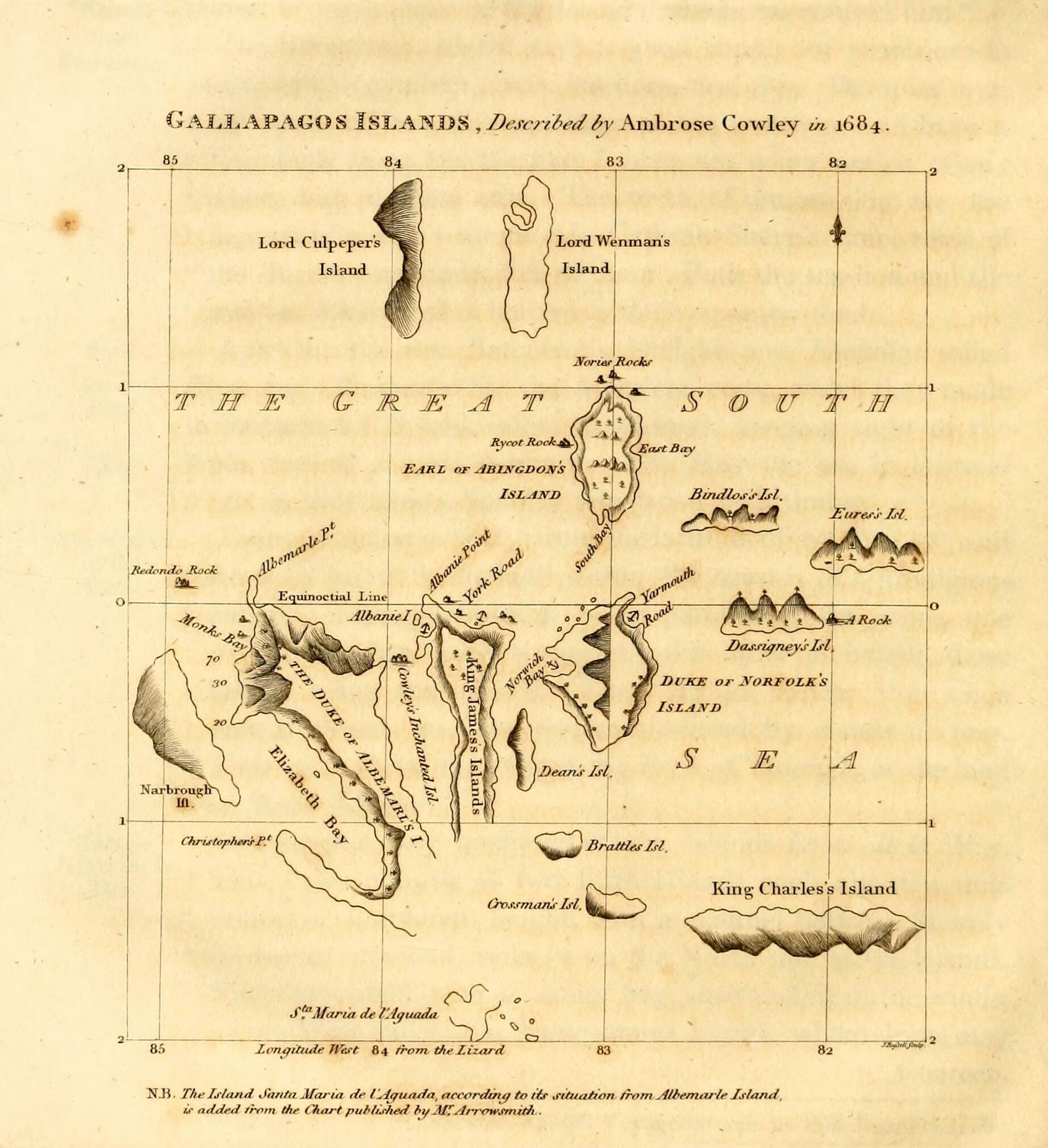
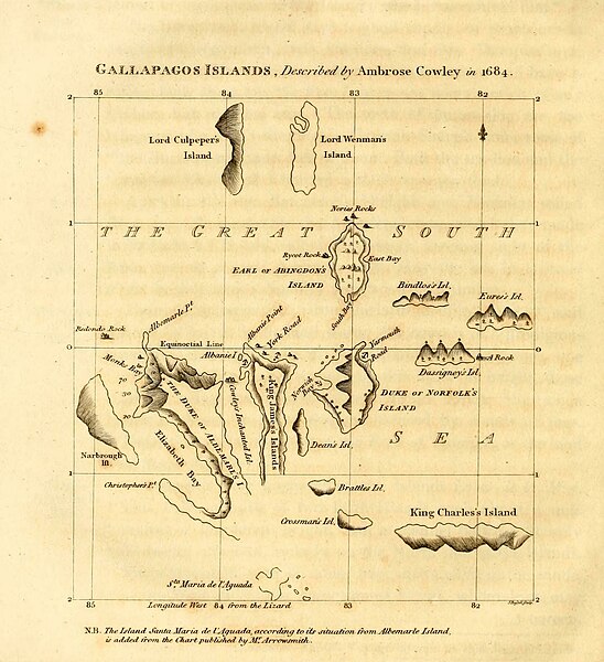
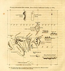
1816 English map of the Galapagos, revising a 1684 original
摘要
[编辑]
| 描述 |
English: Galapagos Islands, described by Ambrose Cowley in 1684.
|
| 日期 | 1816, revision of a 1684 map |
| 来源 | James Burney's A Chronological History of the Discoveries in the South Sea or Pacific Ocean, Vol. IV, p. 145. |
| 作者 | John Russell, based on an map by William Ambrosia Cowley with influence from Emanuel Bowen and William Arrowsmith's separate revisions |
许可协议
[编辑]
|
|
 | |
 |
| 注解 | 该图片含有注解:在维基媒体共享资源上查看注解 |
文件历史
点击某个日期/时间查看对应时刻的文件。
| 日期/时间 | 缩略图 | 大小 | 用户 | 备注 | |
|---|---|---|---|---|---|
| 当前 | 2023年5月11日 (四) 21:17 | | 1,845 × 2,020(335 KB) | LlywelynII(留言 | 贡献) | Cropped using CropTool to the size of the actual map pasted onto the book page. |
| 2023年5月11日 (四) 21:13 |  | 2,148 × 2,892(437 KB) | LlywelynII(留言 | 贡献) | Much higher quality version from archive.org copy of the work | |
| 2023年5月11日 (四) 20:10 |  | 672 × 845(413 KB) | LlywelynII(留言 | 贡献) | Reverted to version as of 18:11, 11 November 2010 (UTC) These are completely different maps from different sources and the original shouldn't've been replaced. | |
| 2012年9月25日 (二) 19:12 |  | 2,357 × 3,831(10.46 MB) | Jojagal(留言 | 贡献) | Mapa de las Islas Galápagos según el Capitán Cowley (1684) - AHG | |
| 2010年11月11日 (四) 18:11 |  | 672 × 845(413 KB) | Alcmaeonid(留言 | 贡献) | {{Information |Description={{en|1=Map of the Galapagos Islands as described by Ambrose Cowlev in 1684.}} |Source=A chronological history of the discoveries in the South Sea or Pacific Ocean ; illustrated with charts volume 4 |Author=James Burney |Date=180 |
您不可以覆盖此文件。
文件用途
以下页面使用本文件:
全域文件用途
以下其他wiki使用此文件:
- ast.wikipedia.org上的用途
- de.wikipedia.org上的用途
- en.wikipedia.org上的用途
- es.wikipedia.org上的用途
- fi.wikipedia.org上的用途
- fr.wikipedia.org上的用途
- ko.wikipedia.org上的用途
- mk.wikipedia.org上的用途
- pl.wikipedia.org上的用途
- stq.wikipedia.org上的用途
- zh.wikipedia.org上的用途