File:Gauripur in Mymensingh division (Bangladesh).svg
Jump to navigation
Jump to search

Size of this PNG preview of this SVG file: 762 × 600 pixels. Other resolutions: 305 × 240 pixels | 610 × 480 pixels | 976 × 768 pixels | 1,280 × 1,008 pixels | 2,560 × 2,015 pixels | 1,142 × 899 pixels.
Original file (SVG file, nominally 1,142 × 899 pixels, file size: 1.09 MB)
Captions
Captions
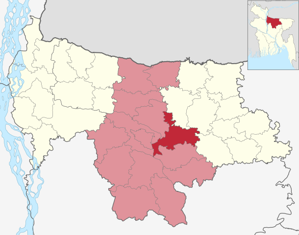
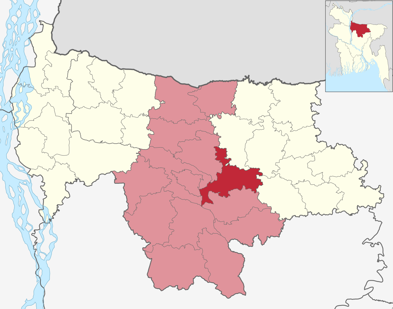
Gouripur, Mymensingh
Summary[edit]
.svg&action=edit§ion=1)
| Description |
বাংলা: গৌরীপুর উপজেলার মানচিত্র, ময়মনসিংহ জেলা, ময়মনসিংহ বিভাগ English: Map of Gauripur upazila in Mymensingh district, Mymensingh division |
| Date | |
| Source | Derivative of File:Bangladesh Mymensingh division location map.svg |
| Author | Own work |
Licensing[edit]
.svg&action=edit§ion=2)
This file is licensed under the Creative Commons Attribution-Share Alike 4.0 International license.
- You are free:
- to share – to copy, distribute and transmit the work
- to remix – to adapt the work
- Under the following conditions:
- attribution – You must give appropriate credit, provide a link to the license, and indicate if changes were made. You may do so in any reasonable manner, but not in any way that suggests the licensor endorses you or your use.
- share alike – If you remix, transform, or build upon the material, you must distribute your contributions under the same or compatible license as the original.
File history
Click on a date/time to view the file as it appeared at that time.
| Date/Time | Thumbnail | Dimensions | User | Comment | |
|---|---|---|---|---|---|
| current | 02:19, 24 December 2023 | | 1,142 × 899 (1.09 MB) | C1MM (talk | contribs) | Added Mymensingh city corporation |
| 17:14, 16 September 2023 |  | 1,142 × 899 (1.08 MB) | C1MM (talk | contribs) | {{Information|Description=Map of Gauripur upazila in Mymensingh district, Mymensingh division|Source=Derivative of File:Bangladesh Mymensingh division location map.svg|Date=2023-09-16|Author=Own work|Permission={{Cc-by-sa-4.0}}}} Category:SVG locator maps of upazilas of Mymensingh division |
You cannot overwrite this file.
File usage on Commons
The following page uses this file:
File usage on other wikis
The following other wikis use this file:
- Usage on bn.wikipedia.org
- Usage on en.wikipedia.org
- Usage on fr.wikipedia.org
- Usage on ru.wikipedia.org
- Usage on www.wikidata.org
.svg&oldid=848007395)