File:Geertruidenberg on a 16th century map.png
Jump to navigation
Jump to search
Size of this preview: 800 × 479 pixels. Other resolutions: 320 × 192 pixels | 640 × 383 pixels | 1,024 × 613 pixels | 1,280 × 766 pixels | 1,881 × 1,126 pixels.
Original file (1,881 × 1,126 pixels, file size: 3.72 MB, MIME type: image/png)
Captions
Captions
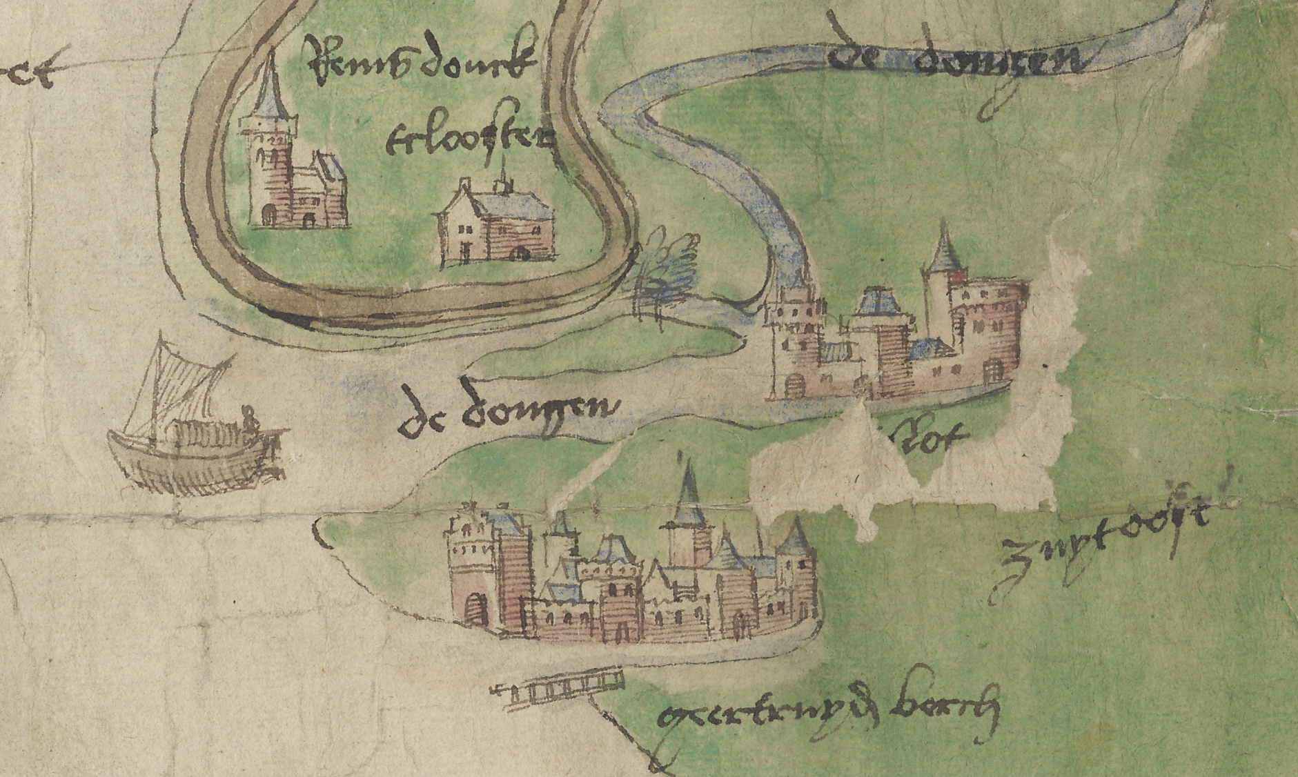
Geertruidenberg and its castle on a fragment of a 16th century map.
Summary
[edit]
| Description |
English: Geertruidenberg and its castle on a fragment of a 16th century map. The map has been dated c. 1550.
Nederlands: Geertruidenberg en het kasteel van Geertruidenberg op een fragment van een 16e eeuwse kaart. De kaart is gedateerd op ca. 1550. |
| Date | |
| Source | http://hdl.handle.net/1887.1/item:2371848 Leiden University Libraries Digital Collection |
| Author | Unknown c. 1550 |
Licensing
[edit]
| This file is made available under the Creative Commons CC0 1.0 Universal Public Domain Dedication. | |
| The person who associated a work with this deed has dedicated the work to the public domain by waiving all of their rights to the work worldwide under copyright law, including all related and neighboring rights, to the extent allowed by law. You can copy, modify, distribute and perform the work, even for commercial purposes, all without asking permission.
|
File history
Click on a date/time to view the file as it appeared at that time.
| Date/Time | Thumbnail | Dimensions | User | Comment | |
|---|---|---|---|---|---|
| current | 06:29, 4 January 2024 | | 1,881 × 1,126 (3.72 MB) | Grieg2 (talk | contribs) | Uploaded a work by Unknown c. 1550 from http://hdl.handle.net/1887.1/item:2371848 Leiden University Libraries Digital Collection with UploadWizard |
You cannot overwrite this file.
File usage on Commons
There are no pages that use this file.
File usage on other wikis
The following other wikis use this file:
- Usage on en.wikipedia.org
- Usage on www.wikidata.org