File:Gemeente Nuth kadasterindeling MIN11077VK1.jpg
Jump to navigation
Jump to search

Size of this preview: 800 × 538 pixels. Other resolutions: 320 × 215 pixels | 640 × 430 pixels | 1,024 × 688 pixels | 1,280 × 860 pixels | 2,560 × 1,720 pixels | 7,524 × 5,056 pixels.
Original file (7,524 × 5,056 pixels, file size: 5.81 MB, MIME type: image/jpeg)
Captions
Captions
Add a one-line explanation of what this file represents
Summary
[edit]
| Description |
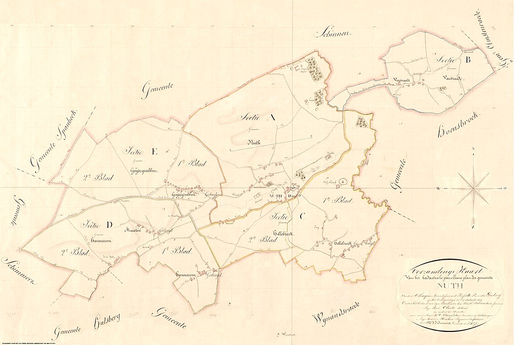
Nederlands: In de Franse tijd heeft men een begin gemaakt met landmetingen voor het Kadaster. Kadastrale aanduidingen in het archief zijn gebaseerd op een verdeling in secties en bladen. De assemblagekaart laat zien hoe deze verdeling gedaan is. |
| Date | |
| Source | Rijksdienst voor het Cultureel Erfgoed , Amersfoort |
| Author | M.J.J. Cremers |
Licensing
[edit]
This file is licensed under the Creative Commons Attribution 4.0 International license.
- You are free:
- to share – to copy, distribute and transmit the work
- to remix – to adapt the work
- Under the following conditions:
- attribution – You must give appropriate credit, provide a link to the license, and indicate if changes were made. You may do so in any reasonable manner, but not in any way that suggests the licensor endorses you or your use.
File history
Click on a date/time to view the file as it appeared at that time.
| Date/Time | Thumbnail | Dimensions | User | Comment | |
|---|---|---|---|---|---|
| current | 21:56, 3 February 2023 | | 7,524 × 5,056 (5.81 MB) | Wvdbroek (talk | contribs) | Uploaded a work by M.J.J. Cremers from Rijksdienst voor het Cultureel Erfgoed , Amersfoort with UploadWizard |
You cannot overwrite this file.
File usage on Commons
There are no pages that use this file.
File usage on other wikis
The following other wikis use this file:
- Usage on nl.wikipedia.org