File:GeologicMap.png
Jump to navigation
Jump to search
Size of this preview: 470 × 599 pixels. Other resolutions: 188 × 240 pixels | 377 × 480 pixels | 603 × 768 pixels | 1,268 × 1,616 pixels.
Original file (1,268 × 1,616 pixels, file size: 836 KB, MIME type: image/png)
Captions
Captions
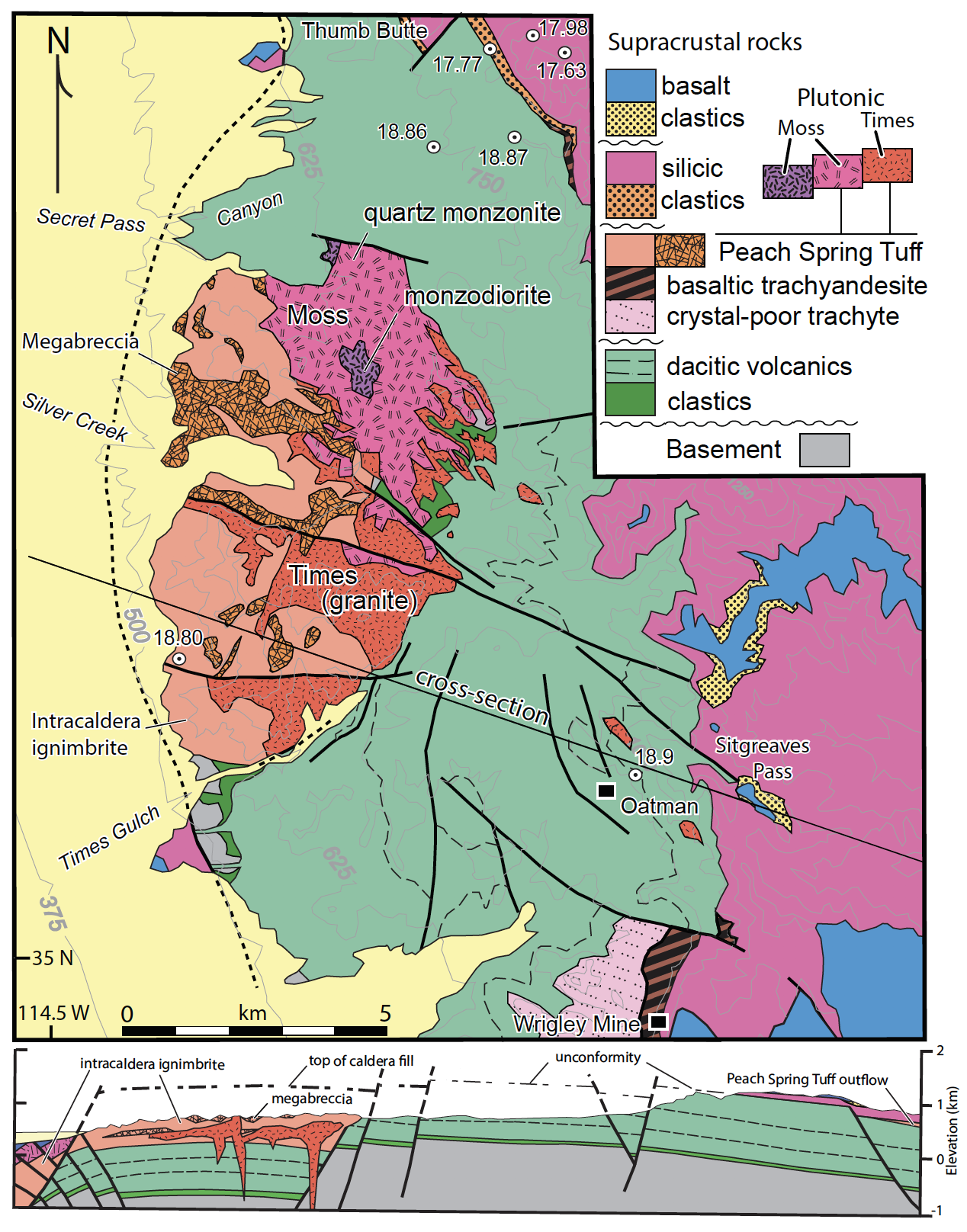
Geologic Map and Cross Section of the Silver Creek Caldera in Oatman, Arizona.
Summary
[edit]
| Description |
English: This map describes the rock units surrounding Oatman, AZ, as well as the size and shape of the Silver Creek Caldera. |
| Date | |
| Source | Unpublished Map Associated with "Silver Creek Caldera- The tectonically dismembered source of the Peach Spring Tuff" by Ferguson et al. |
| Author | Charles A. Ferguson |
Licensing
[edit]
| This file is made available under the Creative Commons CC0 1.0 Universal Public Domain Dedication. | |
| The person who associated a work with this deed has dedicated the work to the public domain by waiving all of their rights to the work worldwide under copyright law, including all related and neighboring rights, to the extent allowed by law. You can copy, modify, distribute and perform the work, even for commercial purposes, all without asking permission.
|
File history
Click on a date/time to view the file as it appeared at that time.
| Date/Time | Thumbnail | Dimensions | User | Comment | |
|---|---|---|---|---|---|
| current | 15:08, 18 April 2021 | | 1,268 × 1,616 (836 KB) | Mettsis (talk | contribs) | Uploaded a work by Charles A. Ferguson from Unpublished Map Associated with "Silver Creek Caldera- The tectonically dismembered source of the Peach Spring Tuff" by Ferguson et al. with UploadWizard |
You cannot overwrite this file.
File usage on Commons
There are no pages that use this file.
File usage on other wikis
The following other wikis use this file:
- Usage on en.wikipedia.org
- Usage on www.wikidata.org