File:Georgia 57.svg
Zur Navigation springen
Zur Suche springen

Größe der PNG-Vorschau dieser SVG-Datei: 600 × 600 Pixel. Weitere Auflösungen: 240 × 240 Pixel | 480 × 480 Pixel | 768 × 768 Pixel | 1.024 × 1.024 Pixel | 2.048 × 2.048 Pixel.
Originaldatei (SVG-Datei, Basisgröße: 600 × 600 Pixel, Dateigröße: 4 KB)
Bildtexte
Kurzbeschreibungen
Ergänze eine einzeilige Erklärung, was diese Datei darstellt.
Beschreibung[Bearbeiten]
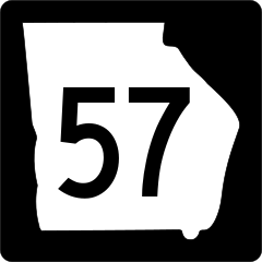
| Beschreibung | Georgia state route marker. Signs use FHWA type D or type C font. |
| Datum | |
| Quelle | http://www.dot.ga.gov/PartnerSmart/DesignManuals/smguide/GDOT%20SIGNING%20AND%20MARKING%20DESIGN%20GUIDELINES.pdf and approximated from photos |
| Urheber | Fredddie, originally created by Pedriana |
Lizenz[Bearbeiten]
This file is in the public domain because it is prescribed by the Georgia Supplement to the Manual on Uniform Traffic Control Devices, sign number M1-5. The Georgia Supplement states on page 1-3 that "[MUTCD 2009 edition is the] latest edition adopted by GDOT. This document shall govern those aspects of the application of all signs, signals, and pavement markings". The federal MUTCD states specifically on page I-1 that:
No provisions of the supplement supersede this provision of the MUTCD. |
Dateiversionen
Klicke auf einen Zeitpunkt, um diese Version zu laden.
| Version vom | Vorschaubild | Maße | Benutzer | Kommentar | |
|---|---|---|---|---|---|
| aktuell | 16:02, 3. Jun. 2010 | | 600 × 600 (4 KB) | Fredddie (Diskussion | Beiträge) | |
| 19:14, 5. Jun. 2006 |  | 500 × 500 (8 KB) | Pedriana~commonswiki (Diskussion | Beiträge) | changed font from Series D to Series C to reflect actual use in the field | |
| 15:36, 16. Apr. 2006 |  | 500 × 500 (9 KB) | Pedriana~commonswiki (Diskussion | Beiträge) | Georgia State Route 57 shield, 24 inches square. Based on [http://www.dot.state.ga.us/operations/traffic-safety-design/Documents/PDF/3.%20Non-Interstate%20Signing%20and%20Marking%20Design%20Guidelines.pdf GDOT's Non-Interstate Signing and Marking Design G |
Du kannst diese Datei nicht überschreiben.
Dateiverwendung
Die folgenden 5 Seiten verwenden diese Datei:
.svg&redirect=no)
Globale Dateiverwendung
Die nachfolgenden anderen Wikis verwenden diese Datei:
- Verwendung auf de.wikipedia.org
- Verwendung auf en.wikipedia.org
- Interstate 16
- Wilkinson County, Georgia
- Washington County, Georgia
- Twiggs County, Georgia
- Tattnall County, Georgia
- McIntosh County, Georgia
- Long County, Georgia
- Jones County, Georgia
- Johnson County, Georgia
- Emanuel County, Georgia
- Candler County, Georgia
- Glennville, Georgia
- U.S. Route 280
- List of state routes in Georgia
- Georgia State Route 15
- Fall Line Freeway
- Wikipedia:WikiProject U.S. Roads/Redirects/Georgia
- Interstate 95 in Georgia
- U.S. Route 1 in Georgia
- Georgia State Route 4
- U.S. Route 17 in Georgia
- Georgia State Route 25
- List of highways numbered 57
- Georgia State Route 144
- Georgia State Route 112
- Georgia State Route 30
- User:MPD01605/Exit lists
- Georgia State Route 18
- Georgia State Route 19
- Georgia State Route 23
- Georgia State Route 26
- Georgia State Route 29
- Georgia State Route 31
- U.S. Route 84 in Georgia
- Georgia State Route 46
- Georgia State Route 297
- Georgia State Route 56
- Georgia State Route 57
- U.S. Route 11 in Georgia
- Georgia State Route 292
- Georgia State Route 251
- Georgia State Route 243
- Special routes of U.S. Route 1
- U.S. Route 221 in Georgia
- U.S. Route 80 in Georgia
- U.S. Route 25 in Georgia
- Georgia State Route 99
- Georgia State Route 196
- U.S. Route 301 in Georgia
Weitere globale Verwendungen dieser Datei anschauen.