File:Georgia Kvemo Kartli relief location map.svg
跳至導覽
跳至搜尋

此 SVG 檔案的 PNG 預覽的大小:753 × 444 像素。 其他解析度:320 × 189 像素 | 640 × 377 像素 | 1,024 × 604 像素 | 1,280 × 755 像素 | 2,560 × 1,509 像素。
原始檔案 (SVG 檔案,表面大小:753 × 444 像素,檔案大小:8.96 MB)
說明
說明
添加單行說明來描述出檔案所代表的內容
摘要[編輯]
| 描述 |
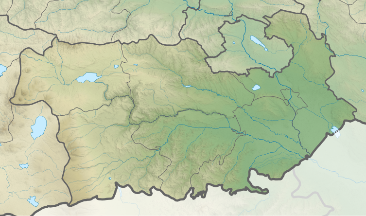
English: Kvemo Kartli relief location map
ქართული: ქვემო ქართლის გეორეფერენსირებული რელიეფური რუკა
Equirectangular projection, N/S stretching 135 %. Geographic limits of the map:
|
||
| 日期 | |||
| 來源 | 自己的作品 | ||
| 作者 | Giorgi Balakhadze |


授權條款[編輯]
維基媒體基金會的Giorgi Balakhadze,此作品的版權所有人,決定用以下授權條款發佈本作品:
此檔案採用創用CC 姓名標示-相同方式分享 4.0 國際授權條款。
姓名標示: 維基媒體基金會的Giorgi Balakhadze
- 您可以自由:
- 分享 – 複製、發佈和傳播本作品
- 重新修改 – 創作演繹作品
- 惟需遵照下列條件:
- 姓名標示 – 您必須指名出正確的製作者,和提供授權條款的連結,以及表示是否有對內容上做出變更。您可以用任何合理的方式來行動,但不得以任何方式表明授權條款是對您許可或是由您所使用。
- 相同方式分享 – 如果您利用本素材進行再混合、轉換或創作,您必須基於如同原先的相同或兼容的條款,來分布您的貢獻成品。
檔案歷史
點選日期/時間以檢視該時間的檔案版本。
| 日期/時間 | 縮圖 | 尺寸 | 使用者 | 備註 | |
|---|---|---|---|---|---|
| 目前 | 2019年1月15日 (二) 22:18 | | 753 × 444(8.96 MB) | Giorgi Balakhadze(留言 | 貢獻) | style fix |
| 2018年2月20日 (二) 13:35 |  | 753 × 444(9.07 MB) | Giorgi Balakhadze(留言 | 貢獻) | u.0.1 | |
| 2018年2月20日 (二) 13:13 |  | 753 × 444(9.07 MB) | Giorgi Balakhadze(留言 | 貢獻) | User created page with UploadWizard |
無法覆蓋此檔案。
檔案用途
下列28個頁面有用到此檔案:
- User:Giorgi Balakhadze/Lab
- File:Georgia Abkhazia relief location map.svg
- File:Georgia Adjara location map.svg
- File:Georgia Adjara location relief map.svg
- File:Georgia Autonomous Republic of Abkhazia Location map.svg
- File:Georgia Guria location map.svg
- File:Georgia Guria relief location map.svg
- File:Georgia Imereti location map.svg
- File:Georgia Imereti relief location map.svg
- File:Georgia Kakheti location map.svg
- File:Georgia Kakheti relief location map.svg
- File:Georgia Kvemo Kartli location map.svg
- File:Georgia Kvemo Kartli relief location map.svg
- File:Georgia Mtskheta-Mtianeti location map.svg
- File:Georgia Mtskheta-Mtianeti relief location map.svg
- File:Georgia Racha-Lechkhumi and Kvemo Svaneti location map.svg
- File:Georgia Racha-Lechkhumi and Kvemo Svaneti relief location map.svg
- File:Georgia Samegrelo-Zemo Svaneti location map.svg
- File:Georgia Samegrelo-Zemo Svaneti relief location map.svg
- File:Georgia Samtskhe-Javakheti location map.svg
- File:Georgia Shida Kartli location map.svg
- File:Georgia Tbilisi location map.svg
- File:Georgia Tbilisi relief location map.svg
- File:Georgia location map2.svg
- File:Relief Map of Georgia.svg
- File:Relief Map of Samtskhe-Javakheti.svg
- File:Relief Map of Shida Kartli.svg
- Template:Georgia's location maps
全域檔案使用狀況
以下其他 wiki 使用了這個檔案:
- az.wikipedia.org 的使用狀況
- ce.wikipedia.org 的使用狀況
- de.wikipedia.org 的使用狀況
- en.wikipedia.org 的使用狀況
- Mount Didgori
- Rustavi
- Tetritsqaro
- Dmanisi
- Bolnisi
- Tsalka
- Kazreti
- Gachiani
- Marneuli
- Bediani
- Gardabani
- Shavnabada
- Algeti National Park
- Birtvisi Fortress
- Martqopi
- Tsalka Plateau
- Tamarisi
- Module:Location map/data/Georgia Kvemo Kartli
- Module:Location map/data/Georgia Kvemo Kartli/doc
- Gardabani Managed Reserve
- Kazreti monastery
- Samshvilde Canyon Natural Monument
- Tsalka Canyon
- Birtvisi Natural Monument
- Khramhesi
- eo.wikipedia.org 的使用狀況
- es.wikipedia.org 的使用狀況
- fa.wikipedia.org 的使用狀況
- fr.wikipedia.org 的使用狀況
- he.wikipedia.org 的使用狀況
- ka.wikipedia.org 的使用狀況
檢視此檔案的更多全域使用狀況。