File:Geostationary balloon satellite.jpeg

Original file (2,000 × 2,000 pixels, file size: 393 KB, MIME type: image/jpeg)
Captions
Captions
Summary
[edit]
| Description |
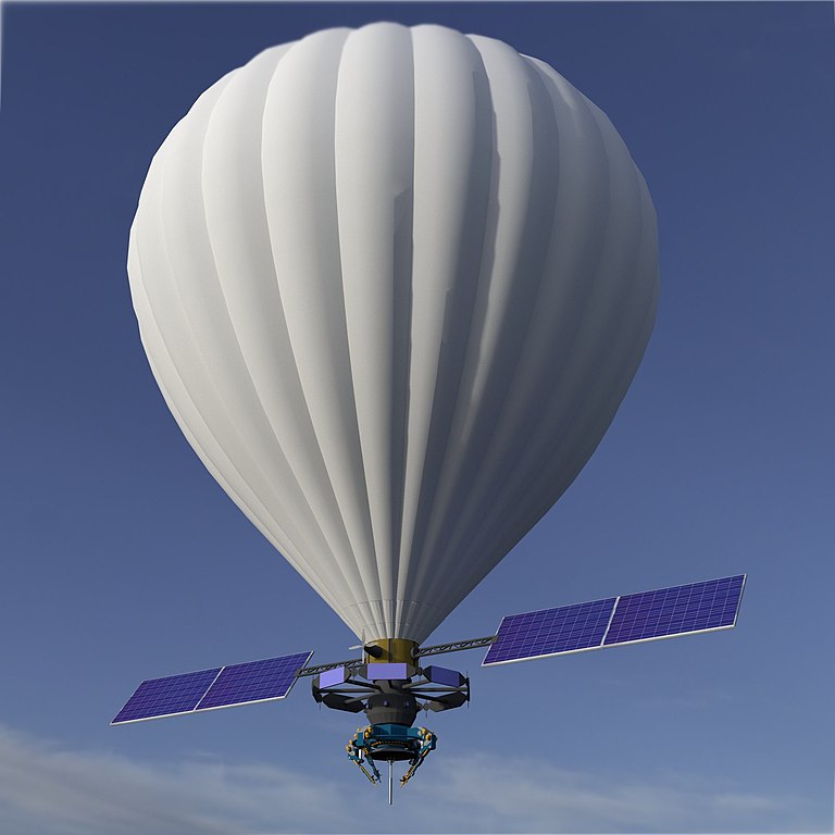
English: The Geostationary Balloon Satellite floats at about 65,000 feet and receives data from parabolic antenna base station. It rains down cellular data and and can capture aerial video and imagery. |
| Date | 21 November 2015 (original upload date) |
| Source | https://3dwarehouse.sketchup.com/user.html?id=1408070876965359698548109 |
| Author | Kcida10 (talk) (Uploads). |
| Permission (Reusing this file) |
English: I hereby affirm that I, (kcida10) the creator of
( geostationary balloon satellite ) is my work. I agree to publish that work under the free license I acknowledge that by doing so I grant anyone the right to use the work in a commercial product or otherwise, and to modify it according to their needs, I am aware that this agreement is not limited to Wikipedia or related sites. Modifications others make to the work will not be claimed to have been made by me. I acknowledge that I cannot withdraw this agreement, and that the content may or may not be kept permanently on a Wikimedia project. Kcida10 La Crosse, WI 54603. I am the designer and creator of the 3D model ( geostationary balloon satellite ) on Sketchup Make's open source repository. 29Nov15 |
Licensing
[edit]
| This file is made available under the Creative Commons CC0 1.0 Universal Public Domain Dedication. | |
| The person who associated a work with this deed has dedicated the work to the public domain by waiving all of their rights to the work worldwide under copyright law, including all related and neighboring rights, to the extent allowed by law. You can copy, modify, distribute and perform the work, even for commercial purposes, all without asking permission.
|
Original upload log
[edit]
| Date/Time | Dimensions | User | Comment |
|---|---|---|---|
| 2015-11-21 08:54 | 1536×2048× (255485 bytes) | Kcida10 | Made the balloon bigger |
| 2015-11-21 08:08 | 1536×2048× (265916 bytes) | Kcida10 | I hereby affirm that I, (kcida10) the creator and/or sole owner of the exclusive copyright of ( Geostationary_balloon_satellite ) is my work. I agree to publish that work under the free license "Creative Commons Attribution-ShareAlike 3.0 Unported"... |
File history
Click on a date/time to view the file as it appeared at that time.
| Date/Time | Thumbnail | Dimensions | User | Comment | |
|---|---|---|---|---|---|
| current | 08:20, 6 February 2023 | | 2,000 × 2,000 (393 KB) | Wikideas1 (talk | contribs) | Rendered with V-Ray |
| 16:34, 5 March 2016 |  | 1,536 × 2,048 (249 KB) | OgreBot (talk | contribs) | (BOT): Reverting to most recent version before archival | |
| 16:34, 5 March 2016 |  | 1,536 × 2,048 (260 KB) | OgreBot (talk | contribs) | (BOT): Uploading old version of file from en.wikipedia; originally uploaded on 2015-11-21 08:08:39 by Kcida10 | |
| 10:51, 2 March 2016 |  | 1,536 × 2,048 (249 KB) | FastilyClone (talk | contribs) | Transferred from enwp |
You cannot overwrite this file.
File usage on Commons
There are no pages that use this file.
File usage on other wikis
The following other wikis use this file:
- Usage on en.wikipedia.org
- Usage on it.wiktionary.org