File:Ghana Map.jpg
跳至導覽
跳至搜尋

預覽大小:489 × 599 像素。 其他解析度:196 × 240 像素 | 392 × 480 像素 | 627 × 768 像素 | 1,060 × 1,298 像素。
原始檔案 (1,060 × 1,298 像素,檔案大小:309 KB,MIME 類型:image/jpeg)
說明
說明
添加單行說明來描述出檔案所代表的內容

檔案歷史
點選日期/時間以檢視該時間的檔案版本。
| 日期/時間 | 縮圖 | 尺寸 | 使用者 | 備註 | |
|---|---|---|---|---|---|
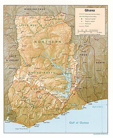
| 目前 | 2006年8月3日 (四) 18:46 | | 1,060 × 1,298(309 KB) | DO11.10(留言 | 貢獻) | Shaded relief map of Ghana. Image source: [http://www.lib.utexas.edu/maps/africa/ghana_rel95.jpg], from the [http://www.lib.utexas.edu/maps/ghana.html Perry-Castañeda Library Map Collection]. {{PD-USGov-CIA}} Category:Maps of Ghana |
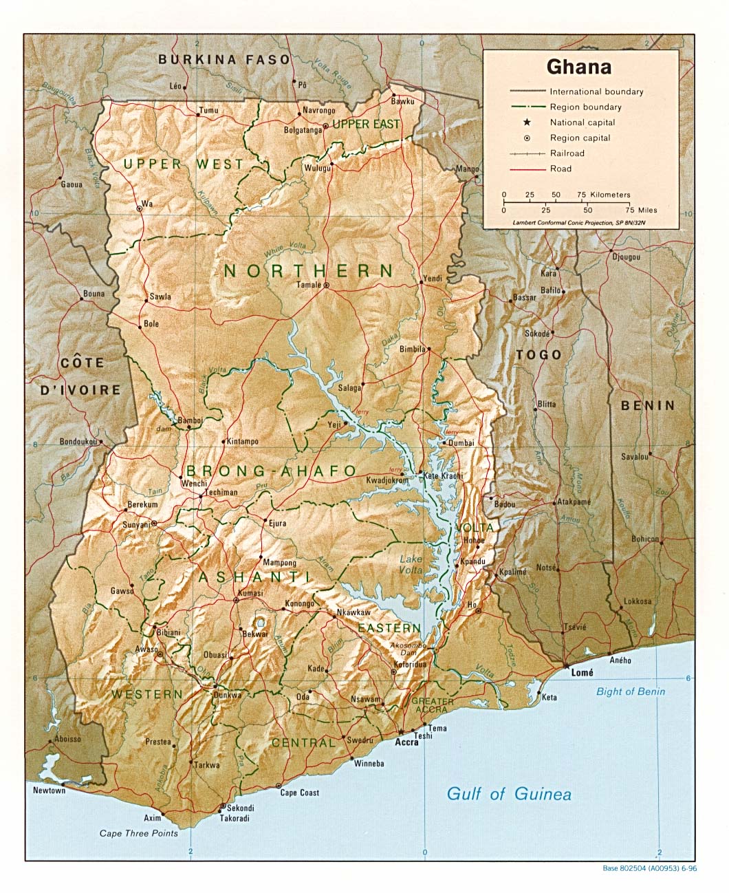
| 2006年2月21日 (二) 10:50 |  | 1,341 × 1,653(570 KB) | Lupo(留言 | 貢獻) | Shaded relief map of Ghana. Image source: [http://www.lib.utexas.edu/maps/africa/ghana_rel95.jpg], from the [http://www.lib.utexas.edu/maps/ghana.html Perry-Castañeda Library Map Collection]. {{PD-USGov-CIA}} Category:Maps of Ghana |
無法覆蓋此檔案。
檔案用途
下列2個頁面有用到此檔案:
全域檔案使用狀況
以下其他 wiki 使用了這個檔案:
- ast.wikipedia.org 的使用狀況
- avk.wikipedia.org 的使用狀況
- br.wikipedia.org 的使用狀況
- de.wikipedia.org 的使用狀況
- el.wikipedia.org 的使用狀況
- en.wikipedia.org 的使用狀況
- es.wikipedia.org 的使用狀況
- fa.wikipedia.org 的使用狀況
- fr.wikipedia.org 的使用狀況
- gag.wikipedia.org 的使用狀況
- gd.wikipedia.org 的使用狀況
- gl.wikipedia.org 的使用狀況
- hr.wiktionary.org 的使用狀況
- id.wikipedia.org 的使用狀況
- it.wikipedia.org 的使用狀況
- lfn.wikipedia.org 的使用狀況
- lt.wikipedia.org 的使用狀況
- ms.wikipedia.org 的使用狀況
- pl.wikipedia.org 的使用狀況
- simple.wikipedia.org 的使用狀況
- sr.wikipedia.org 的使用狀況
- tr.wikipedia.org 的使用狀況
- uk.wikipedia.org 的使用狀況
- vec.wikipedia.org 的使用狀況
- wa.wikipedia.org 的使用狀況
- yo.wikipedia.org 的使用狀況
- zh.wikipedia.org 的使用狀況