File:Ghana empire map.png
Jump to navigation
Jump to search
Size of this preview: 683 × 600 pixels. Other resolutions: 273 × 240 pixels | 547 × 480 pixels | 984 × 864 pixels.
Original file (984 × 864 pixels, file size: 51 KB, MIME type: image/png)
Captions
Captions
Add a one-line explanation of what this file represents
Summary
[edit]
| Description |
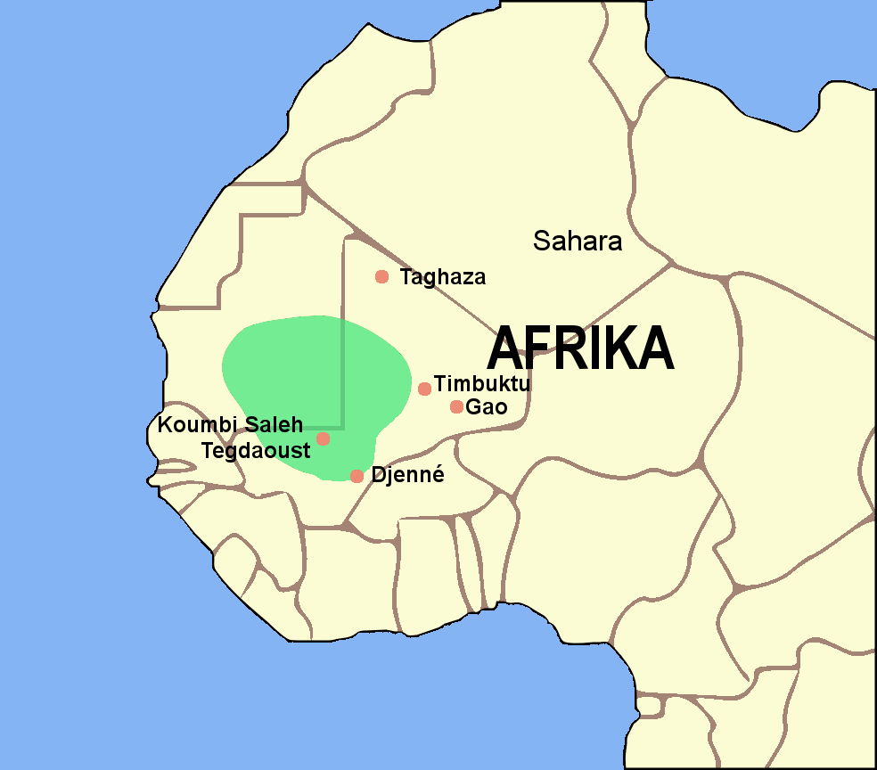
English: Map of the Ghana Empire. (German version) Deutsch: Karte vom Reich von Ghana. (Deutsche Version) |
| Date | |
| Source | Image:BlankMap-World gray.svg |
| Author | Luxo |
| Other versions |

|
This historical map image could be re-created using vector graphics as an SVG file. This has several advantages; see Commons:Media for cleanup for more information. If an SVG form of this image is available, please upload it and afterwards replace this template with
{{vector version available|new image name}}.
It is recommended to name the SVG file “Ghana empire map.svg”—then the template Vector version available (or Vva) does not need the new image name parameter. |
If you want to have a version in other language, you can ask me.
Licensing
[edit]

|
Permission is granted to copy, distribute and/or modify this document under the terms of the GNU Free Documentation License, Version 1.2 or any later version published by the Free Software Foundation; with no Invariant Sections, no Front-Cover Texts, and no Back-Cover Texts. A copy of the license is included in the section entitled GNU Free Documentation License. |
| This file is licensed under the Creative Commons Attribution-Share Alike 3.0 Unported license. | ||
| ||
| This licensing tag was added to this file as part of the GFDL licensing update. |
File history
Click on a date/time to view the file as it appeared at that time.
| Date/Time | Thumbnail | Dimensions | User | Comment | |
|---|---|---|---|---|---|
| current | 16:27, 27 August 2006 | | 984 × 864 (51 KB) | Luxo (talk | contribs) | == Beschreibung == {{Information |Description='''en:''' Map of the Ghana Empire. (German version)<br>'''de:''' Karte vom Reich von Ghana. (Deutsche Version) |Source=Image:BlankMap-World gray.svg |Date=27. |
| 22:02, 26 August 2006 |  | 984 × 864 (51 KB) | Luxo (talk | contribs) | {{Information |Description='''en:'''Map of the Ghana empire.<br>'''de:'''Karte vom Reich von Ghana |Source=Image:BlankMap-World gray.svg |Date=27.08.2006 |Author=Luxo |Permission= GNU Free Documentation License |
You cannot overwrite this file.
File usage on Commons
The following page uses this file:
File usage on other wikis
The following other wikis use this file:
- Usage on af.wikipedia.org
- Usage on ar.wikipedia.org
- Usage on azb.wikipedia.org
- Usage on az.wikipedia.org
- Usage on ba.wikipedia.org
- Usage on bg.wikipedia.org
- Usage on bm.wikipedia.org
- Usage on ca.wikipedia.org
- Usage on cs.wikipedia.org
- Usage on da.wikipedia.org
- Usage on de.wikipedia.org
- Usage on en.wikipedia.org
- Usage on en.wikibooks.org
- Usage on eo.wikipedia.org
- Usage on eu.wikipedia.org
- Usage on fa.wikipedia.org
- Usage on ff.wikipedia.org
- Usage on fi.wikibooks.org
- Usage on fr.wikipedia.org
- Usage on fr.wiktionary.org
- Usage on he.wikipedia.org
- Usage on hi.wikipedia.org
- Usage on hy.wikipedia.org
- Usage on id.wikipedia.org
- Usage on id.wikibooks.org
- Usage on is.wikipedia.org
- Usage on it.wikipedia.org
- Usage on ja.wikipedia.org
- Usage on ka.wikipedia.org
- Usage on ko.wikipedia.org
View more global usage of this file.