File:Gielniów (gmina) location map.png
Jump to navigation
Jump to search

Size of this preview: 493 × 599 pixels. Other resolutions: 197 × 240 pixels | 395 × 480 pixels | 663 × 806 pixels.
Original file (663 × 806 pixels, file size: 109 KB, MIME type: image/png)
Captions
Captions
Add a one-line explanation of what this file represents
| Description |
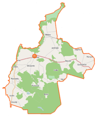
Polski: Mapa gminy Gielniów, Polska
English: Map of Gmina Gielniów, Poland |
|||||||||
| Date | ||||||||||
| Source | You may find a page on the OpenStreetMap wiki page for Gielniów (gmina) | |||||||||
| Creator |
OpenStreetMap contributors OpenStreetMap contributors |
|||||||||
| Permission (Reusing this file) |
OpenStreetMap data is available under the Open Database License (details). Map tiles are licensed under the Creative Commons Attribution-ShareAlike 2.0 license (CC-BY-SA 2.0).
This file is licensed under the Creative Commons Attribution-Share Alike 2.0 Generic license.
|
|||||||||
| Geotemporal data | ||||||||||
| Bounding box |
|
|||||||||
| Georeferencing | If inappropriate please set warp_status = skip to hide. | |||||||||
File history
Click on a date/time to view the file as it appeared at that time.
| Date/Time | Thumbnail | Dimensions | User | Comment | |
|---|---|---|---|---|---|
| current | 11:11, 24 September 2014 | | 663 × 806 (109 KB) | VanWiel (talk | contribs) | {{OpenStreetMap | name = Gielniów (gmina) | location = Gielniów (gmina) | description = {{pl|Mapa gminy Gielniów, Polska}} {{en|Map of Gmina Gielniów, Poland}} | top = 51.4660 | left = 20.4119... |
You cannot overwrite this file.
File usage on Commons
There are no pages that use this file.
File usage on other wikis
The following other wikis use this file:
- Usage on be.wikipedia.org
- Usage on de.wikipedia.org
- Usage on fr.wikipedia.org
- Usage on pl.wikipedia.org
- Gielniów (gmina)
- Gielniów
- Rozwady (województwo mazowieckie)
- Wywóz
- Goździków (województwo mazowieckie)
- Kotfin (województwo mazowieckie)
- Mechlin (województwo mazowieckie)
- Sołtysy (województwo mazowieckie)
- Stoczki (województwo mazowieckie)
- Zygmuntów (województwo mazowieckie)
- Antoniów (powiat przysuski)
- Bieliny (powiat przysuski)
- Brzezinki (powiat przysuski)
- Budy (powiat przysuski)
- Jastrząb (powiat przysuski)
- Zielonka (powiat przysuski)
- Gałki (gmina Gielniów)
- Marysin (gmina Gielniów)
- Huta (powiat przysuski)
- Snarki
- Drynia (Kotfin)
- Gościniec (Sołtysy)
- Bieliny Opoczyńskie
- Parafia bł. Władysława z Gielniowa w Gielniowie
- Lelitek
- Parafia św. Szymona i Judy Tadeusza w Bielinach
- Wywóz (kolonia)
- Chonowa
- Piaski (gmina Gielniów)
- Rożek (Gielniów)
- Tartak (powiat przysuski)
- Kościół bł. Władysława z Gielniowa w Gielniowie
- Moduł:Mapa/dane/Gielniów (gmina)
- Bród (Kotfin)
- Alfredów
- Bochenka
- Bród (Rozwady)
- Drynia (Rozwady)
- Góźdź
- Zawały (Sołtysy)
- Stefanów (uroczysko)
- Puszcza Rozwadzka
- Moduł:Mapa/dane/Gielniów
- Kaplica bł. Władysława z Gielniowa w Gielniowie
- Usage on pl.wikibooks.org
_location_map.png&oldid=519964030)