File:Giovanni map mars.jpg
跳至導覽
跳至搜尋
預覽大小:800 × 474 像素。 其他解析度:320 × 190 像素 | 640 × 379 像素 | 1,024 × 607 像素 | 1,393 × 826 像素。
原始檔案 (1,393 × 826 像素,檔案大小:253 KB,MIME 類型:image/jpeg)
說明
說明
添加單行說明來描述出檔案所代表的內容
摘要
[編輯]| 描述 |
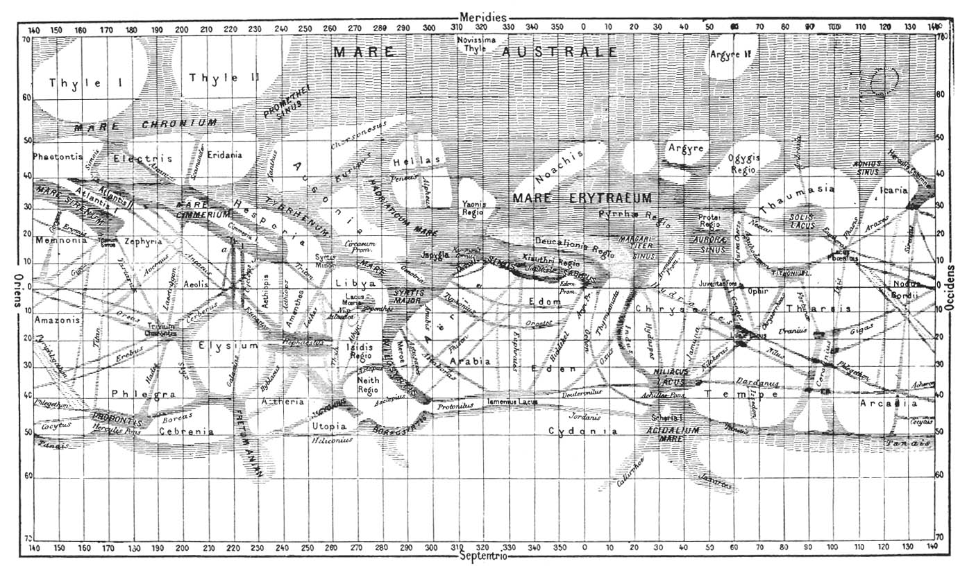
Ελληνικά: Χάρτης του Άρη σχεδιασμένος από τον ιταλό αστρονόμο Τζιοβάννι Σκιαπαρέλλι, με τα χαρακτηριστικά κανάλια που λανθασμένα πιστευόταν ότι υπήρχαν στον πλανήτη. Από την έκδοση του Καμίλ Φλαμαριόν La Planète Mars.
English: The caption from the source reads, "Giovanni Schiaparelli's map of Mars, compiled over the period 1877-1886, used names based on classical geography or were simply descriptive terms; for example, Mare australe (Southern Sea). Most of these place names are still in use today. Flammarion, La Planète Mars." |
||||
| 日期 | |||||
| 來源 | NASA publication SP-4212, On Mars: Exploration of the Red Planet. 1958-1978. ch1-2. | ||||
| 作者 | |||||
| 授權許可 (重用此檔案) |
|
||||
| 其他版本 |
|
||||


檔案歷史
點選日期/時間以檢視該時間的檔案版本。
| 日期/時間 | 縮圖 | 尺寸 | 用戶 | 備註 | |
|---|---|---|---|---|---|
| 目前 | 2011年9月22日 (四) 20:01 | | 1,393 × 826(253 KB) | Badseed(對話 | 貢獻) | larger version |
| 2010年4月13日 (二) 16:46 |  | 874 × 514(122 KB) | RJHall(對話 | 貢獻) | {{Information |Description=The dcamption from the source reads, "Giovanni Schiaparelli's map of Mars, compiled over the period 1877-1886, used names based on classical geography or were simply descriptive terms; for example, Mare australe (Southern Sea). |
無法覆蓋此檔案。
檔案用途
下列頁面有用到此檔案:
全域檔案使用狀況
以下其他 wiki 使用了這個檔案:
- ar.wikipedia.org 的使用狀況
- ca.wikipedia.org 的使用狀況
- en.wikipedia.org 的使用狀況
- eo.wikipedia.org 的使用狀況
- es.wikipedia.org 的使用狀況
- ja.wikipedia.org 的使用狀況
- ru.wikipedia.org 的使用狀況
- sh.wikipedia.org 的使用狀況
- uk.wikipedia.org 的使用狀況