File:Gmina Świerklaniec location map.png
Jump to navigation
Jump to search

Size of this preview: 655 × 600 pixels. Other resolutions: 262 × 240 pixels | 524 × 480 pixels | 839 × 768 pixels | 1,118 × 1,024 pixels | 2,077 × 1,902 pixels.
Original file (2,077 × 1,902 pixels, file size: 5.33 MB, MIME type: image/png)
Captions
Captions
Add a one-line explanation of what this file represents
| Description |
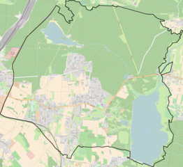
Location map of gmina Świerklaniec, Poland This map of gmina Świerklaniec was created from OpenStreetMap project data, collected by the community. This map may be incomplete, and may contain errors. Don't rely solely on it for navigation. |
|||||||||
| Date | ||||||||||
| Source | You may find a page on the OpenStreetMap wiki page for gmina Świerklaniec | |||||||||
| Creator |
OpenStreetMap contributors OpenStreetMap contributors |
|||||||||
| Permission (Reusing this file) |
OpenStreetMap data is available under the Open Database License (details). Map tiles are licensed under the Creative Commons Attribution-ShareAlike 2.0 license (CC-BY-SA 2.0).
This file is licensed under the Creative Commons Attribution-Share Alike 2.0 Generic license.
|
|||||||||
| Geotemporal data | ||||||||||
| Bounding box |
|
|||||||||
| Georeferencing | If inappropriate please set warp_status = skip to hide. | |||||||||
File history
Click on a date/time to view the file as it appeared at that time.
| Date/Time | Thumbnail | Dimensions | User | Comment | |
|---|---|---|---|---|---|
| current | 19:39, 21 April 2017 | | 2,077 × 1,902 (5.33 MB) | Gabriel trzy (talk | contribs) | dodano granice gminy borders of the gmina added |
| 20:01, 11 February 2017 |  | 2,077 × 1,902 (5.76 MB) | Gabriel trzy (talk | contribs) | User created page with UploadWizard |
You cannot overwrite this file.
File usage on Commons
There are no pages that use this file.
File usage on other wikis
The following other wikis use this file:
- Usage on pl.wikipedia.org
- Świerklaniec
- Pałac w Świerklańcu
- Nowe Chechło
- Orzech (wieś)
- Nakło Śląskie
- Przedsiębiorstwo Komunikacji Metropolitalnej w Świerklańcu
- Kozłowa Góra (zbiornik)
- Jezioro Chechło-Nakło
- Pałac Donnersmarcków w Nakle Śląskim
- Nakło Śląskie (stacja kolejowa)
- Park w Świerklańcu
- Pałac Kawalera
- Zamek w Świerklańcu
- Parafia Najświętszego Serca Pana Jezusa w Nakle Śląskim
- Parafia Chrystusa Króla w Świerklańcu
- Parafia Najświętszej Maryi Panny Jasnogórskiej w Orzechu
- Parafia św. Brata Alberta w Nowym Chechle
- Moduł:Mapa/dane/Świerklaniec (gmina)
- Bizja (Świerklaniec)
- Ostrożnica (Świerklaniec)
- Wapienniki (Nakło Śląskie)
- Kościół Dobrego Pasterza w Świerklańcu
- Kościół Najświętszego Serca Pana Jezusa w Nakle Śląskim
- Romantyczne ruiny w Orzechu
- Stare Chechło
- Usage on pl.wikibooks.org