File:Godów (gmina) location map.png

Original file (2,039 × 1,896 pixels, file size: 776 KB, MIME type: image/png)
Captions
Captions
Summary
[edit]_location_map.png&action=edit§ion=1)
| Description |
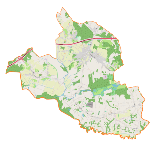
English: Location map |
| Date | |
| Source | Own work |
| Author | Smat |
| Description |
Polski: Mapa gminy Godów, Polska
English: Map of Godów (gmina), Poland |
|||||||||
| Date | ||||||||||
| Source | You may find a page on the OpenStreetMap wiki page for Godów (gmina) | |||||||||
| Creator |
OpenStreetMap contributors OpenStreetMap contributors |
|||||||||
| Permission (Reusing this file) |
OpenStreetMap data is available under the Open Database License (details). Map tiles are licensed under the Creative Commons Attribution-ShareAlike 2.0 license (CC-BY-SA 2.0).
This file is licensed under the Creative Commons Attribution-Share Alike 2.0 Generic license.
|
|||||||||
| Geotemporal data | ||||||||||
| Bounding box |
|
|||||||||
| Georeferencing | If inappropriate please set warp_status = skip to hide. | |||||||||
Licensing
[edit]_location_map.png&action=edit§ion=2)
| This work contains information from OpenStreetMap, which is made available under the Open Database License (ODbL).
The ODbL does not require any particular license for maps produced from ODbL data. Prior to 1 August 2020, map tiles produced by the OpenStreetMap Foundation were licensed under the CC-BY-SA-2.0 license. Maps produced by other people may be subject to other licences. |
File history
Click on a date/time to view the file as it appeared at that time.
| Date/Time | Thumbnail | Dimensions | User | Comment | |
|---|---|---|---|---|---|
| current | 13:03, 11 November 2018 | | 2,039 × 1,896 (776 KB) | Smat (talk | contribs) | User created page with UploadWizard |
You cannot overwrite this file.
File usage on Commons
There are no pages that use this file.
File usage on other wikis
The following other wikis use this file:
- Usage on de.wikipedia.org
- Usage on pl.wikipedia.org
- Gołkowice (województwo śląskie)
- Krostoszowice
- Podbucze
- Skrbeńsko
- Godów (województwo śląskie)
- Łaziska (województwo śląskie)
- Skrzyszów (województwo śląskie)
- Parafia św. Michała Archanioła w Skrzyszowie
- Parafia Podwyższenia Krzyża Świętego i św. Anny w Gołkowicach
- Parafia św. Józefa Robotnika w Godowie
- Parafia św. Jana Nepomucena w Krostoszowicach
- Parafia Wszystkich Świętych w Łaziskach
- Parafia Najświętszego Serca Pana Jezusa w Skrbeńsku
- Łaziska Śląskie
- Godów (stacja kolejowa)
- Parafia Ewangelicko-Augsburska w Gołkowicach
- Kościół Wszystkich Świętych w Łaziskach
- Przejście graniczne Gołkowice-Závada
- Przejście graniczne Skrbeńsko-Petrovice u Karviné
- Przejście graniczne Łaziska-Věřnovice
- Borowica (Gołkowice)
- Głębocz
- Podlesie (Gołkowice)
- Żabków
- Dębina (Skrzyszów)
- Olszyna (Skrzyszów)
- Pustynia (Skrzyszów)
- Kościół św. Anny w Gołkowicach
- Moduł:Mapa/dane/Godów (gmina)
- Kościół Najświętszego Serca Pana Jezusa w Skrbeńsku
- Kościół św. Józefa Robotnika w Godowie
- Wikipedysta:Marcel Chwistek/Rduch
- Usage on pl.wikibooks.org
_location_map.png&oldid=706459886)