File:Grünzug Akazienwäldchen zur Poelchaustraße (1).jpg
Jump to navigation
Jump to search
No higher resolution available.
Grünzug_Akazienwäldchen_zur_Poelchaustraße_(1).jpg (800 × 600 pixels, file size: 535 KB, MIME type: image/jpeg)
Captions
Captions
Add a one-line explanation of what this file represents
Summary
[edit].jpg&action=edit§ion=1)
| Description |
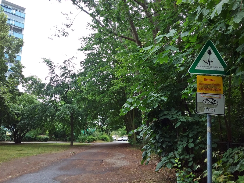
Deutsch: Blick in den Grünzug Akazienwäldchen zur Poelchaustraße in Berlin-Marzahn. Der Fotostandpunkt liegt an einem Zugang vom Murtzaner Ring aus. Dieser liegt auf Höhe der Hofdurchgangslücke zischen Nr. 10 und 12 vom Murtzaner Ring. Das Links angeschnittene Gebäude ist der Block Allee der Kosmonauten 137 und 139 und zu sehen sind die Balkone der Giebelwand vom Aufgang Nr. 137. Rechts befindet sich ein eingezäuntes Gelände, auf dem zu DDR Zeiten irgendwas der Komunalen Wirtschaft untergebracht war. Jetzt befindet sich neben dem Betrachterstandort, etwas Kleingartenfläche, scheinbar Gemeinschaftsgartenartig und weiter Rechts rüber, eine Station vom Deutschen Roten Kreuz. Vorraus, hinter den Autos, welche sich hinter dem Grün befinden, liegt ein großer Sportplatz.
|
| Date | |
| Source | Own work |
| Author | Auto1234 |
| Camera location | | View this and other nearby images on: OpenStreetMap |
|---|
.jpg¶ms=052.531868_N_0013.546400_E_globe:Earth_type:camera__&language=en)
Licensing
[edit].jpg&action=edit§ion=2)
I, the copyright holder of this work, hereby publish it under the following license:
This file is licensed under the Creative Commons Attribution-Share Alike 3.0 Unported license.
- You are free:
- to share – to copy, distribute and transmit the work
- to remix – to adapt the work
- Under the following conditions:
- attribution – You must give appropriate credit, provide a link to the license, and indicate if changes were made. You may do so in any reasonable manner, but not in any way that suggests the licensor endorses you or your use.
- share alike – If you remix, transform, or build upon the material, you must distribute your contributions under the same or compatible license as the original.
File history
Click on a date/time to view the file as it appeared at that time.
| Date/Time | Thumbnail | Dimensions | User | Comment | |
|---|---|---|---|---|---|
| current | 18:46, 9 May 2021 | | 800 × 600 (535 KB) | कार (talk | contribs) | Uploaded own work with UploadWizard |
You cannot overwrite this file.
File usage on Commons
There are no pages that use this file.
.jpg&oldid=891405147)