File:Gran Rio & Pikin Rio.png
Jump to navigation
Jump to search
No higher resolution available.
Gran_Rio_&_Pikin_Rio.png (161 × 117 pixels, file size: 2 KB, MIME type: image/png)
Captions
Captions
Add a one-line explanation of what this file represents
Summary
[edit]| Description |
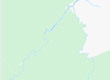
Nederlands: Boven-Surinamerivier, inclusief de benedenloop van de Gran Rio en Pikin Rio
English: Upper-Suriname River, including downstream Gran Rio and Pikin Rio |
|||||||||||||||
| Date | ||||||||||||||||
| Source | www.openstreetmap.org, 4.565 North, -55.62 West -55.28 East -3.84 South | |||||||||||||||
| Author | OpenStreetMap contributors | |||||||||||||||
| Permission (Reusing this file) |
|
|||||||||||||||
| Other versions |

File history
Click on a date/time to view the file as it appeared at that time.
| Date/Time | Thumbnail | Dimensions | User | Comment | |
|---|---|---|---|---|---|
| current | 15:30, 24 June 2023 | | 161 × 117 (2 KB) | Ymnes (talk | contribs) | File:Boven-Surinamerivier, met Gran en Pikin Rio.png cropped 45 % horizontally, 78 % vertically using CropTool with precise mode. |
You cannot overwrite this file.
File usage on Commons
The following page uses this file: