File:Grand Canyon National Park Walhalla Glades Ruin (NR) 0515 (5898358603).jpg

Original file (4,345 × 4,889 pixels, file size: 3.21 MB, MIME type: image/jpeg)
Captions
Captions
Summary
[edit]_0515_(5898358603).jpg&action=edit§ion=1)
| Description |
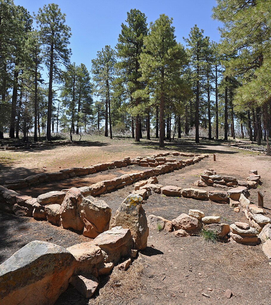
(4345 x 4889) Nine hundred years ago, people were living on the North Rim at Walhalla Glades. The site was a summer home for families for over 100 years. Walhalla Plateau is “peninsula” surrounded on three sides by the Grand Canyon. The elevation in this area is a bit lower than most of the North Rim of Grand Canyon, and updrafts of warm air from the inner canyon allow the winter snows to melt early, making Walhalla a favorable place for ancestral people to farm. Download the trail guide here (1.73 MB pdf) <a href="http://www.nps.gov/grca/planyourvisit/upload/Walhalla.pdf" rel="nofollow">www.nps.gov/grca/planyourvisit/upload/Walhalla.pdf</a> Thousands of people have called Grand Canyon home during the past 10,000 years. During your visit, you may come across the remnants of cultures from long ago. You may see evidence left by miners, explorers, or cattlemen, or the remains of Native American dwellings, rock art, or artifacts such as pottery and projectile points. Unintentional damage by visitors to cultural sites is a major, but preventable, problem. Remains and artifacts are a fragile, irreplaceable legacy. The National Park Service preserves and protects these priceless resources. Federal law prohibits the excavation, injury, or destruction of historic or archaeological sites and the removal of any artifacts. Irreplaceable cultural sites tell the story of this country and remain places of ancestral importance to Native Americans. Treat these treasures with utmost care and respect. NPS Photo by Michael Quinn |
| Date | |
| Source | Grand Canyon National Park: Walhalla Glades Ruin (NR) 0515 |
| Author | Grand Canyon National Park |
| Camera location | | View this and other nearby images on: OpenStreetMap |
|---|
_0515_(5898358603).jpg¶ms=036.168125_N_-111.948044_E_globe:Earth_type:camera_source:Flickr_&language=en)
Licensing
[edit]_0515_(5898358603).jpg&action=edit§ion=2)
- You are free:
- to share – to copy, distribute and transmit the work
- to remix – to adapt the work
- Under the following conditions:
- attribution – You must give appropriate credit, provide a link to the license, and indicate if changes were made. You may do so in any reasonable manner, but not in any way that suggests the licensor endorses you or your use.
| This image was originally posted to Flickr by Grand Canyon NPS at https://flickr.com/photos/50693818@N08/5898358603. It was reviewed on 20 April 2020 by FlickreviewR 2 and was confirmed to be licensed under the terms of the cc-by-2.0. |
| This image or media file contains material based on a work of a National Park Service employee, created as part of that person's official duties. As a work of the U.S. federal government, such work is in the public domain in the United States. See the NPS website and NPS copyright policy for more information. |
File history
Click on a date/time to view the file as it appeared at that time.
| Date/Time | Thumbnail | Dimensions | User | Comment | |
|---|---|---|---|---|---|
| current | 18:15, 20 April 2020 | | 4,345 × 4,889 (3.21 MB) | Killarnee (talk | contribs) | Transferred from Flickr via #flickr2commons |
You cannot overwrite this file.
File usage on Commons
The following page uses this file:
_0515_(5898358603).jpg&oldid=721262763)