File:Grand Canyon layers (cropped).jpg
Jump to navigation
Jump to search

Size of this preview: 800 × 514 pixels. Other resolutions: 320 × 206 pixels | 640 × 411 pixels | 1,024 × 658 pixels | 1,280 × 823 pixels | 2,560 × 1,646 pixels | 3,335 × 2,144 pixels.
Original file (3,335 × 2,144 pixels, file size: 2.93 MB, MIME type: image/jpeg)
Captions
Captions
Add a one-line explanation of what this file represents
Summary
[edit]| Description |
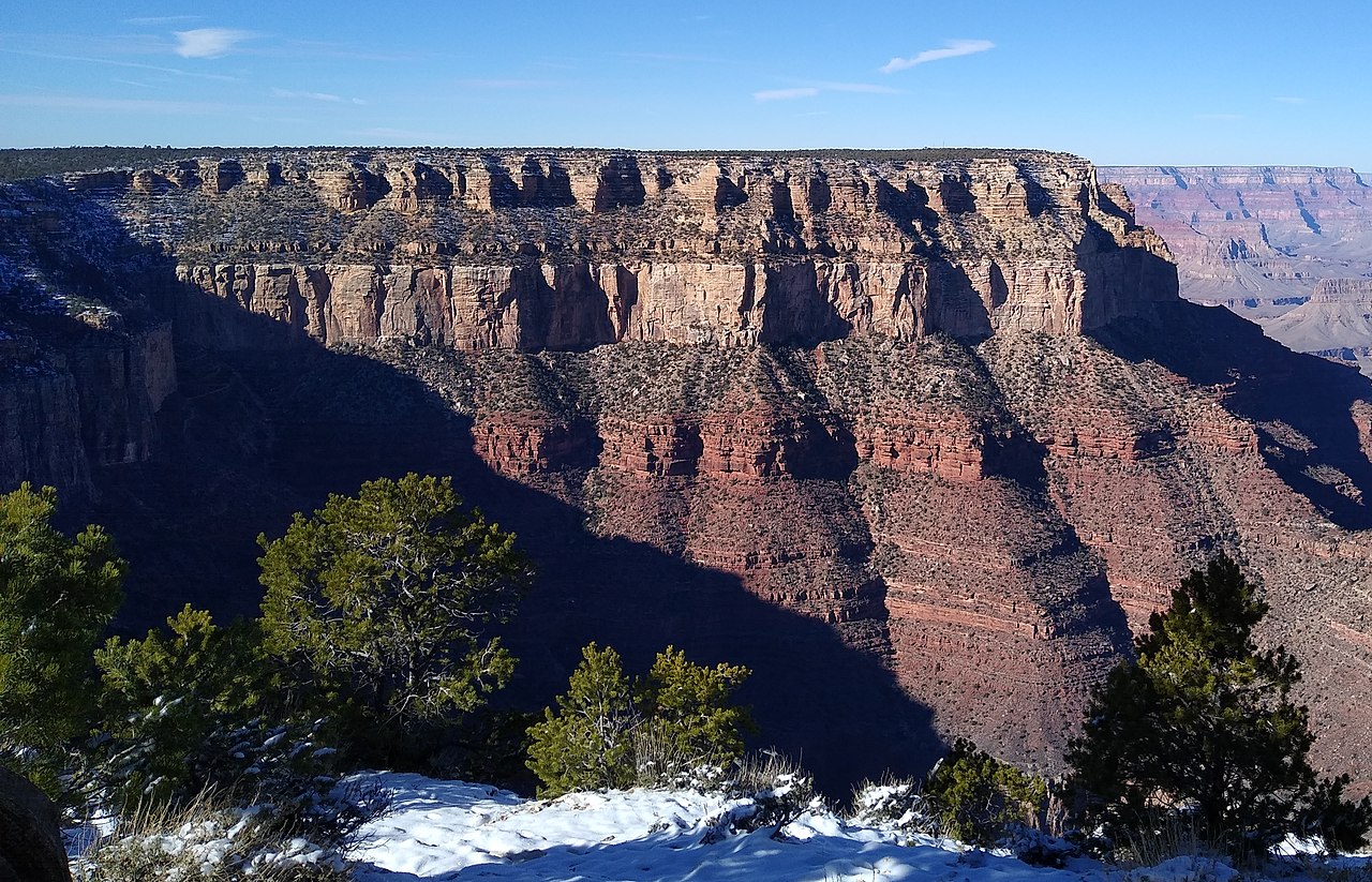
English: Layers of rock at the Grand Canyon. According to the interpretive sign, the top four layers are:
Kaibab Formation Toroweap Formation Coconino Sandstone Hermit Formation |
| Date | |
| Source | Own work |
| Author | Mx. Granger |
| Other versions |

.jpg&action=edit§ion=1)
| Camera location | | View this and other nearby images on: OpenStreetMap |
|---|
.jpg¶ms=036.063759_N_-112.123009_E_globe:Earth_type:camera__&language=en)
Licensing
[edit].jpg&action=edit§ion=2)
I, the copyright holder of this work, hereby publish it under the following license:
| This file is made available under the Creative Commons CC0 1.0 Universal Public Domain Dedication. | |
| The person who associated a work with this deed has dedicated the work to the public domain by waiving all of their rights to the work worldwide under copyright law, including all related and neighboring rights, to the extent allowed by law. You can copy, modify, distribute and perform the work, even for commercial purposes, all without asking permission.
|
| Annotations | This image is annotated: View the annotations at Commons |
.jpg)
File history
Click on a date/time to view the file as it appeared at that time.
| Date/Time | Thumbnail | Dimensions | User | Comment | |
|---|---|---|---|---|---|
| current | 17:37, 15 December 2021 | | 3,335 × 2,144 (2.93 MB) | Mx. Granger (talk | contribs) | File:Grand Canyon layers.jpg cropped 19 % horizontally, 30 % vertically using CropTool with lossless mode. |
You cannot overwrite this file.
File usage on Commons
The following page uses this file:
File usage on other wikis
The following other wikis use this file:
- Usage on en.wikipedia.org
.jpg&oldid=614249125)