File:Grandes structures et domaines géologiques de la Corse.svg
Jump to navigation
Jump to search

Size of this PNG preview of this SVG file: 283 × 340 pixels. Other resolutions: 200 × 240 pixels | 399 × 480 pixels | 639 × 768 pixels | 852 × 1,024 pixels | 1,705 × 2,048 pixels.
Original file (SVG file, nominally 283 × 340 pixels, file size: 226 KB)
Captions
Captions
Add a one-line explanation of what this file represents
Summary
[edit]
| Description |
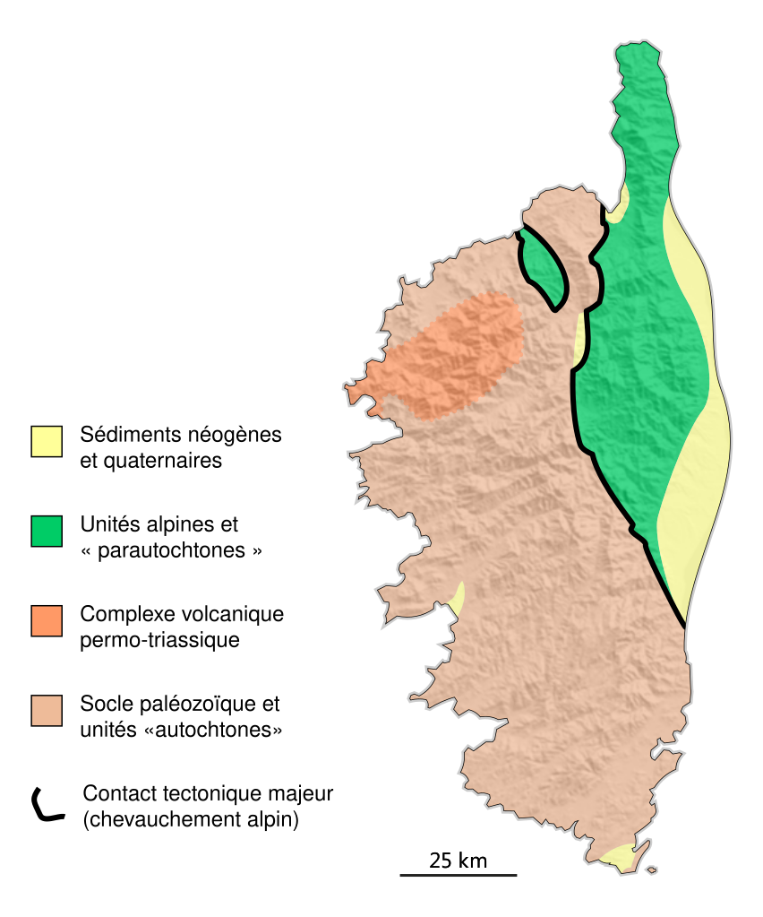
Français : Carte géologique simplifiée de la Corse. Format SVG avec fonctions d'édition sous Adobe Illustrator.
English: Generalized geologic map of Corsica. SVG format retaining editing abilities under Adobe Illustrator. |
| Date | |
| Source | Own work |
| Author | Cardioceras |
Made with Adobe Illustrator from public data and own work: shaded DEM is NASA SRTM, geologic units drawn after geologic map of the world and compilation of French sources, etc.
Licensing
[edit]
I, the copyright holder of this work, hereby publish it under the following license:
| This file is made available under the Creative Commons CC0 1.0 Universal Public Domain Dedication. | |
| The person who associated a work with this deed has dedicated the work to the public domain by waiving all of their rights to the work worldwide under copyright law, including all related and neighboring rights, to the extent allowed by law. You can copy, modify, distribute and perform the work, even for commercial purposes, all without asking permission.
|
File history
Click on a date/time to view the file as it appeared at that time.
| Date/Time | Thumbnail | Dimensions | User | Comment | |
|---|---|---|---|---|---|
| current | 23:17, 17 June 2012 | | 283 × 340 (226 KB) | Cardioceras (talk | contribs) | improved layout / colors / geological units outline. Fixed font size. |
| 19:25, 17 June 2012 |  | 287 × 347 (482 KB) | Cardioceras (talk | contribs) |
You cannot overwrite this file.
File usage on Commons
There are no pages that use this file.
File usage on other wikis
The following other wikis use this file:
- Usage on fr.wikipedia.org